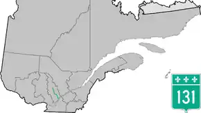
Quebec Route 131
Route 131 is a Quebec highway running from Lavaltrie (junction of Route 138) to Saint-Michel-des-Saints in Lanaudière. This route, combined with Autoroute 31, provides the key route to Joliette, and then continues northward through Saint-Félix-de-Valois, Saint-Jean-de-Matha and Saint-Zénon for a distance of almost 140 km.
| ||||
|---|---|---|---|---|
 | ||||
| Route information | ||||
| Maintained by Transports Québec | ||||
| Length | 132.6 km[1] (82.4 mi) | |||
| Major junctions | ||||
| South end | ||||
| North end | Chemin du Lac in Saint-Ignace-du-Lac (Saint-Michel-des-Saints) | |||
| Highway system | ||||
| ||||

Municipalities along Route 131
See also
References
- Ministère des transports, "Distances routières", page 61-62, Les Publications du Québec, 2005
External links
- Provincial Route Map (Courtesy of the Quebec Ministry of Transportation) (in French)
- Route 131 on Google Maps
This article is issued from Wikipedia. The text is licensed under Creative Commons - Attribution - Sharealike. Additional terms may apply for the media files.