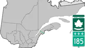
Quebec Route 185
Route 185 is part of the Trans-Canada Highway. It travels from Saint-Antonin to Saint-Louis-du-Ha! Ha!, a distance of about 41 km (25.5 mi). It connects the 2 sections of Autoroute 85 and is the former designation for all of A-85.
| ||||
|---|---|---|---|---|
 | ||||
| Route information | ||||
| Maintained by Transports Québec | ||||
| Length | 41.0 km[1] (25.5 mi) | |||
| Major junctions | ||||
| South end | ||||
| North end | ||||
| Location | ||||
| Major cities | Saint-Louis-du-Ha! Ha! | |||
| Highway system | ||||
| ||||


The southern section of the highway follows the valley of the Madawaska River.
At present, Route 185 is a 2-lane highway with passing lanes. Often cited as one of the most dangerous highways in Canada, it is slowly being upgraded to Autoroute standards and is eventually planned to be a 4-lane restricted-access freeway, assuming and extending the existing Autoroute 85 designation. Several sections have been completed and opened as such. Once this upgrade is completed, it will close one of the last gaps in the nearly continuous freeway section of the Trans-Canada between Arnprior, Ontario, and Sutherlands River, Nova Scotia, and for an even longer interprovincial freeway route between Windsor, Ontario and Halifax, Nova Scotia, roughly playing the same role that the old Quebec Route 2 (which Route 185 was formerly part of) played before its renumbering into several roads in the early-1970s.
Route 185 has been or is being made 4 lanes through most towns along its route.
Currently, there are 2 sections of A-85, the latter from A-20 to Saint-Antonin, and the other from Saint-Louis-du-Ha! Ha! to New Brunswick Route 2 at the provincial border in Degelis, and as of 2016, route 185 no longer connects to New Brunswick route 2 at the provincial border. The opening of the remaining portion in 2025 will also mark the end of Route 185.
Major intersections
The entire route is located in Bas-Saint-Laurent.
| Location | km[2] | mi | Destinations | Notes | |||
|---|---|---|---|---|---|---|---|
| Saint-Louis-du-Ha! Ha! | 0.0 | 0.0 | Road transitions to/from A-85 | ||||
| Saint-Honoré-de-Témiscouata | 12.2 | 7.6 | |||||
| Saint-Antonin | 38.1 | 23.7 | Chemin Rivière-Verte | Former Route 185 alignment to Rivière-du-Loup | |||
| 41.0 | 25.5 | Road transitions to/from A-85 | |||||
| Via Chemin Rivière-Verte | |||||||
| Rivière-du-Loup | 45.7 | 28.4 | |||||
| 50.0 | 31.1 | ||||||
| 50.2 | 31.2 | ||||||
1.000 mi = 1.609 km; 1.000 km = 0.621 mi
| |||||||
See also
References
- Ministère des transports, "Distances routières", page 76, Les Publications du Québec, 2005
- Google (January 2, 2020). "Route 185 in Quebec" (Map). Google Maps. Google. Retrieved January 2, 2020.
External links
| Wikimedia Commons has media related to Quebec Route 185. |
- Autoroute 85 at Exitlists.com
- Interactive Provincial Route Map (Transports Québec) (in French)
| Preceded by |
|
Succeeded by |
| British Columbia | ||
|---|---|---|
| Alberta | ||
| Saskatchewan | ||
| Manitoba | ||
| Ontario | ||
| Quebec | ||
| New Brunswick | ||
| Prince Edward Island | ||
| Nova Scotia | ||
| Newfoundland | ||
| ||