Rabey, Minnesota
Rabey is an unincorporated community in Aitkin County, Minnesota, United States, within the Savanna State Forest. The community is located between Hill City and Jacobson along State Highway 200 (MN 200) near Rabey Road (250th Avenue) and Elliot Road. Rabey is located within Northwest Aitkin Unorganized Territory of Aitkin County.
Rabey | |
|---|---|
 Rabey Location of the community of Rabey within Aitkin County  Rabey Rabey (the United States) | |
| Coordinates: 46°59′55″N 93°22′35″W | |
| Country | United States |
| State | Minnesota |
| County | Aitkin |
| Elevation | 1,266 ft (386 m) |
| Time zone | UTC-6 (Central (CST)) |
| • Summer (DST) | UTC-5 (CDT) |
| ZIP code | 55744 |
| Area code(s) | 218 |
| GNIS feature ID | 2070920[1] |
History
The community had a post office from 1913 to 1941. Rabey at one time had a railroad station and a large mercantile store.[2]
References
- "Rabey, Minnesota". Geographic Names Information System. United States Geological Survey.
- Upham, Warren (2001). Minnesota Place Names: A Geographical Encyclopedia. Minnesota Historical Society Press. p. 17. ISBN 978-0-87351-396-8.
Municipalities and communities of Aitkin County, Minnesota, United States | ||
|---|---|---|
| Cities | 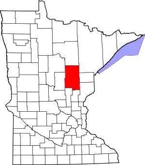 Map of Minnesota highlighting Aitkin County | |
| Townships |
| |
| Unorganized territories | ||
| Unincorporated communities | ||
| Indian reservations | ||
| Footnotes | ‡This populated place also has portions in an adjacent county or counties | |
| ||
This article is issued from Wikipedia. The text is licensed under Creative Commons - Attribution - Sharealike. Additional terms may apply for the media files.
