Waukenabo, Minnesota
Waukenabo is an unincorporated community in Waukenabo Township, Aitkin County, Minnesota, United States; located near Palisade.
Waukenabo | |
|---|---|
 Waukenabo Location of the community of Waukenabo within Waukenabo Township, Aitkin County  Waukenabo Waukenabo (the United States) | |
| Coordinates: 46°44′24″N 93°36′01″W | |
| Country | United States |
| State | Minnesota |
| County | Aitkin |
| Township | Waukenabo Township |
| Elevation | 1,247 ft (380 m) |
| Time zone | UTC-6 (Central (CST)) |
| • Summer (DST) | UTC-5 (CDT) |
| ZIP code | 56469 |
| Area code(s) | 218 |
| GNIS feature ID | 653853[1] |
The community is located between Aitkin and Hill City at the junction of U.S. Highway 169 and 500th Lane.
Aitkin County Road 3 (Grove Street / 480th Street) is nearby.
Waukenabo is located within ZIP code 56469, based in Palisade. A post office previously operated in Waukenabo from 1902 to 1916.
References
- Official State of Minnesota Highway Map – 2011/2012 edition
Municipalities and communities of Aitkin County, Minnesota, United States | ||
|---|---|---|
| Cities | 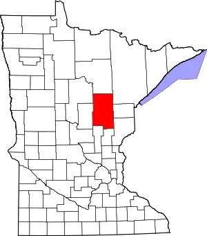 Map of Minnesota highlighting Aitkin County | |
| Townships |
| |
| Unorganized territories | ||
| Unincorporated communities | ||
| Indian reservations | ||
| Footnotes | ‡This populated place also has portions in an adjacent county or counties | |
| ||
This article is issued from Wikipedia. The text is licensed under Creative Commons - Attribution - Sharealike. Additional terms may apply for the media files.
