Swatara, Minnesota
Swatara is an unincorporated community in Macville Township, Aitkin County, Minnesota, United States. Although unincorporated, Swatara has a post office with the ZIP code 55785.[2]
Swatara | |
|---|---|
 Swatara Location of the community of Swatara within Macville Township, Aitkin County  Swatara Swatara (the United States) | |
| Coordinates: 46°53′44″N 93°40′27″W | |
| Country | United States |
| State | Minnesota |
| County | Aitkin |
| Township | Macville Township |
| Elevation | 1,299 ft (396 m) |
| Time zone | UTC-6 (Central (CST)) |
| • Summer (DST) | UTC-5 (CDT) |
| ZIP code | 55785 |
| Area code(s) | 218 |
| GNIS feature ID | 658572[1] |
History
The community at one time was served by the Soo Line Railroad and had a railroad station.
Swatara and neighboring townships were considered as a potential location of the Minnesota Experimental City that was proposed by scientist Athelstan Spilhaus in the 1970s.[3] The city was envisioned to house 250,000 people and would use experimental technologies and methodologies such as moving walkways and monorail systems for transportation and a transparent dome encapsulating the city.
Despite support from state legislature, and prominent companies such as Ford, Boeing, and Honeywell, Aitkin County residents pushed back against the proposed city, citing environmental concerns as well as concerns about changing their way of life. The newly formed Minnesota Pollution Control Agency voted to abandon the project in 1973.[4]
Geography
Swatara is located along Aitkin County Road 7 (610th Street) near the junction with County Road 29 (Osprey Avenue). Nearby places include Hill City, Remer, and Haypoint. U.S. 169 is nearby. Swatara is located in the northwest part of Aitkin County. It is seven miles southwest of Hill City.
References
- "Swatara, Minnesota". Geographic Names Information System. United States Geological Survey.
- ZIP Code Lookup
- Enger, John (7 July 2017). "How a futuristic dome city was nearly built in northern Minnesota". MPR News. Retrieved 7 July 2017.
- Chaduvula, Raju (26 September 2016). "In the 1960s, a former University professor hoped to model a city after a machine". Minnesota Daily. Retrieved 7 July 2017.
Municipalities and communities of Aitkin County, Minnesota, United States | ||
|---|---|---|
| Cities | 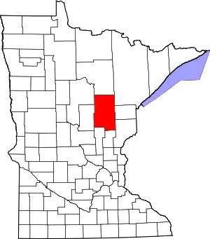 Map of Minnesota highlighting Aitkin County | |
| Townships |
| |
| Unorganized territories | ||
| Unincorporated communities | ||
| Indian reservations | ||
| Footnotes | ‡This populated place also has portions in an adjacent county or counties | |
| ||
