Bismarck Sea
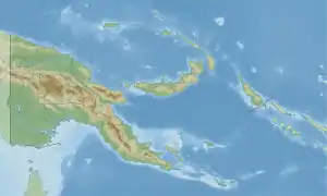
The Bismarck Sea (German: Bismarcksee) lies in the southwestern Pacific Ocean within the nation of Papua New Guinea. It is located northeast of the island of New Guinea and south of the Bismarck Archipelago. It has coastlines in districts of the Islands Region, Momase Region, and Papua Region.
| Bismarck Sea | |
|---|---|
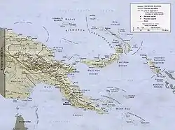 Bismarck Sea in Papua New Guinea | |
 Bismarck Sea | |
| Location | Oceania |
| Coordinates | 4°S 148°E |
| Type | Sea |
| Etymology | Otto von Bismarck |
| Part of | Pacific Ocean |
| Basin countries | Papua New Guinea |
| Settlements | Madang |
Geography
Like the Bismarck Archipelago, it is named in honour of the first German Chancellor Otto von Bismarck. The Bismarck Archipelago extends round to the east and north of the sea, enclosing the Bismarck Sea and separating it from the Southern Pacific Ocean. To the south it is linked to the Solomon Sea by the Vitiaz Strait.[1]
Official boundaries
The International Hydrographic Organization defines the Bismarck Sea as "that area of the South Pacific Ocean off the northeast coast of New Guinea", with the following limits:[2]
On the North and East. By the Northern and Northeastern coasts of the islands of New Ireland, New Hanover, the Admiralty Islands, Hermit Island, and the Ninigo Group, through Manu and Aua Islands to Wuvulu Island and thence a line to Baudissin Point in New Guinea (142°02'E).
On the Southeast. A line from the Southern point of New Ireland along the parallel of 4°50' South to the coast of New Britain, along its Northern coast and thence a line from its Western extreme through the Northern point of Umboi Island to Teliata Point, New Guinea (5°55′S 147°24′E)
On the Southwest. By the Northeast coast of New Guinea.
Mineral wealth
Recent explorations in the Bismarck Sea seabed have yielded discoveries of mineral-rich beds of sulfides, copper, zinc, silver and gold. These findings are especially important because they lie in shallow, calm waters. Papua New Guinea owns the mining rights to these minerals under international law.[3]
History
It was the site of a major Japanese naval defeat in the Battle of the Bismarck Sea during World War II on 3 and 4 March 1943.[4]
See also
- Bismarck Sea topics
- Karkar Island
- Shipwrecks in the Bismarck Sea
References
- "Bismarck Sea". Encyclopædia Britannica. Retrieved 15 July 2007.
- "Limits of Oceans and Seas, 3rd edition" (PDF). International Hydrographic Organization. 1953. Archived from the original (PDF) on 8 October 2011. Retrieved 28 December 2020.
- "The Mineral Wealth of the Bismarck Sea". Scientific American Digital. Archived from the original on 31 January 2013. Retrieved 15 July 2007.
- "Pacific War Maps". Retrieved 15 July 2007.
External links
- CombinedFleet.com: Battle of Bismarck Sea
- BattleforAustralia.org: Battle of the Bismarck Sea
- ABC.net.au: The Battle of the Bismarck Sea