Samburu County
Samburu County is a county in the former Rift Valley Province, Kenya. It covers an area of roughly 21,000 km2 (8,000 mi2) in northern Kenya where the Samburu, Turkana and many other tribes live. It stretches north from the Wuaso Ng'iro River to the south of Lake Turkana. According to the 2019 census, the county has a population of 310,327.[1]
Samburu County | |
|---|---|
 Brick Construction In Samburu | |
 Flag  Coat of arms | |
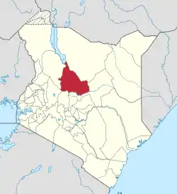 Location of Samburu County in Kenya | |
| Coordinates: 1°10′N 36°40′E | |
| Country | |
| Formed | March 4th 2013 |
| Capital | Maralal |
| Government | |
| • Governor | Moses Kasaine Lenolkulal |
| Area | |
| • Total | 20,182.5 km2 (7,792.5 sq mi) |
| Population (2019) | |
| • Total | 310,327 |
| • Density | 15/km2 (40/sq mi) |
| Time zone | UTC+3 (EAT) |
| Website | samburu |
Within Samburu County are the towns of Maralal (capital and largest town),[2] Baragoi, Archers Post, South Horr, Wamba, Lodosoit, and Kisima.
It also includes the Samburu National Reserve, Bisanadi National Reserve, and Buffalo Springs National Reserve, Mount Ng'iro, Ndoro Mountains, Mathews Range (Ol Doinyo Lenkiyo), Kirisia Hills, and Loroki Forest.
The main access road to Samburu County is the A4 road from Rumuruti-Maralal-Baragoi, which as of 2019 was being tarmaced from Rumuruti up to Maralal.[3]
There is a town named Samburu in Kwale County also in Kenya, but it is not related to Samburu County or Samburu people.
Population
| Year | Pop. | ±% |
|---|---|---|
| 1979 | 76,908 | — |
| 1989 | 108,884 | +41.6% |
| 1999 | 143,547 | +31.8% |
| 2009 | 223,947 | +56.0% |
| 2019 | 310,327 | +38.6% |
| source:[4] | ||
County subdivisions
The county has three constituencies: Samburu East, Samburu West, and Samburu North. The headquarters of Samburu Central is Maralal, Samburu North is Baragoi and headquarters for Samburu East is Wamba. There has been controversy about the headquarters of Samburu East. Some schools of thought proposed Archers Post, a rapidly growing town, while others proposed Wamba town a less rapidly growing town[5]
| Authority | Type | Population* | Urban pop.* |
|---|---|---|---|
| Maralal | Town | 24,612 | 16,281 |
| Samburu | County | 118,935 | 18,507 |
| Total | - | 143,547 | 34,788 |
| * 1999 census. Source:[6] | |||
| Division | Population* | Headquarters |
|---|---|---|
| Baragoi | 19,884 | Baragoi |
| Kirisia | 47,072 | Mararal |
| Lorroki | 25,571 | Suguta mar mar |
| Nyiro | 15,551 | |
| Wamba | 24,155 | Wamba |
| Waso | 10,314 | |
| Total | 143,547 | - |
| * 1999 census. Sources:[7] | ||
Government
The Samburu County Government is headed by Governor Moses Kasaine Lenolkulal, referred to within Samburu County as 'M.K.'. A member of the national Jubilee political party, Lenolkulal was the first governor following Kenya's devolution to county administrations.[8]
References
- "2019 Kenya Population and Housing Census Volume I: Population by County and Sub-County". Kenya National Bureau of Statistics. Retrieved 6 November 2019.
- "Archived copy" (PDF). Archived from the original (PDF) on 21 February 2013. Retrieved 21 February 2013.CS1 maint: archived copy as title (link)
- "Samburu County Integrated Development Plan 2018-2022". Maarifa. Retrieved 18 December 2019.
- Kenya: Administrative Division population statistics
- admin-samburu. "Downloads". Samburu County Government. Retrieved 23 May 2020.
- http://treasury.go.ke/cbs.go.ke/pdf/authority.pdf%5B%5D
- "Archived copy" (PDF). Archived from the original (PDF) on 30 May 2009. Retrieved 28 September 2007.CS1 maint: archived copy as title (link)
- "Moses Lenolkula Kasaine Biography - Softkenya.com". Softkenya.com. 11 December 2015. Retrieved 9 February 2018.
External links
- Office for the Coordination of Humanitarian Affairs – Kenya AdminLevels 1-4 (.pdf)
- Kenyan Police Attack Samburu Villages