Embu, Kenya
Embu is a municipality located approximately 125 kilometres (78 mi) northeast of Nairobi towards Mount Kenya. Embu served as the provincial capital of the former Eastern Province and currently serves as the headquarters of the Eastern Region in Kenya. It is also the county headquarters of Embu County. Located on the south-eastern foothills of Mount Kenya, the Municipality of Embu had a population of 64,979 in 2019 census.[1] It is the commercial hub of the Central Eastern part of Kenya and provides an avenue for trade, tourism and highway transit between the national capital and the Northern Frontier.
Embu, Kenya | |
|---|---|
| Municipality of Embu | |
 Flag Coat of arms | |
| Motto(s): A Prosperous Municipality for All | |
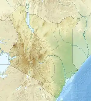 Embu, Kenya Location in Kenya  Embu, Kenya Embu, Kenya (Africa) | |
| Coordinates: 0°32′20″S 37°27′30″E | |
| Country | |
| Region | Eastern Region |
| County | Embu County |
| Constituency | Manyatta Constituency |
| Wards | Blue Valley, Itabua, Kamiu, Kangaru, Majengo, Matakari and Njukiri |
| Government | |
| • Type | Municipal Board |
| • Chairperson of the Municipal Board | Ken Mwige |
| Area | |
| • Total | 100 km2 (40 sq mi) |
| • Land | 100 km2 (40 sq mi) |
| • Water | 0 km2 (0 sq mi) |
| Elevation | 1,350 m (4,429 ft) |
| Population (2019)[1] | |
| • Total | 64,979 |
| • Density | 649.79/km2 (1,682.9/sq mi) |
| Demonym(s) | Embian |
| Time zone | UTC+3 (EAT) |
| Postal Code | 60100 |
| Area code(s) | 068 |
| Climate | Aw |
| Website | municipalityofembu |
History
Embu town is a major trading centre in Eastern Kenya. For a long time, it was the main economic center for the Embu, Mbeere and Kamba communities as well as other communities from central Kenya. Mbeere was carved out of the former Embu district in the 1990s and Siakago town, about 25 km (16 mi) east of Embu town, was made its headquarters.
Origins of Embu people are cited from North West Africa. They moved south to Congo. Then they later moved Eastward to the coast of Kenya via Tanganyika. It is in Tanganyika that there were intermarriages with both natives and migrants from farther south (mostly Bantus). Due to many circumstances they moved North towards Meru leaving their relatives, the Gikuyu at Ithanga. They then crossed Igambang'ombe ford. They settled at Gikuuri near Maranga hills. They had come from Igembe and came to Tharaka where they also settled. They left Tharaka possibly due to famines and moved to the current Embu. It is believed as they moved towards the slopes of Mt Kenya, they encountered pygmy tribes such as the Gumba and the Zimba in the forest; some of whom were cannibalistic. They are cultivaters. They planted crops like sorghum, millet and sweet potatoes. Today they have cash crops like coffee, tea and macadamia, among others.
Geography
The Municipality of Embu has an elevation of 1,350 metres (4,429 ft), and is itself located on the foothills of Mount Kenya. It was the provincial headquarters of the defunct Eastern province, and is currently the Embu County Headquarters, hosting major public offices including and institutions, including Embu Provincial General Hospital.
The area around the Municipality of Embu has conducive altitude for endurance training by athletes. As such, Kenyan athletes use the altitude and climate advantage of Embu for training, with specialised facilities at Kigari Teachers' Training College, about 15 km (9.3 mi) outside Embu Town.
The Municipality of Embu, Kenya is known for its jacaranda trees that literally turn the municipality into a purple shower when in bloom. The Jacaranda trees usually bloom in October–November each year, depending on the rainfall.
The Municipality slopes from west to east, with the highest elevation at the Ruvingaci River, up to the Kangaru School as well as from Njukiri forest in the west to Muthatari in the east, a radius of about 10 km (6 mi) in size. Embu has a small airstrip (1 km (0.62 mi) long), which is 7.1 km (4.4 mi) southeast of the heart of the town.
Way past Kigari Teachers College approximately 25 km from Embu Town is a small town known as Kianjokoma that is a centre for other shopping centres like Miandari, Kathande, Kiriari, Irangi and others; This town is fast growing due to the situated Tea factory - Mungania Tea Factory and now a County Hospital as well as a police line in the area. Other small towns in Embu are Kibugu, Karurumo, Rukuriri, Mukuuri, Kathageri, Kanja and Manyatta.
Climate
| Climate data for Embu, Kenya | |||||||||||||
|---|---|---|---|---|---|---|---|---|---|---|---|---|---|
| Month | Jan | Feb | Mar | Apr | May | Jun | Jul | Aug | Sep | Oct | Nov | Dec | Year |
| Average high °C (°F) | 28.7 (83.7) |
30.3 (86.5) |
30.4 (86.7) |
28.6 (83.5) |
27.2 (81.0) |
26.4 (79.5) |
25.1 (77.2) |
25.4 (77.7) |
28.2 (82.8) |
29.5 (85.1) |
27.5 (81.5) |
27.2 (81.0) |
27.9 (82.2) |
| Average low °C (°F) | 13.7 (56.7) |
14.3 (57.7) |
16.3 (61.3) |
17.4 (63.3) |
17.2 (63.0) |
15.6 (60.1) |
15.2 (59.4) |
15.2 (59.4) |
15.8 (60.4) |
16.9 (62.4) |
16.4 (61.5) |
14.7 (58.5) |
15.7 (60.3) |
| Average precipitation mm (inches) | 41 (1.6) |
34 (1.3) |
64 (2.5) |
218 (8.6) |
139 (5.5) |
21 (0.8) |
28 (1.1) |
11 (0.4) |
17 (0.7) |
86 (3.4) |
189 (7.4) |
45 (1.8) |
893 (35.2) |
| Average precipitation days | 4 | 3 | 7 | 13 | 10 | 3 | 3 | 4 | 2 | 8 | 15 | 5 | 77 |
| Source: World Meteorological Organization[2] | |||||||||||||
Religion
There are numerous Christian churches and ministries in Embu, including the Seventh Day Adventist, East African Pentecostal Churches Dallas, Gakwegori, Kigumo, Kanginga, Kathari, Karurumo, Kiritiri among others Anglican Church of Kenya's St. Paul's Cathedral, the Presbyterian Church of East Africa's Blue Valley, PCEA, the national independent church of Africa, the African independent Pentecostal church of Africa, Majimbo, Kangaru Kathangariri, Kibugu, Kavutiri, Ndunduri, Itabua, Gichera, Makengi, Kirigiri and the Roman Catholic Diocese of Embu's Sts. Peter and Paul Cathedral. The latter cathedral has a unique African-inspired design and is among the largest in Africa. Missions for Christ Ministries office and churches in Embu county. Churches under Missions for Christ Ministries includes Kevote Family Church, Embu town Family Church, Runyenjes Family Church, Kamugere Family Church and Kianjokoma Family Church. The national Independent church of Africa is located at Gakwegwori (Mwamba Imara), Kianjokoma, Kiriari, Kithunguriri, Kamugere, Mukuuri, Keria, Kibugu, and Kavutiri.
Another Protestant church, the first encountered, on entering Embu from Kirinyaga county is that of the Kenya Assemblies of God (KAG). It is better known as the Eastern Gate assembly as it is also the first church encountered on crossing into Eastern Province from all the Provinces except North Eastern.
Family Worship Church Inc is a Protestant Christian church founded in the early 1970s. It has the headquarters at Nembure and branches in Manyatta, Kithimu, Kiandundu, Gaikiro, Makengi and is in the process of starting a branch in Embu town.
Electoral subdivisions
Embu forms a municipality that has seven wards (Blue Valley, Itabua, Kamiu, Kangaru, Majengo, Matakari and Njukiri). All of them belong to Manyatta Constituency, which has a total of eleven wards. The remaining four are located within Embu County Council, the rural council of Embu.[3]
Notable residents
Jeremiah Nyagah - former cabinet minister.
Joseph Nyagah - son of Jeremiah Nyagah and former cabinet minister.
Norman Nyagah - son of Jeremiah Nyagah and former Govt chief whip and Member of Parliament.
Nahashon Nyagah - son of Jeremiah Nyagah and former governor of the central bank of kenya.
Mary Nyagah Khimulu - daughter of Jeremiah Nyagah and former ambassador to UNEP
Anne Nyagah - granddaughter to Jeremiah Nyagah and Cabinet assistant secretary for Agriculture.
- Justin Muturi - Speaker of the National Assembly
- Kithinji Kiragu - public sector management consultant; retired
- Patrick Njiru - safari rally driver in east Africa
- Cardinal John Njue - Archbishop of Nairobi and former Bishop of Embu
- Martin Nyaga Wambora - first Governor of Embu; former Runyenjes MP and chair of Kenya Airports Authority
- Dan K Mukundi - Medical Microbiologist From JKUAT and ENTERPRENURE.
- Steven Njeru Muthangari - Retired Banker, Lecturer and Philanthropist.
- General Kubu Kubu (Njagi wa Ikutha) was a freedom fighter from Embu.
- Kubu Kubu died in 1955, burned alive by the colonialists after he was betrayed by a local informant.
He successfully repulsed settler encroachment on Embu for over 10 years before he was captured
University education
- University of Embu
- Embu College
See also
- Embu people
- Embu County
- Rotary club of Embu
- Rotaract club of Embu
References
- "2019 Kenya Population and Housing Census Volume II: Distribution of Population by Administrative Units (Table 2.5: Distribution of Population by Urban Centres, Sex* and County, p. 241)". Kenya National Bureau of Statistics. Retrieved 21 February 2020.
- "World Weather Information Service – Embu". World Meteorological Organization. Retrieved 31 August 2016.
- Electoral Commission of Kenya: Registration centres by electoral area and constituency Archived June 28, 2007, at the Wayback Machine
External links
- Embu University College
- Embu Water and Sanitation Company
- Embu Music
- Aerial imagery and geographical features around Embu, Kenya
