Tana River County
Tana River County is a county in the former Coast Province, Kenya. It is named after the Tana River. It has an area of 38,437 square kilometres (14,841 sq mi) and a population of 315,943. The capital and largest town is Hola (sometimes known as Galole).
Tana River County | |
|---|---|
 Tana | |
 Flag | |
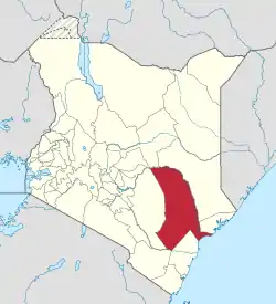 Location in Kenya | |
| Coordinates: 1°30′S 40°0′E | |
| Country | |
| Formed | March 4th 2013 |
| Capital | Hola |
| Government | |
| • Governor | Godhana Dhadho Gaddae |
| Area | |
| • Total | 35,375.8 km2 (13,658.7 sq mi) |
| Population (2019) | |
| • Total | 315,943 |
| • Density | 8.9/km2 (23/sq mi) |
| Time zone | UTC+3 (EAT) |
| Website | tanariver.go.ke |
The major ethnic groups are the Dagodie, Sheekhaal, Ogaden Pokomo, many of whom are farmers, and the Orma, Wardey and Gadsan who are peaceful people . The county is generally dry and prone to drought. Rainfall is erratic, with rainy seasons in March–May and October–December. Conflicts have occurred between farmers and other people over access to water. Flooding is also a regular problem, caused by heavy rainfall in upstream areas of the Tana River. On 22 August 2012, in the worst violent incident in Kenya since 2001, at least 52 people were killed in ethnic violence in Tana River County between the Orma'wardey and Pokomo groups.
Tana River County presents an interesting case of the nexus between conflict and food security. A recent survey prepared by ALMRP, Tana River District and presented to the Tana River District Steering Group (2004) found that the county is 79% food insecure and with an incidence of poverty at 62% (Interim Poverty Strategy Paper (I-PSP), 2000–2003, Kenya). Tana River County comprises several areas of forest, woodland and grassland which are minor centres of endemism. The forests are designated National Reserve status if they have >4 plant endemics and >7 vertebrate endemics (IUCN, 2003). Despite the apparent adequate natural resources, the region remains marginalised from the rest of the country. Efforts at development always seem to centre on the huge River Tana, despite massive failures in all the previous irrigation projects in the district, i.e. Bura, Hola and the Tana delta rice irrigation project which failed after the water works were damaged by the El Niño rains in 1998.
District subdivisions
Despite the large area of the Tana River district, its only local authority is Tana River County Council. The district has three constituencies: Garsen, Galole and Bura.
| Administrative divisions | |||||
| Division | Population* | Urban population* |
population density |
Area (km2) | Headquarters |
|---|---|---|---|---|---|
| Bangale | 14,853 | 0 | 2 | x | Murarandia |
| Bura | 28,848 | 0 | 6 | x | Bura |
| Galole | 34,948 | 9,383 | 4 | x | Hola |
| Garsen | 51,592 | 4,885 | 4 | x | Garsen |
| Kipini | 16,243 | 0 | 19 | x | Kipini |
| Madogo | 21,731 | 0 | 12 | x | Kamwangi |
| Wenje | 12,686 | 0 | 23 | x | Wenje |
| Total | 180,901 | 14,268 | 5 (average) | x | |
| * 1999 census. Sources:[1][2] | |||||
Population
| Year | Pop. | ±% |
|---|---|---|
| 1979 | 92,401 | — |
| 1989 | 128,426 | +39.0% |
| 1999 | 180,901 | +40.9% |
| 2009 | 240,075 | +32.7% |
| 2019 | 315,943 | +31.6% |
| source:[3] | ||
2012 ethnic violence
On 22 August 2012, in the worst violent incident in Kenya since 2007, at least 52 people were killed in ethnic violence in Tana River County between the Orma and Pokomo groups.[4]
Villages and settlements
Bura Irrigation and Settlement Project is located in Tana River County. During the years 1981-1988 about 2,200 families from different parts of Kenya were settled in this irrigation scheme.
See also
References
- Communications Commission of Kenya – Status of Coverage of Communications Services Archived 16 June 2007 at the Wayback Machine
- International Livestock Research Institute – Urban Poverty Archived 18 July 2011 at the Wayback Machine (.xls)
- Kenya: Administrative Division population statistics
- "Dozens killed in Kenya clashes". Al Jazeera. 22 August 2012. Retrieved 22 August 2012.
External links
- Office for the Coordination of Humanitarian Affairs – Kenya AdminLevels 1-4
- Tana River District: a showcase of conflict over natural resources at ITDG
- Map of the District
- Bura Irrigation and Settlement Project
- http://www.mambolook.com/tana-river