Shoal Lake 40
Shoal Lake 40 is a First Nations reserve straddling the border of Manitoba and Ontario on the shores of Shoal Lake. It is one the reserves of the Shoal Lake 40 First Nation.
Shoal Lake 40 | |
|---|---|
| Shoal Lake Indian Reserve No. 40 | |
 Shoal Lake 40 | |
| Coordinates: 49°37′N 95°09′W | |
| Country | |
| Provinces | |
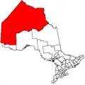
| District / Division | Kenora / Division 1 |
| First Nation | Shoal Lake 40 |
| Area | |
| • Land | 26.21 km2 (10.12 sq mi) |
| Population | |
| • Total | 101 |
| • Density | 3.9/km2 (10/sq mi) |
| Website | www.sl40.ca |
References
- "Shoal Lake (part) 40 census profile". 2011 Census of Population. Statistics Canada. Retrieved 22 June 2015.
- "Shoal Lake (part) 40 census profile". 2011 Census of Population. Statistics Canada. Retrieved 22 June 2015.
Places adjacent to Shoal Lake 40 | |
|---|---|
Division No. 1, Manitoba (Eastern Manitoba) | ||
|---|---|---|
| Towns | 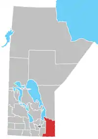 | |
| Local government districts | ||
| Rural municipalities | ||
| First Nations | ||
| Indian reserves |
| |
| Unorganized areas | ||
| Unincorporated communities | ||
This article is issued from Wikipedia. The text is licensed under Creative Commons - Attribution - Sharealike. Additional terms may apply for the media files.