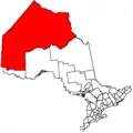
Kenora
Kenora, originally named Rat Portage (French: Portage-aux-Rats), is a small city situated on the Lake of the Woods in Northwestern Ontario, Canada, close to the Manitoba boundary, and about 200 km (124 mi) east of Winnipeg. It is the seat of Kenora District.
Kenora | |
|---|---|
| City of Kenora | |
 | |
| Nickname(s): K-Town | |
 Kenora  Kenora | |
| Coordinates: 49°46′N 94°29′W | |
| Country | Canada |
| Province | Ontario |
| Incorporated (town) | 1882 as Rat Portage |
| Renamed | 1905 as Kenora |
| Amalgamated (City) | 2000[1] |
| Government | |
| • Mayor | Dan Reynard |
| • Governing Body | Kenora City Council |
| • MP | Eric Melillo (Kenora, CPC) |
| • MPP | Greg Rickford (Kenora—Rainy River, PC) |
| Area | |
| • Land | 211.59 km2 (81.70 sq mi) |
| Elevation | 409.70 m (1,344.16 ft) |
| Population | |
| • Total | 15,096 |
| • Density | 71.3/km2 (185/sq mi) |
| Time zone | UTC−06:00 (CST) |
| • Summer (DST) | UTC−05:00 (CDT) |
| Forward sortation area | P9N |
| Area code(s) | 807 |
| Website | www.kenora.ca |
The town of Rat Portage was renamed in 1905 by using the first two letters of itself and the neighbouring towns of Keewatin and Norman to form the present-day City of Kenora.[5] In 2001, the towns of Kenora and Keewatin as well as the unincorporated communities of Norman and Jaffray Melick amalgamated under the Municipal Act, 2001.
Kenora is the administrative headquarters of the Anishinabe of Wauzhushk Onigum, Obashkaandagaang Bay, and Washagamis Bay First Nations band governments.
Toponymy
The name "Kenora" was coined by combining the first two letters of Keewatin, Norman and Rat Portage.[6]
History
Kenora's future site was in the territory of the Ojibway when the first European, Jacques de Noyon, sighted Lake of the Woods in 1688.
Pierre de La Vérendrye established a secure French trading post, Fort Saint Charles, to the south of present-day Kenora near the current Canada/U.S. border in 1732, and France maintained the post until 1763 when it lost the territory to the British in the Seven Years' War. Until then, it was the most northwesterly settlement of New France. In 1836 the Hudson's Bay Company established a post on Old Fort Island, and in 1861, the Company opened a post on the mainland at Kenora's current location.
In 1878, the company surveyed lots for the permanent settlement of Rat Portage ("portage to the country of the muskrat")[7] — the community kept that name until 1905, when it was renamed Kenora.[6]
Kenora was once claimed as part of the Province of Manitoba, and there are early references to Rat Portage, Manitoba. There was a long lasting argument between the two provinces known as the Ontario-Manitoba boundary dispute. Each province claimed the town as part of their territory and the dispute lasted from 1870 to 1884. Although Ottawa had ruled the town part of Manitoba in 1881, the issue was finally taken up with the Judicial Committee of the Privy Council which eventually decided in Ontario's favour.[8] Kenora officially became part of the province of Ontario in 1889.[9] Boundaries were drawn up for the provinces and the Northwest Angle on Lake of the Woods which definitively drew the borders between Ontario, Manitoba, Canada, and Minnesota, U.S.
Gold and the railway were both important in the community's early history: gold was first discovered in the area in 1850, and by 1893, 20 mines were operating within 24 km (15 mi) of Rat Portage, and the first Canadian ocean-to-ocean train passed through in 1886 on the Canadian Pacific Railway. Among the entrepreneurs attracted to the town was the Hon. JEP Vereker, a retired British army officer and youngest son of the 4th Viscount Gort.[10]
Later, a highway was built through Kenora in 1932, becoming part of Canada's first coast-to-coast highway in 1943, and then part of the Trans-Canada Highway, placing the community on both of Canada's major transcontinental transportation routes. The original barrier to the completion of the highway concerned the crossing of the Winnipeg River at two locations. The single span arch bridges are among the longest of their type in North America.
During the Prohibition era in the United States, the Lake of the Woods served as a smuggler's route for the transport of alcohol.
In December 1883, there was a large fire in Rat Portage, rendering 70 of the town's then population of 700 homeless.[11]
The Stanley Cup was won by the Kenora Thistles hockey team in 1907. The team featured such Hall of Famers as Billy McGimsie, Tommy Phillips, and Art Ross, for whom the Art Ross Trophy is named. Kenora is the smallest town to have won a major North American sports title.
Rat Portage is mentioned in Algernon Blackwood's famous 1910 story, "The Wendigo".
.jpg.webp)
In 1967, the year of the Canadian Centennial, Kenora erected a sculpture known as Husky the Muskie. It has become the town's mascot and one of its most recognizable features.[1]
A dramatic bank robbery took place in Kenora on May 10, 1973. An unknown man entered the Canadian Imperial Bank of Commerce heavily armed and wearing a "dead man's switch", a device utilising a clothespin, wires, battery and dynamite, where the user holds the clothespin in the mouth, exerting force on the clothespin. Should the user release the clothespin, two wires attached to both sides of the pin complete an electrical circuit, sending current from the battery, detonating the explosives. After robbing the bank, the robber exited the CIBC, and was preparing to enter a city vehicle driven by undercover police officer Don Milliard. A sniper, Robert Letain, positioned across the street, shot the robber, causing the explosives to detonate and kill the robber. Most of the windows on the shops on the main street were shattered as a result of the blast. Recently, Kenora Police submitted DNA samples from the robber's remains to a national database to identify him; however, the suspect was never positively identified.
The importance of the logging industry declined in the second part of the 20th century, and the last log boom was towed into Kenora in 1985. The tourist and recreation industries have become more important.

Geography
Neighbourhoods
In addition to the formerly separate towns of Keewatin and Jaffray Melick, the city also includes the neighbourhoods of Norman, Rabbit Lake, Rideout, Pinecrest, Minto, and Lakeside.
Keewatin currently forms the westernmost section of the City of Kenora. Norman was a small community located halfway between the village of Keewatin and Rat Portage. The Village of Keewatin was founded in 1877 while the Village of Norman was founded in 1892; both communities amalgamated with Rat Portage in 1905 to form the Township of Kenora. Keewatin eventually separated and was founded as a Township in 1908.
The Jaffray Melick neighbourhood currently delineates the north-easternmost section of the City of Kenora. The Township of Jaffray was founded in 1894 and the Township of Melick in 1902; the two townships were amalgamated in 1908 as Jaffray and Melick, and renamed as Jaffray Melick in 1911. Compared to Keewatin, Norman, and Rat Portage, Jaffray Melick is the most rural community, with few retail stores and one golf course, Beauty Bay, on Black Sturgeon lake.
Climate
Kenora has a humid continental climate (Köppen climate classification Dfb) with warm summers and cold, dry winters.[12] Its climate is influenced by continental air masses. Winters are cold with a January high of −11 °C (12 °F) and a low of −21 °C (−6 °F). Temperatures below −20 °C (−4 °F) occur on 45 days.[4] The average annual snowfall is 158 cm (62 in), which is lower than places to the east as it is influenced by the dry air of continental high pressure zones, resulting in relatively dry winters.[12] Summers are warm with a July high of 24 °C (75 °F) and a low of 15 °C (59 °F) and temperatures above 30 °C (86 °F) occur on 5.3 days.[4] The average annual precipitation is 662 mm (26 in), with most of it being concentrated in the summer months with June being the wettest month and February the driest.[4]
During the winter Kenora will get precipitation mostly in the form of snow, other forms of winter precipitation include ice, sleet, and freezing rain. Snow cover usually lasts from November till March, about 154 days or 42% of the year;.[13] The city frequently gets thunderstorms during the summer, averaging 24 days a year with thunderstorms.[14]
The highest temperature ever recorded in Kenora was 40.6 °C (105.1 °F) on 11 July 1936.[15] The coldest temperature ever recorded was −43.9 °C (−47.0 °F) on 20 January 1943.[4]
| Climate data for Kenora Airport, 1981−2010 normals, extremes 1899−present[lower-alpha 1] | |||||||||||||
|---|---|---|---|---|---|---|---|---|---|---|---|---|---|
| Month | Jan | Feb | Mar | Apr | May | Jun | Jul | Aug | Sep | Oct | Nov | Dec | Year |
| Record high humidex | 9.0 | 8.5 | 27.0 | 30.0 | 39.3 | 41.2 | 43.2 | 41.6 | 41.6 | 28.9 | 18.9 | 8.7 | 43.2 |
| Record high °C (°F) | 9.1 (48.4) |
8.8 (47.8) |
23.8 (74.8) |
30.6 (87.1) |
35.4 (95.7) |
37.2 (99.0) |
40.6 (105.1) |
35.0 (95.0) |
34.6 (94.3) |
26.7 (80.1) |
19.4 (66.9) |
9.4 (48.9) |
40.6 (105.1) |
| Average high °C (°F) | −11.4 (11.5) |
−7.6 (18.3) |
−0.2 (31.6) |
9.4 (48.9) |
16.7 (62.1) |
21.7 (71.1) |
24.4 (75.9) |
23.4 (74.1) |
17.1 (62.8) |
8.8 (47.8) |
−0.9 (30.4) |
−9.2 (15.4) |
7.7 (45.9) |
| Daily mean °C (°F) | −16 (3) |
−12.5 (9.5) |
−5.2 (22.6) |
4.1 (39.4) |
11.3 (52.3) |
16.8 (62.2) |
19.7 (67.5) |
18.6 (65.5) |
12.7 (54.9) |
5.1 (41.2) |
−4.2 (24.4) |
−13.1 (8.4) |
3.1 (37.6) |
| Average low °C (°F) | −20.5 (−4.9) |
−17.4 (0.7) |
−10.1 (13.8) |
−1.3 (29.7) |
5.8 (42.4) |
11.8 (53.2) |
14.9 (58.8) |
13.9 (57.0) |
8.3 (46.9) |
1.4 (34.5) |
−7.4 (18.7) |
−17.1 (1.2) |
−1.5 (29.3) |
| Record low °C (°F) | −43.9 (−47.0) |
−43.3 (−45.9) |
−36.1 (−33.0) |
−27.2 (−17.0) |
−12.2 (10.0) |
−1.1 (30.0) |
3.9 (39.0) |
−1.7 (28.9) |
−6.7 (19.9) |
−20 (−4) |
−31.3 (−24.3) |
−41.1 (−42.0) |
−43.9 (−47.0) |
| Record low wind chill | −57.5 | −54.3 | −46.7 | −37.7 | −20.5 | −4.2 | 0.0 | 0.0 | −12.6 | −22.2 | −46.8 | −51.5 | −57.5 |
| Average precipitation mm (inches) | 25.6 (1.01) |
19.4 (0.76) |
28.1 (1.11) |
36.3 (1.43) |
80.8 (3.18) |
118.7 (4.67) |
103.4 (4.07) |
84.2 (3.31) |
85.6 (3.37) |
62.6 (2.46) |
42.1 (1.66) |
28.3 (1.11) |
715.0 (28.15) |
| Average rainfall mm (inches) | 0.7 (0.03) |
3.0 (0.12) |
8.5 (0.33) |
22.4 (0.88) |
77.4 (3.05) |
118.6 (4.67) |
103.4 (4.07) |
84.2 (3.31) |
84.6 (3.33) |
49.4 (1.94) |
12.0 (0.47) |
1.1 (0.04) |
565.3 (22.26) |
| Average snowfall cm (inches) | 28.4 (11.2) |
18.6 (7.3) |
21.1 (8.3) |
14.6 (5.7) |
3.5 (1.4) |
0.1 (0.0) |
0.0 (0.0) |
0.0 (0.0) |
0.8 (0.3) |
14.2 (5.6) |
32.2 (12.7) |
30.6 (12.0) |
164.1 (64.6) |
| Average precipitation days (≥ 0.2 mm) | 13.4 | 10.9 | 10.5 | 9.0 | 12.9 | 14.5 | 13.3 | 12.2 | 13.0 | 13.7 | 14.0 | 15.6 | 152.9 |
| Average rainy days (≥ 0.2 mm) | 0.50 | 1.1 | 2.9 | 5.6 | 12.1 | 14.5 | 13.3 | 12.2 | 12.9 | 10.1 | 3.6 | 0.83 | 89.5 |
| Average snowy days (≥ 0.2 cm) | 13.8 | 10.7 | 8.9 | 4.8 | 1.5 | 0.10 | 0.0 | 0.0 | 0.47 | 5.5 | 12.4 | 15.5 | 73.7 |
| Source: Environment Canada,[4][15][16] Extremes for Kenora 1899-1939[17] | |||||||||||||
Demographics
| Year | Pop. | ±% |
|---|---|---|
| 1891 | 1,806 | — |
| 1901 | 5,202 | +188.0% |
| 1911 | 6,158 | +18.4% |
| 1921 | 5,407 | −12.2% |
| 1931 | 6,766 | +25.1% |
| 1941 | 7,672 | +13.4% |
| 1951 | 8,695 | +13.3% |
| 1961 | 10,904 | +25.4% |
| 1971 | 10,952 | +0.4% |
| 1981 | 9,817 | −10.4% |
| 1991 | 9,782 | −0.4% |
| 1996 | 10,063 | +2.9% |
| 2001 | 15,838 | +57.4% |
| 2006 | 15,177 | −4.2% |
| 2011 | 15,348 | +1.1% |
| 2016 | 15,096 | −1.6% |
| The population change between 1996 and 2001 reflects Kenora's amalgamation in 2000. | ||
Kenora had a population of 15,096 people in 2016, which was a decrease of 1.6% from the 2011 census count. The median household income in 2005 for Kenora was $59,946, which is slightly below the Ontario provincial average of $60,455.[2]
| Ethnic groups | |||
|---|---|---|---|
| Canada 2016 Census | Population | % of Total Population | |
| Visible minority group Source:[18] | Filipino | 140 | 0.9 |
| South Asian | 45 | 0.3 | |
| Black | 45 | 0.3 | |
| Chinese | 40 | 0.3 | |
| Latin American | 20 | 0.1 | |
| Japanese | 20 | 0.1 | |
| Other or mixed visible minority | 50 | 0.3 | |
| Total visible minority population | 355 | 2.4 | |
| Aboriginal group Source:[19] | First Nations | 1,610 | 10.9 |
| Métis | 1,495 | 10.1 | |
| Inuit | 10 | 0.1 | |
| Total Aboriginal population | 3,150 | 21.3 | |
| European | 11,285 | 76.3 | |
| Total population | 14,790 | 100 | |
Economy
Forestry, tourism and mining are the three largest sectors of the Kenora economy. The population balloons in the spring and summer to almost double the normal population when summer residents move in. The Lake of the Woods and numerous smaller lakes situated all around Kenora are the major draw for cottagers who summer here. Many are from the neighbouring province of Manitoba and the state of Minnesota.
Tourism
Kenora, a site of natural attractions, has visitors from all over the world year round. In the summer months visitors come to the area to undertake activities including swimming, biking, fishing, hiking, and boating. Kenora's tourist industry is also active during the winter months as visitors come not only to observe its natural environment but also to partake in ice fishing, snowboarding, skiing (both downhill and cross country) and snowmachining.
Kenora has two travel information centres. One is the newly renovated (2011) pavilion, located on the Harbourfront (the blue and grey building on Bernier Dr). The second information centre, called the Discovery Centre, opened July 22, 2011, and serves visitors year-round from its location at 931 Lake View Drive (just off of highway 17 West aka the Trans Canada highway).
Arts and culture
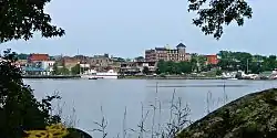
The city's most prominent cultural venue is the downtown Harbourfront, a park on the shore of Lake of the Woods which hosts the city's annual winter and summer festivals, as well as concert series, and other special events.
Kenora is home to Huskie the Muskie, a 40 feet (12 m) statue of a fighting muskellunge. Huskie the Muskie, as it is known, is situated in McLeod Park at the northernmost tip of Lake of the Woods.
The city's downtown core has a public arts project, with 20 murals depicting the region's history painted on buildings in the business district.
The city is home to a major international freshwater bass fishing tournament.
Kenora is sometimes stereotyped as an archetypal hoser community, evidenced by the phrase "Kenora dinner jacket"[20] as a nickname for a hoser's flannel shirt.
The City of Kenora is home to the Lake of the Woods Museum, which has won awards from the Ontario Historical Society and the Ontario Museum Association for its exhibits and programming. It was called "one of the coolest little museums in Canada" by the CAA.[21] In June 2011, the Museum was recognized by the Ontario Historical Society for its exhibit, Bakaan nake'ii ngii-izhi-gakinoo'amaagoomin (We Were Taught Differently): The Indian Residential School Experience, based on stories of residential school life told by local residents.[22] Most recently the museum in 2012 the museum was awarded the 2012 Ontario Museum Association Award of Excellence in Special Projects for its work on the IPad based "mobile tour".[23]
St. Alban's Anglican Cathedral is in Kenora.
The now defunct Kenora Thistles ice hockey team is widely seen as a monument in the city's history, having won the Stanley Cup in 1907, making Kenora the smallest city to have ever gotten the trophy.[24] Many local contemporary ice hockey clubs pay homage to the team by using its name, including the town's amateur, junior, and senior-level men's team.[25]
Government
Kenora is represented in the House of Commons by Conservative MP Eric Melillo, and in the Legislative Assembly of Ontario by MPP Greg Rickford of the Progressive Conservative Party of Ontario.
Kenora has been served by two mayors since the municipal amalgamation in 2000. Dave Canfield served from 2000 until 2006, when he was defeated by Len Compton in the 2006 municipal election; Compton did not run in the subsequent 2010 municipal election, however, and Canfield was re-elected as his successor.[26]
Some residents of Kenora, citing dissatisfaction with the level of government service provided to the region by the provincial government, have proposed that the region secede from Ontario to join the province of Manitoba.
Military presence
The federal government maintains an armoury (Kenora Armoury at 800-11th Avenue North) in Kenora for the 116th Independent Field Battery, RCA.
Infrastructure
Transportation
Via Rail offers passenger service to Redditt on the CN transcontinental rail line, approximately 30 minutes and 20 km (12 mi) north of Kenora. The CP transcontinental rail line passes directly through town.
Kenora Airport is located 5 nautical miles (9.3 km; 5.8 mi) east northeast of the city centre.[27]
M.S. Kenora is a cruise located at the waterfront.
Highway 17 passes through Kenora's urban core, and the Highway 17A Kenora By-Pass goes around the city. Both routes are designated as part of the Trans-Canada Highway. Highway 658 extends northerly from Kenora to Redditt.
Kenora Transit operates three routes, from Monday to Saturday, 7:00am to 6:30pm.[28]
Health care
Kenora's hospital, Lake of the Woods District Hospital, has three facilities in the city: the hospital itself, Morningstar Rehabilitation Centre, and Mental Health and Addictions services, located in St. Joseph's Health Centre.
Housing
Since Kenora is one of two judicial districts in Northwestern Ontario,[29] it has disproportionate housing shortage as people from across the region with little to no social support in Kenora are unable to find places to stay after release from prison or while waiting in the city before their court dates.[30] The situation worsened in 2013, when the judge in the Rainy River District moved and the position and its responsibilities was transferred to Kenora.[29]
Education
Two school boards and a community college function in the Kenora Area.
The Keewatin-Patricia District School Board operates one high school (Beaver Brae Secondary School) and four elementary schools (Keewatin Public School, Evergreen School, King George IV School, and Valleyview School).
The Kenora Catholic District School Board operates one high school (Saint Thomas Aquinas High School) and three elementary schools (École Ste. Marguerite-Bourgeois, Pope John Paul II School and St. Louis School). The elementary school, officially named Pope John Paul II, amalgamated approximately 350 students from the former Mount Carmel and Our Lady of the Valley schools. École Ste. Marguerite-Bourgeois is a French immersion school.
Confederation College has a Kenora campus and serves post-secondary and adult education needs in the city and surrounding area.
Housed within the college is Contact North, which offers Kenora residents local access to university and college programs not directly offered by the college campus. Contact North is Ontario's most extensive distance education network providing access to education and training opportunities in remote locations of Northern Ontario through a network of access centres. Contact North works with 13 colleges and universities.
There is also an Indigenous college and education facility added called Seven Generations, located in the building that once housed Lakewood Junior High School before becoming Seven Generations Education Institute. It prepares Indigenous and Non-Indigenous students for work within the community and surrounding region.[31]
Media
The major news source in Kenora is the Kenora Daily Miner and News, one of Canada's smallest daily newspapers.
Radio
- FM 89.5 - CJRL-FM ("89.5 The Lake"), adult contemporary
- FM 93.5 - CKSB-7-FM, Ici Radio-Canada Première (relays CKSB-10-FM, Winnipeg)
- FM 98.7 - CBQX-FM, CBC Radio One (relays CBQT-FM, Thunder Bay)
- FM 104.5 - CKQV-FM-2 ("Q104"), hot adult contemporary (relays CKQV-FM, Vermilion Bay)
Television
Kenora was Canada's smallest (and North America's second smallest) television market, served by only one television station, CJBN-TV channel 13, a Global affiliate that ceased broadcasting in January 2017. The Kenora region is not designated as a mandatory market for digital television conversion. The Winnipeg outlets of CBC Television (CBWT-DT), Radio-Canada (CBWFT-DT), CTV (CKY-DT) and Global (CKND-DT) are piped in via cable.
Notable people
- Gary Bergman - former NHL and Team Canada 1972 player
- Glory Annen Clibbery - actress
- Ralph Connor - writer
- Tim Coulis - former NHL player
- Phil Eyler - politician
- Silas Griffis - Hockey Hall of Famer
- Peter Heenan - municipal/provincial/federal politician
- Robert Hilles - poet
- Tom Hooper - Hockey Hall of Famer
- Kyle Koch - former CFL offensive guard (Toronto Argonauts)
- Victor Lindquist - Olympic hockey gold medal winner (1932), two-time world gold medalist (1931 and 1935) and Olympic Swedish coach (1936)
- Joe Murphy - former NHL player
- Bob Nault - former MP and Indian Affairs Minister
- Tom Phillips - Hockey Hall of Famer
- Mike Richards - former Team Canada captain, Philadelphia Flyers captain, two-time NHL Stanley Cup Champion with the Los Angeles Kings
- Greg Rickford - MPP and Ontario Minister of Energy, Northern Development and Mines, former MP and Natural Resources Minister
- Rick St. Croix - former NHL goaltender and assistant coach for the Toronto Maple Leafs[32][33]
- Jacques Schyrgens - painter
- Mike Smith - silver medalist in the decathlon at the 1991 World Championships
References
- City of Kenora - History Milestones Archived 2012-03-13 at the Wayback Machine and City of Kenora - History and Culture Archived 2007-10-21 at the Wayback Machine both accessed 9 November 2007
- "Kenora census profile". 2016 Census of Population. Statistics Canada. Archived from the original on 2017-03-16. Retrieved 2017-03-15.
- "Kenora (Population Centre) census profile". 2016 Census of Population. Statistics Canada. Archived from the original on 2017-03-17. Retrieved 2017-03-15.
- "Kenora Airport". Canadian Climate Normal's 1981–2010. Environment Canada. 2011. Archived from the original on April 13, 2014. Retrieved April 9, 2014.
- "How Kenora Got Its Name". Retrieved August 23, 2020.
- Barnes, Michael (1995). Gold in Ontario. Erin: The Boston Mills Press. p. 22. ISBN 155046146X.
- "History of Kenora, Ontario, Canada". ontariotowns.net. Archived from the original on March 15, 2015. Retrieved December 2, 2018.
- "Residents of Ontario town want to join Manitoba". CTV. 10 August 2005. Archived from the original on 11 March 2007. Retrieved 2010-05-28.
- "Lake of the Woods History". Lake of the Woods Museum. Archived from the original on 2011-07-26. Retrieved 2010-05-28.
- "Kenora was once home to a peer of the realm". Kenora Daily Miner and News. Archived from the original on 2016-03-04. Retrieved 2013-06-23.
- "Chronicle of the week". The Week : a Canadian journal of politics, literature, science and arts. 1 (4): 62. 27 Dec 1883. Archived from the original on 26 June 2013. Retrieved 23 April 2013.
- "Physical Geography of Ontario" (PDF). Archived from the original (PDF) on 17 December 2007. Retrieved 30 September 2012.
- "Longest snow cover season (days)". Environment Canada. Archived from the original on 20 January 2013. Retrieved 22 December 2012.
- "Most thunderstorm days". Environment Canada. Archived from the original on 20 January 2013. Retrieved 10 October 2010.
- "July 1936". Canadian Climate Data. Environment Canada. Archived from the original on 9 August 2016. Retrieved 25 March 2016.
- "March 2012". Canadian Climate Data. Environment Canada. Archived from the original on 9 August 2016. Retrieved 14 June 2016.
- "Kenora 1899-1939". Canadian Climate Data. Environment Canada. 2011. Archived from the original on August 9, 2016. Retrieved March 28, 2016.
- "Community Profiles from the 2016 Census". Statistics Canada.
- "Aboriginal Peoples - Data table". Statistics Canada. Archived from the original on 2013-07-08. Retrieved 2012-07-03.
- "True North strong and plaid". Globe & Mail. Archived from the original on 5 October 2006. Retrieved 23 September 2006.
- "Magazine rates Lake of the Woods museum one of Canada's 'coolest'". Miner & Newsl. Archived from the original on 14 March 2012. Retrieved 26 January 2011.
- "Residential school exhibit honoured with Ontario Historical Society award". Daily Miner & News. Archived from the original on 27 September 2011. Retrieved 22 June 2011.
- "Mobile Tour wins Kenora museum provincial award". Daily Miner & News. Archived from the original on 4 March 2016. Retrieved 21 June 2013.
-
- Danakas, John; Brignall, Richard (2006), Small Town Glory: The Story of the Kenora Thistles' Remarkable Quest for the Stanley Cup, Toronto: James Lorimer & Company, ISBN 978-1-55028-961-9
-
- Milton, Steve (April 11, 2014), "Kenora Thistles Have Lots Of History – But Not Much Ice Time", Hamilton Spectator, Hamilton, Ontario, archived from the original on February 17, 2019, retrieved February 16, 2019
- "Former mayor to lead council of veterans, newcomers". Kenora Daily Miner, October 26, 2010.
- Canada Flight Supplement. Effective 0901Z 16 July 2020 to 0901Z 10 September 2020.
- Kenora Transit Archived 2008-02-29 at the Wayback Machine. Accessed 14 January 2008.
- Bruineman, Marg. (April 8, 2013). "CDLPA head worried about northern Ontario justice system". Law Times. Archived from the original on January 5, 2017. Retrieved January 4, 2017.
- "'Ovewhelmed' courts and 'unsustainable' policing costs cause for concern in Kenora district". CBC News. July 25, 2016. Archived from the original on January 5, 2017. Retrieved January 4, 2017.
- "History". Seven Generations Education Institute. Archived from the original on March 1, 2018. Retrieved June 7, 2019.
- "Rick St. Croix School of Goaltending". Rick St. Croix. Archived from the original on 3 December 2018. Retrieved 2 December 2018.
- "Rick St. Croix". The Internet Hockey Database. Archived from the original on 3 December 2018. Retrieved 2 December 2018.
Notes
- Temperature data was recorded in the city of Kenora from October 1899 to March 1939, and at Kenora Airport from August 1938 to present.
External links
| Wikimedia Commons has media related to Kenora. |
 Kenora travel guide from Wikivoyage
- City of Kenora
Places adjacent to Kenora | |
|---|---|