Winisk 90
Winisk 90 is a small First Nation reserve and ghost town in extreme Northern Ontario, situated along the Winisk River. It was destroyed in the 1986 Winisk Flood. After the flood, the residents of the Weenusk First Nation re-located to Peawanuck, 30 km inland.
Winisk 90 | |
|---|---|
| Winisk Indian Reserve No. 90 | |
 Winisk 90 | |
| Coordinates: 55°16′N 85°11′W | |
| Country | |
| Province | |
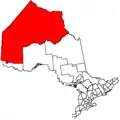
| District | Kenora |
| First Nation | Weenusk |
| Area | |
| • Land | 53.10 km2 (20.50 sq mi) |
Winisk was home to Royal Canadian Air Force Station Winisk, a Mid-Canada Line radar control station from 1958 to 1965.
The town was served by Winisk Airport, with its 6,000 feet plus gravel runway which can still be seen. (Code: YWN)
References
- Hubbert, Mildred Young (1997). Winisk: On the Shore of Hudson Bay. Dundurn Press. ISBN 1-896219-35-7.
- Indigenous and Northern Affairs Canada profile
This article is issued from Wikipedia. The text is licensed under Creative Commons - Attribution - Sharealike. Additional terms may apply for the media files.
