Superior Junction, Ontario
Superior Junction is a community in the town of Sioux Lookout, Kenora District in northwestern Ontario, Canada.[1][2] It is on the Marchington River downstream of Botsford Lake and upstream of the river's mouth at Abram Lake on the English River.
Superior Junction | |
|---|---|
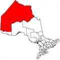
 Superior Junction Location of Superior Junction in Ontario | |
| Coordinates: 50°05′52″N 91°46′40″W | |
| Country | Canada |
| Province | Ontario |
| Region | Northwestern Ontario |
| District | Kenora |
| Town | Sioux Lookout |
| Elevation | 364 m (1,194 ft) |
| Time zone | UTC-6 (Central Time Zone) |
| • Summer (DST) | UTC-5 (Central Time Zone) |
| Postal code FSA | P0V |
| Area code(s) | 807 |
Transportation
Superior Junction lies on the Canadian National Railway transcontinental main line,[3] between the centre of the town of Sioux Lookout to the west and Rosnel to the east, has a passing track, and is passed but not served by Via Rail transcontinental Canadian trains. It is also at the junction of a CN branch line that heads to and comes from Thunder Bay at the southeast; the next point on the line is Alcona.
Ontario Highway 642 crosses the Marchington River and CN main line at Superior Junction.
References
- "Superior Junction". Geographical Names Data Base. Natural Resources Canada. Retrieved 2011-07-22.
- "Sioux Lookout Boundary Map" (PDF). Town of Sioux Lookout. October 2010. Archived from the original (PDF) on 2011-10-02. Retrieved 2011-07-22.
- Map 13 (PDF) (Map). 1 : 1,600,000. Official road map of Ontario. Ministry of Transportation of Ontario. 2010-01-01. Retrieved 2011-07-22.
This article is issued from Wikipedia. The text is licensed under Creative Commons - Attribution - Sharealike. Additional terms may apply for the media files.