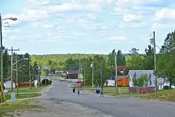
Pickle Lake
Pickle Lake is a township in the Canadian province of Ontario, and is the most northerly community in the province that has year-round access by road. Located 530 kilometres (330 mi) north of Thunder Bay, highway access is via Highway 599, the only access road to the town from the south. More northerly communities rely on winter roads for access and are cut off to land travel in the summer. Highway 599 meets the Northern Ontario Resource Trail, formerly Tertiary Highway 808, at Pickle Lake.
Pickle Lake | |
|---|---|
| Township of Pickle Lake | |
 | |
 Pickle Lake | |
| Coordinates: 51°28′N 90°11′W | |
| Country | Canada |
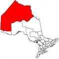
| Province | Ontario |
| District | Kenora |
| Settled | 1929 |
| Incorporated | December 1980 |
| Government | |
| • Mayor | Dwight Monck |
| • Federal riding | Kenora |
| • Prov. riding | Kenora—Rainy River |
| Area | |
| • Land | 252.18 km2 (97.37 sq mi) |
| Elevation | 390.80 m (1,282.15 ft) |
| Population (2016)[1] | |
| • Total | 388 |
| • Density | 1.5/km2 (4/sq mi) |
| Time zone | UTC-5 (EST (geographically in Central Time Zone, but observes Eastern Time year round)) |
| Postal Code | P0V 3A0 |
| Area code(s) | 807 |
| Website | www.picklelake.ca |
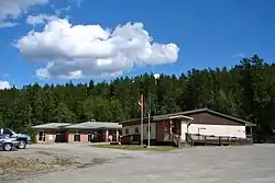
The Township of Pickle Lake has a population of 425 and its main industries are transportation (by air and land) and tourism. Pickle Lake Airport serves as the supply point to northern First Nations. It is an access point for animal watching, with many opportunities to view moose, woodland caribou, timber wolf, black bear, game birds, bald eagles, song birds, and migratory birds such as ducks and geese. It is also a popular fishing and hunting destination. The town is sometimes referred to as the gateway to Ontario's "Last Frontier" because of its remote location. Pickle Lake has its own detachment of the Ontario Provincial Police.
The community is located on the north-east shore of Pickle Lake, from which it takes its name.
History
Pickle Lake was founded as a local transportation centre for mining activities after gold was discovered nearby in 1928. From that time until 1995 over 2.5 million ounces of gold were produced in the area. Copper was also mined near Pickle Lake in the 1970s. Exploration for gold and copper in the Pickle Lake area continues to this day.
Jack Hammell's Pickle Crow Gold Mines (1935–1961) produced 1,446,214 ounces of gold. Alex and Murdoch Mosher's Central Patricia Mine (1927–1951) produced 621,806 ounces.[3]
Pickle Lake was incorporated as a township in 1980. It got its name from the shape of the lake which resembled a cucumber, or 'Pickle'.
The township also includes the former townsites of Central Patricia and Pickle Crow. Both formerly independent settlements, Central Patricia now consists only of a few buildings located at the terminus of Highway 599 within the township, while Pickle Crow is a ghost town. After the Pickle Crow gold mine was shut down in 1966, the Ministry of Natural Resources set fire to the site as part of its program to clean up abandoned mines.[4]
Demographics
| Canada census – Pickle Lake community profile | |||
|---|---|---|---|
| 2016 | 2011 | 2006 | |
| Population: | 388 (−8.7% from 2011) | 425 (−11.3% from 2006) | 479 (+20.1% from 2001) |
| Land area: | 252.18 km2 (97.37 sq mi) | 255.08 km2 (98.49 sq mi) | 255.08 km2 (98.49 sq mi) |
| Population density: | 1.5/km2 (3.9/sq mi) | 1.7/km2 (4.4/sq mi) | 1.9/km2 (4.9/sq mi) |
| Median age: | 32.0 (M: 33.0, F: 30.0) | 28.5 (M: 28.2, F: 29.2) | 30.2 (M: 31.0, F: 28.5) |
| Total private dwellings: | 223 | 225 | 275 |
| Median household income: | $80,896 | $43,499 | |
| References: 2016[5] 2011[6] 2006[7] earlier[8] | |||
Historic populations:[8][9][10][1]
- Population in 2016: 386 (−8.7% from 2011)
- Population in 2011: 425 (−11.3% from 2006)
- Population in 2006: 479 (+20.1% from 2001)
- Population in 2001: 399
- Population in 1996: 544
- Population in 1991: 654
Climate
Pickle Lake has a humid continental climate that closely borders on a subarctic climate (Köppen Dfb/Dfc) and actually used to have a subarctic climate, but not anymore due to global warming.[11] Winters are cold and dry with a January high of −14.3 °C (6.3 °F) and a low of −24.1 °C (−11.4 °F). Most of the precipitation falls in the form of snow, averaging 257 centimetres (101.2 in) with reliable snow cover from November to April.[2] There are 17.3 nights where the temperature will drop below −30 °C (−22.0 °F).[2]
Summers are warm and wetter but short with a July high of 23.0 °C (73.4 °F) and a low of 12.3 °C (54.1 °F). There are 4.8 days where the temperature will exceed 30.0 °C (86.0 °F). Precipitation tends to be higher during the summer months, with each month (June to August) averaging 16 days with measurable precipitation.
The highest temperature ever recorded in Pickle Lake was 40.0 °C (104 °F) on 19 June 1933.[12] The coldest temperature ever recorded was −51.1 °C (−60 °F) on 8 February 1934.[13]
| Climate data for Pickle Lake Airport, 1981−2010 normals, extremes 1930−present | |||||||||||||
|---|---|---|---|---|---|---|---|---|---|---|---|---|---|
| Month | Jan | Feb | Mar | Apr | May | Jun | Jul | Aug | Sep | Oct | Nov | Dec | Year |
| Record high °C (°F) | 6.1 (43.0) |
9.6 (49.3) |
20.8 (69.4) |
29.0 (84.2) |
34.0 (93.2) |
40.0 (104.0) |
37.8 (100.0) |
36.7 (98.1) |
32.2 (90.0) |
26.7 (80.1) |
18.6 (65.5) |
7.0 (44.6) |
40.0 (104.0) |
| Average high °C (°F) | −14.3 (6.3) |
−9.9 (14.2) |
−2.0 (28.4) |
6.8 (44.2) |
14.4 (57.9) |
20.9 (69.6) |
23.0 (73.4) |
22.0 (71.6) |
15.2 (59.4) |
6.1 (43.0) |
−3.1 (26.4) |
−11.1 (12.0) |
5.7 (42.3) |
| Daily mean °C (°F) | −19.3 (−2.7) |
−15.9 (3.4) |
−8.2 (17.2) |
0.7 (33.3) |
8.5 (47.3) |
15.2 (59.4) |
17.7 (63.9) |
16.8 (62.2) |
10.6 (51.1) |
2.5 (36.5) |
−6.6 (20.1) |
−15.5 (4.1) |
0.5 (32.9) |
| Average low °C (°F) | −24.1 (−11.4) |
−21.8 (−7.2) |
−14.4 (6.1) |
−5.3 (22.5) |
2.5 (36.5) |
9.4 (48.9) |
12.3 (54.1) |
11.4 (52.5) |
5.9 (42.6) |
−1.1 (30.0) |
−10.1 (13.8) |
−19.8 (−3.6) |
−4.6 (23.7) |
| Record low °C (°F) | −46.7 (−52.1) |
−51.1 (−60.0) |
−41.7 (−43.1) |
−32.8 (−27.0) |
−17.8 (0.0) |
−6.7 (19.9) |
0.0 (32.0) |
−2.8 (27.0) |
−9.4 (15.1) |
−24.4 (−11.9) |
−38.8 (−37.8) |
−47.8 (−54.0) |
−51.1 (−60.0) |
| Average precipitation mm (inches) | 26.8 (1.06) |
18.9 (0.74) |
30.8 (1.21) |
37.0 (1.46) |
71.3 (2.81) |
100.5 (3.96) |
106.7 (4.20) |
88.3 (3.48) |
98.7 (3.89) |
67.5 (2.66) |
50.7 (2.00) |
31.5 (1.24) |
728.5 (28.68) |
| Average rainfall mm (inches) | 0.3 (0.01) |
0.8 (0.03) |
5.6 (0.22) |
14.9 (0.59) |
59.3 (2.33) |
100.3 (3.95) |
106.7 (4.20) |
88.3 (3.48) |
95.5 (3.76) |
39.9 (1.57) |
9.8 (0.39) |
0.7 (0.03) |
522.0 (20.55) |
| Average snowfall cm (inches) | 36.8 (14.5) |
25.3 (10.0) |
31.4 (12.4) |
24.9 (9.8) |
13.2 (5.2) |
0.2 (0.1) |
0.0 (0.0) |
0.0 (0.0) |
3.5 (1.4) |
30.0 (11.8) |
49.9 (19.6) |
41.9 (16.5) |
257.0 (101.2) |
| Average precipitation days (≥ 0.2 mm) | 14.5 | 10.4 | 11.6 | 8.6 | 13.7 | 16.1 | 17.7 | 15.6 | 16.3 | 16.1 | 16.0 | 15.0 | 171.5 |
| Average rainy days (≥ 0.2 mm) | 0.35 | 0.62 | 1.8 | 4.2 | 12.1 | 16.1 | 17.7 | 15.6 | 15.8 | 10.2 | 3.0 | 0.67 | 98.0 |
| Average snowy days (≥ 0.2 cm) | 15.4 | 11.3 | 11.3 | 6.4 | 3.3 | 0.24 | 0.0 | 0.0 | 1.1 | 8.8 | 15.4 | 16.0 | 89.3 |
| Source: Environment Canada[2][14] | |||||||||||||
Media
Pickle Lake's only local media service is the new CJTL-FM, which airs a mixed Christian radio and First Nations format.[15] The region is otherwise served through rebroadcasters of services from larger cities such as Thunder Bay, Toronto and Winnipeg.
Radio
- FM 96.5 – CJTL-FM, Christian radio/First Nations
- FM 98.5 – CFDK-FM,[16] (defunct)
- FM 105.1 – CBQP-FM, CBC Radio One (relays CBQT-FM, Thunder Bay)
See also
References
- "Census Profile, 2016 Census Pickle Lake, Township". Statistics Canada. Retrieved June 6, 2019.
- "Pickle Lake Airport". Canadian Climate Normals 1981–2010. Environment Canada. Retrieved April 9, 2014.
- Barnes, Michael (1995). Gold in Ontario. Erin: The Boston Mills Press. pp. 85–89. ISBN 155046146X.
- Brief History of Pickle Lake.
- "2016 Community Profiles". 2016 Canadian Census. Statistics Canada. February 21, 2017. Retrieved 2019-06-06.
- "2011 Community Profiles". 2011 Canadian Census. Statistics Canada. July 5, 2013. Retrieved 2012-04-03.
- "2006 Community Profiles". 2006 Canadian Census. Statistics Canada. March 30, 2011. Retrieved 2011-06-28.
- "2001 Community Profiles". 2001 Canadian Census. Statistics Canada. February 17, 2012.
- Statistics Canada: Canada 1996 Census
- "2011 Pickle Lake census profile". 2011 Census of Population. Statistics Canada. Retrieved 2012-04-03.
- Canada, Environment and Climate Change (2011-02-09). "Canadian Climate Normals 1961-1990 Station Data - Climate - Environment and Climate Change Canada". climate.weather.gc.ca. Retrieved 2020-07-04.
- "Daily Data Report for June 1933". Canadian Climate Data. Environment Canada. Retrieved 13 November 2016.
- "Daily Data Report for February 1934". Canadian Climate Data. Environment Canada. Retrieved 13 November 2016.
- "Pickle Lake (AUT)". Canadian Climate Data. Environment Canada. Retrieved 13 November 2016.
- Broadcasting Decision CRTC 2008-106.
- Decision CRTC 92-731, CRTC, October 16, 1992
External links
Places adjacent to Pickle Lake | |
|---|---|