Sironcha
Sironcha is a town and municipal council in Gadchiroli district of Maharashtra state in India. It connected with NH-63.
Sironcha | |
|---|---|
Town | |
 Sironcha Location in Maharashtra, India | |
| Coordinates: 18.847244°N 79.968195°E | |
| Country | |
| State | Maharashtra |
| District | Gadchiroli |
| Government | |
| • Type | Municipal Council |
| • Body | Sironcha Municipal Council |
| Elevation | 323 m (1,060 ft) |
| Population (2011)[1] | |
| • Total | 7,427 |
| Languages | |
| • Official | Marathi[2] |
| Time zone | UTC+5:30 (IST) |
History
Historically Sironcha was a key location for the East India Company from Nizam perspective, it was the Southern tehsil of Chanda District, Central Provinces. however it is not clear why Sironcha, a remote place, was selected ?. In 1901, Sironcha tehsil area was 2,810 square kilometres (1,085 sq mi), and its population was 51,148. The transfer of the taluks of Nugur, Albaka, and Cherla of the Sironcha tehsil, covering an area of 1,540 square kilometres (593 sq mi) and containing 142 villages with 20,218 persons, to the Madras Presidency has been sanctioned, but further details of administration are still being con- sidered. In 1905 an area of 6,740 square kilometres (2,603 sq mi) of the Chanda tahsil, of which 2,600 were in the Ahiri zamindari estate, was transferred to Sironcha. The revised totals of area and population of the Sironcha tahsil are 8,020 square kilometres (3,095 sq mi) and 55,465 persons. The population in 1891 of the area now constituting the tahsil was 51,732. The density is only 6.9 inhabitants per square kilometre (18/sq mi), and the tahsil contains 421 inhabited villages. Its headquarters are at Sironcha, a village of 2,813 inhabitants, 210 kilometres (130 mi) from Chanda town by road. The area of Government forest in the new tahsil is 1,200 square kilometres (480 sq mi), while 5,840 square kilometres (2,254 sq mi) of the Ahiri zamindari are covered by tree forest, scrub jungle, or grass. The northern portion of the tehsil comprised in the Ahiri zamindari is one of the most densely wooded and sparsely populated areas in the Province; to the south of this Sironcha extends in a long narrow strip to the east of the Godavari, and consists of a belt of rich alluvial soil along the banks of the river and its affluents, with forests and hills in the background. The population is wholly Telugu. The land revenue demand of the tahsil was approximately Rs. 17,000, before the revision of settlement now in progress. [3]
Geography
Sironcha is located at 18.83°N 79.96°E.[4] It has an average elevation of 118 metres (390 feet).
There is a planned National highway No 16 between Karimnagar in Telangana State and Jagdalpur in Chhattisgarh State, Maharashtra and Telangana states. The construction of this National highway includes building bridges over the Pranhita and Indravati rivers. The Tahasil is recently came into news for the discovery of Dinosaur's fossils and large numbers of wood fossils found dating back to crores of years, specially lower Jurassic period.
Climate
| Climate data for Sironcha (1981–2010, extremes 1951–2010) | |||||||||||||
|---|---|---|---|---|---|---|---|---|---|---|---|---|---|
| Month | Jan | Feb | Mar | Apr | May | Jun | Jul | Aug | Sep | Oct | Nov | Dec | Year |
| Record high °C (°F) | 34.3 (93.7) |
38.8 (101.8) |
45.6 (114.1) |
46.8 (116.2) |
48.2 (118.8) |
46.7 (116.1) |
40.0 (104.0) |
37.4 (99.3) |
37.9 (100.2) |
37.0 (98.6) |
36.9 (98.4) |
35.4 (95.7) |
48.2 (118.8) |
| Average high °C (°F) | 29.8 (85.6) |
33.3 (91.9) |
37.6 (99.7) |
41.2 (106.2) |
42.5 (108.5) |
37.4 (99.3) |
32.6 (90.7) |
30.2 (86.4) |
32.0 (89.6) |
32.7 (90.9) |
30.7 (87.3) |
29.3 (84.7) |
34.1 (93.4) |
| Average low °C (°F) | 15.2 (59.4) |
18.2 (64.8) |
21.5 (70.7) |
24.7 (76.5) |
26.0 (78.8) |
25.3 (77.5) |
23.1 (73.6) |
22.8 (73.0) |
22.6 (72.7) |
22.3 (72.1) |
17.6 (63.7) |
14.4 (57.9) |
21.1 (70.0) |
| Record low °C (°F) | 6.0 (42.8) |
7.0 (44.6) |
11.7 (53.1) |
14.0 (57.2) |
11.6 (52.9) |
15.2 (59.4) |
17.0 (62.6) |
15.4 (59.7) |
9.5 (49.1) |
5.2 (41.4) |
4.5 (40.1) |
4.7 (40.5) |
4.5 (40.1) |
| Average rainfall mm (inches) | 7.3 (0.29) |
10.1 (0.40) |
11.8 (0.46) |
4.5 (0.18) |
28.7 (1.13) |
184.5 (7.26) |
389.9 (15.35) |
382.1 (15.04) |
143.0 (5.63) |
79.6 (3.13) |
10.0 (0.39) |
2.6 (0.10) |
1,253.9 (49.37) |
| Average rainy days | 0.4 | 0.7 | 0.6 | 0.6 | 1.7 | 8.1 | 15.9 | 15.6 | 8.6 | 4.2 | 0.9 | 0.2 | 57.5 |
| Average relative humidity (%) (at 17:30 IST) | 43 | 38 | 33 | 28 | 28 | 53 | 72 | 78 | 73 | 65 | 59 | 52 | 52 |
| Source: India Meteorological Department[5][6] | |||||||||||||
Demographics
Population
As of 2011 Indian Census, Sironcha had a total population of 7,427, of which 3,798 were males and 3,629 were females. Population within the age group of 0 to 6 years was 701. The total number of literates in Sironcha was 5,680, which constituted 76.5% of the population with male literacy of 82.4% and female literacy of 70.3%. The effective literacy rate of 7+ population of Sironcha was 84.4%, of which male literacy rate was 91.3% and female literacy rate was 77.3%. The Scheduled Castes and Scheduled Tribes population was 382 and 1,277 respectively. Sironcha had 1814 households in 2011.[1]
Transport
Sironcha is connected by the State Road Transport services to Gadchiroli, Aheri, Chandrapur, Nagpur and Wardha. Sironcha is also connected to the Telangana State capital Hyderabad and some popular Cities/Towns like Bhupalapalli Warangal, Ramagundam, Karimnagar, Godavarikhani, Manchiryal.
See also
References
- "Census of India: Sironcha". www.censusindia.gov.in. Retrieved 13 January 2020.
- "52nd Report of the Commissioner for Linguistic Minorities in India" (PDF). nclm.nic.in. Ministry of Minority Affairs. Archived from the original (PDF) on 25 May 2017. Retrieved 13 April 2019.
- "Full text of "The Imperial gazetteer of India" - Internet Archive".
- Falling Rain Genomics, Inc - Sironcha
- "Station: Sironcha Climatological Table 1981–2010" (PDF). Climatological Normals 1981–2010. India Meteorological Department. January 2015. pp. 719–720. Archived from the original (PDF) on 5 February 2020. Retrieved 10 April 2020.
- "Extremes of Temperature & Rainfall for Indian Stations (Up to 2012)" (PDF). India Meteorological Department. December 2016. p. M153. Archived from the original (PDF) on 5 February 2020. Retrieved 10 April 2020.
- "Language Census of India, 2011".
Places adjacent to Sironcha | ||||||||||
|---|---|---|---|---|---|---|---|---|---|---|
| ||||||||||
Gadchiroli district topics | ||
|---|---|---|
| History | 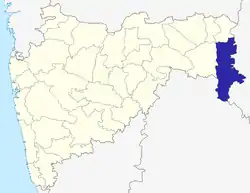 | |
| Geography | ||
| Cities and towns | ||
| Transport | ||
| Culture | ||
| Lok Sabha constituencies | ||
| Vidhan Sabha constituencies | ||