South Coventry Township, Chester County, Pennsylvania
South Coventry Township is a township in Chester County, Pennsylvania, United States. The population was 2,604 at the 2010 census.
South Coventry Township | |
|---|---|
 | |
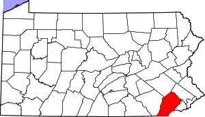
 Location in Chester County and the state of Pennsylvania. | |
.svg.png.webp) Location of Pennsylvania in the United States | |
| Coordinates: 40°11′07″N 75°40′43″W | |
| Country | United States |
| State | Pennsylvania |
| County | Chester |
| Area | |
| • Total | 7.60 sq mi (19.68 km2) |
| • Land | 7.54 sq mi (19.52 km2) |
| • Water | 0.06 sq mi (0.15 km2) |
| Elevation | 650 ft (200 m) |
| Population (2010) | |
| • Total | 2,604 |
| • Estimate (2016)[2] | 2,603 |
| • Density | 345.32/sq mi (133.34/km2) |
| Time zone | UTC-5 (EST) |
| • Summer (DST) | UTC-4 (EDT) |
| Area code(s) | 610 |
| FIPS code | 42-029-72088 |
| School District | Owen J. Roberts |
| Website | www |
History
The township derives its name from Coventry, England, the native home of an early settler.[3]
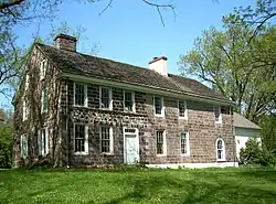
Coventry Hall, Coventryville Historic District, Simon Meredith House, Stephen Meredith House, Nathan Michener House, and Townsend House are listed on the National Register of Historic Places.[4]
Geography
According to the United States Census Bureau, the township has a total area of 7.5 square miles (19 km2), all of it land. The township is located in the Hopewell Big Woods.
There are three main historical and unincorporated villages within the township: Bucktown, Coventryville, and Pughtown.
It is the home of Owen J. Roberts School District's main campus, located at the intersection of Route 23 and Route 100.
Demographics
| Historical population | |||
|---|---|---|---|
| Census | Pop. | %± | |
| 1930 | 589 | — | |
| 1940 | 679 | 15.3% | |
| 1950 | 863 | 27.1% | |
| 1960 | 1,212 | 40.4% | |
| 1970 | 1,518 | 25.2% | |
| 1980 | 1,556 | 2.5% | |
| 1990 | 1,682 | 8.1% | |
| 2000 | 1,895 | 12.7% | |
| 2010 | 2,604 | 37.4% | |
| 2016 (est.) | 2,603 | [2] | 0.0% |
| [5] | |||
At the 2010 census, the township was 95.5% non-Hispanic White, 0.5% Black or African American, 0.2% Native American, 1.0% Asian, and 1.2% were two or more races. 1.7% of the population were of Hispanic or Latino ancestry.[6]
At the 2000 census,[7] there were 1,895 people, 690 households and 529 families living in the township. The population density was 253.6 per square mile (97.9/km2). There were 721 housing units at an average density of 96.5/sq mi (37.3/km2). The racial makeup of the township was 98.47% White, 0.63% African American, 0.16% Native American, 0.11% Asian, 0.21% from other races, and 0.42% from two or more races. Hispanic or Latino of any race were 0.69% of the population.
There were 690 households, of which 34.5% had children under the age of 18 living with them, 68.8% were married couples living together, 4.9% had a female householder with no husband present, and 23.3% were non-families. 18.6% of all households were made up of individuals, and 7.1% had someone living alone who was 65 years of age or older. The average household size was 2.69 and the average family size was 3.09.
Age distribution was 26.0% under the age of 18, 4.5% from 18 to 24, 30.8% from 25 to 44, 24.1% from 45 to 64, and 14.6% who were 65 years of age or older. The median age was 40 years. For every 100 females, there were 98.4 males. For every 100 females age 18 and over, there were 96.5 males.
The median household income was $62,857 and the median family income was $75,157. Males had a median income of $51,063 versus $33,482 for females. The per capita income for the township was $28,956. About 3.2% of families and 3.7% of the population were below the poverty line, including 1.0% of those under age 18 and 13.1% of those age 65 or over.
References
- "2016 U.S. Gazetteer Files". United States Census Bureau. Retrieved Aug 13, 2017.
- "Population and Housing Unit Estimates". Retrieved June 9, 2017.
- "Church's 200th anniversary". Reading Eagle. Nov 10, 1924. p. 11. Retrieved 2 December 2015.
- "National Register Information System". National Register of Historic Places. National Park Service. July 9, 2010.
- http://www.dvrpc.org/data/databull/rdb/db82/appedixa.xls
- https://www.usatoday.com/news/nation/census/profile/PA
- "U.S. Census website". United States Census Bureau. Retrieved 2008-01-31.