South Garo Hills district
South Garo Hills is an administrative district in the state of Meghalaya in India. As of 2011 it is the least populous district of Meghalaya (out of 7).[1] The district was established in 1992.
South Garo Hills district
South Garo | |
|---|---|
District of Meghalaya | |
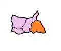
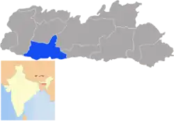 Location of South Garo Hills district in Meghalaya | |
| Country | India |
| State | Meghalaya |
| Headquarters | Baghmara, India |
| Government | |
| • Vidhan Sabha constituencies | 7 |
| Area | |
| • Total | 1,850 km2 (710 sq mi) |
| Population (2011) | |
| • Total | 142,334 |
| • Density | 77/km2 (200/sq mi) |
| Demographics | |
| • Literacy | 53% |
| Time zone | UTC+05:30 (IST) |
| Website | southgarohills |
Geography
The district headquarters are located at Baghmara. The district occupies an area of 1850 km2. South Garo Hills has only 5 assembly constituency at that time but presently it has 3.
Economy
In 2006 the Ministry of Panchayati Raj named South Garo Hills one of the country's 250 most backward districts (out of a total of 640).[2] It is one of the three districts in Meghalaya currently receiving funds from the Backward Regions Grant Fund Programme (BRGF).[2]
Districts
Demographics
According to the 2011 census South Garo Hills district has a population of 142,334,[1] roughly equal to the nation of Saint Lucia.[4] This gives it a ranking of 604th in India (out of a total of 640).[1] The district has a population density of 77 inhabitants per square kilometre (200/sq mi) .[1] Its population growth rate over the decade 2001-2011 was 41.19%.[1] South Garo Hills has a sex ratio of 944 females for every 1000 males,[1] and a literacy rate of 72.39%.[1]
Languages
Languages spoken here include A'Tong, a Tibeto-Burman language spoken by 10,000 people in Bangladesh and India.[5]
Flora and fauna
In 1986 South Garo Hills district became home to Balphakram National Park, which has an area of 220 km2 (84.9 sq mi). It shares Nokrek National Park (47 km2 (18.1 sq mi), established in 1986) with two other districts.[6]
It is also home to the Siju and Baghmara Pitcher Plant Wildlife Sanctuaries.[7]
References
- "District Census 2011". Census2011.co.in. 2011. Retrieved 30 September 2011.
- Ministry of Panchayati Raj (8 September 2009). "A Note on the Backward Regions Grant Fund Programme" (PDF). National Institute of Rural Development. Archived from the original (PDF) on 5 April 2012. Retrieved 27 September 2011.
- Meghalaya Administrative Divisions (PDF) (Map). The Registrar General & Census Commissioner, India, New Delhi, Ministry of Home Affairs, Government of India. 2011. Retrieved 29 September 2011.
- US Directorate of Intelligence. "Country Comparison:Population". Retrieved 1 October 2011.
Saint Lucia 161,557 July 2011 est.
- M. Paul Lewis, ed. (2009). "A'Tong: A language of India". Ethnologue: Languages of the World (16th ed.). Dallas, Texas: SIL International. Retrieved 28 September 2011.
- Indian Ministry of Forests and Environment. "Protected areas: Meghalaya". Archived from the original on 23 August 2011. Retrieved 25 September 2011.
- Indian Ministry of Forests and Environment. "Protected areas: Mizoram". Archived from the original on 23 August 2011. Retrieved 25 September 2011.
External links
| Wikimedia Commons has media related to South Garo Hills district. |
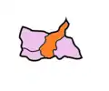
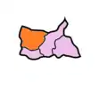
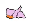
Places adjacent to South Garo Hills district | ||||||||||
|---|---|---|---|---|---|---|---|---|---|---|
| ||||||||||
| State symbols | |
|---|---|
| Topics | |
| Administration |
|
| Divisions |
|
| Districts | |
| Municipalities | |
| |