Tura, Meghalaya
Tura (IPA: ˈtʊərə) is a hilly town and a municipality in West Garo Hills district in the Indian state of Meghalaya. One of the largest towns in Meghalaya, Tura is a valley located at the foothills of the Tura Hills and right below the Tura Peak. The climate in Tura is moderate throughout the year and has many interesting and unexplored areas. The native god Durama was believed to reside in the hills.
Tura | |
|---|---|
Town | |
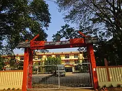 Tura Government College | |
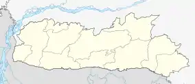 Tura Location in Meghalaya, India  Tura Tura (India) | |
| Coordinates: 25.52°N 90.22°E | |
| Country | India |
| State | Meghalaya |
| District | West Garo Hills |
| Autonomous Regions of India | GHADC |
| Elevation | 349 m (1,145 ft) |
| Population (2011) | |
| • Total | 74,858 |
| Languages | |
| • Official | Garo, English |
| Time zone | UTC+5:30 (IST) |
| Telephone code | 03651 |
| Vehicle registration | ML 08 |
| Climate | Cwa |
It is 220 kilometres from the nearest city Guwahati and is also the district headquarter of the West Garo Hills district. It is filled with small rivulets and green valleys all around. The principal languages are Garo and English. The city has four colleges and a host of good secondary schools. In 1973, the town was made the seat of the Roman Catholic Diocese of Tura.
The capital city of Shillong is 323 kilometres away and can be accessed via buses or the shuttle helicopter service. The border of Bangladesh Dalu, is situated at a proximity of 50 km.
Tura is a cultural and administrative centre of the Garo tribe. To visit popular tourist destinations such as Balpakram, Nokrek and Siju Cave, one needs to pass through this town.
There are many water falls and lot of streams in Tura. Some of the water falls are Rongbangdare, Pelgadare, Gandrak Falls etc. Some of the streams are Rangolwari, Nokmawari, Ganol, and Dachima.
Geography and climate
Tura is located at 25.52°N 90.22°E.[1] It has an average elevation of 349 metres (1145 feet). Its climate is a Humid Subtropical climate (Köppen climate classification: Cwa).
| Climate data for Tura, Meghalaya (1961–1985, extremes 1949–1985) | |||||||||||||
|---|---|---|---|---|---|---|---|---|---|---|---|---|---|
| Month | Jan | Feb | Mar | Apr | May | Jun | Jul | Aug | Sep | Oct | Nov | Dec | Year |
| Record high °C (°F) | 31.5 (88.7) |
35.9 (96.6) |
37.2 (99.0) |
38.5 (101.3) |
39.4 (102.9) |
36.9 (98.4) |
39.1 (102.4) |
36.8 (98.2) |
37.2 (99.0) |
36.6 (97.9) |
34.0 (93.2) |
30.7 (87.3) |
39.4 (102.9) |
| Average high °C (°F) | 22.7 (72.9) |
24.8 (76.6) |
29.0 (84.2) |
30.4 (86.7) |
29.7 (85.5) |
29.1 (84.4) |
28.6 (83.5) |
28.7 (83.7) |
29.0 (84.2) |
28.8 (83.8) |
26.4 (79.5) |
23.3 (73.9) |
27.5 (81.5) |
| Average low °C (°F) | 11.0 (51.8) |
12.7 (54.9) |
16.8 (62.2) |
19.3 (66.7) |
19.4 (66.9) |
20.5 (68.9) |
21.6 (70.9) |
21.5 (70.7) |
21.0 (69.8) |
19.1 (66.4) |
15.6 (60.1) |
12.5 (54.5) |
17.6 (63.7) |
| Record low °C (°F) | 2.5 (36.5) |
5.0 (41.0) |
6.5 (43.7) |
10.1 (50.2) |
10.6 (51.1) |
10.1 (50.2) |
12.6 (54.7) |
12.6 (54.7) |
12.6 (54.7) |
10.6 (51.1) |
8.1 (46.6) |
4.1 (39.4) |
2.5 (36.5) |
| Average rainfall mm (inches) | 9.2 (0.36) |
9.3 (0.37) |
52.5 (2.07) |
165.7 (6.52) |
423.7 (16.68) |
555.8 (21.88) |
669.9 (26.37) |
422.4 (16.63) |
345.8 (13.61) |
173.3 (6.82) |
15.0 (0.59) |
3.3 (0.13) |
2,845.9 (112.04) |
| Average rainy days | 1.0 | 0.6 | 2.8 | 6.5 | 13.6 | 16.0 | 17.7 | 15.5 | 13.2 | 6.3 | 0.8 | 0.2 | 94.2 |
| Average relative humidity (%) (at 17:30 IST) | 65 | 59 | 56 | 67 | 72 | 80 | 82 | 84 | 82 | 78 | 70 | 68 | 72 |
| Source: India Meteorological Department[2] | |||||||||||||
Demographics
Religions in Tura (2011)[3]
The population of Tura city is 75,000 according to census 2011. The indigenous Garo people form the majority of Tura city population other includes Hajong people, Bengalis, Nepalis, Koches, Rabhas, Bodos, and other indigenous tribal ethnic groups along with immigrant Muslims and Biharis. The population of Garo people in the Tura city is 54,750 which makes up 73% of the city population. As of 2011 India census,[4] Tura had a population of 58,391. Males constitute 51% of the population and females 49%. Tura has an average literacy rate of 70%, higher than the national average of 56%: male literacy is 70%, and female literacy is 67%. In Tura, 14% of the population is under 6 years of age.
Connectivity
Tura is situated in the western part of meghalaya which is quite close to the National Border of Bangladesh. Main mode of transport is by road, there are no railways or any scheduled flights from Tura airport. From Guwahati, it is 221 km, through the National Highway 217(Old NH 51). Day time Sumo and overnight bus services are available from Guwahati. There is a 3-days-a-week helicopter service available from Guwahati and Shillong, run by Pawan Hans.
Society
Main Residents of Tura are the Garo tribe (Native People). Christianity is the main religion, Almost 100% of the Garos are Christians. There are different Christian denominations like Baptist, Catholic, Seventh Day Adventist, Church of Jesus Christ (COJC), Christian Revival Church (CRC) etc. The Garos have a matrilineal society, whereas Hajongs are Hindus.
Apart from the Garos, Tura also hosts a variety of other tribes like Hajongs, Koches, Rabhas, Bodos and other indigenous Assamese communities who are Hindu by religion. There are also a considerable number of immigrant Bengali, Bihari and Nepali speaking community etc as well.
Transport
By Air nearest airport is Guwahati Airport (GAU), Bus, Hire Cab. Although Tura has its own airport named Baljek airport situated approx. 30 km from the town but it's not yet functioning. It was inaugurated by then President of India Smt. Pratibha Patil during her visit to the town.
Education
Colleges and Universities
- College of Home Science (under Central Agricultural University, Imphal)
- College of Teacher Education
- Don Bosco College, Tura
- Durama College
- Harding Theological College
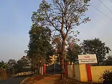
- ICFAI University Meghalaya, Tura
- Martin Luther University, Tura Campus
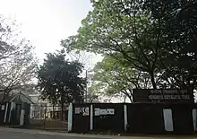
- North-Eastern Hill University, Tura Campus.
- Tura College of Information Technology
- Tura Govt. College
- Tura Law College
- Tura Polytechnic.
- Tura United Christian Academy.
Other institutes
- Regional Vocational Training Institute
- Tura Industrial Training Institute
Food Craft Institute, Tura under NCHMCT, Noida.
Food and drinks
There are many varieties of food available, the common one is the traditional Garo food. Traditional Garo food includes boiled rice, different preparations of pork, beef, chicken and dry fish. Some of the delicacies of Garo Food are Na·kam Bitchi (it is dry fish curry made with chillies and soda), Gal•da Matchu (Roselle leaves boiled with beef), Wak Gominda (it is Pumpkin cooked with Pork, chillies and soda) Wak Pura (it is pork cooked with crushed rice or rice flour), Khappa (meat fried with soda and boiled with fresh garden spices) Ta'a wakgran (Yam with smoked Pork, chillies and soda), Brenga (Meat cooked inside the bamboo), We'tepa (Meat/Fish/vegetables cooked wrapped in banana leaves), Chambil Wak Pura (Pomelo cooked with Pork and crushed rice), Ta'a wak Haldi rasin (Pork cooked with yam, turmeric powder, chillies and onions), Kalai do'o (Black lentils cooked with Chicken), Me'a nakam (Bamboo shoot with dry fish), Me'a wak Pura (Bamboo Shoot with pork and rice flour) etc. The common delicacies are rice cakes called sakkin (made with locally grown sticky rice and sesame seed) and pitta (made with crushed sticky rice and jaggery), Jakkep (made with sticky rice flour and sesame seeds). There are many variety of locally made drinks. Minil bitchi or Mi bitchi (Rice Beer) (made of fermented sticky rice or normal rice) is one of the most common drink. In fact, there are various indigenous delicacies.
Media and communications
All India Radio has a local station in Tura which transmits various programs of mass interest. Recently, daily local newspapers viz., The Tura Times, Janera and Salantini Ku·rang has been disseminating the information to the whole region of Garo Hills and also to parts of Assam (esp. two districts Kamrup and Goalpara) where the areas are populated with Garo People.
References
- Falling Rain Genomics, Inc - Tura
- "Station: Tura Climatological Table 1961–1990" (PDF). Climatological Normals 1961–1990. India Meteorological Department. July 2010. pp. 827–828. Archived from the original (PDF) on 16 February 2020. Retrieved 17 February 2020.
- https://www.in/data/town/801536-tura-meghalaya.html
- "Census of India 2001: Data from the 2001 Census, including cities, villages and towns (Provisional)". Census Commission of India. Archived from the original on 16 June 2004. Retrieved 1 November 2008.
| Wikimedia Commons has media related to Tura, Meghalaya. |
| State symbols | |
|---|---|
| Topics | |
| Administration |
|
| Divisions |
|
| Districts | |
| Municipalities | |
| |