Baghmara, India
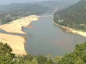
Baghmara (IPA: ˌbægˈmɑ:rə) is the headquarters of South Garo Hills district in the state of Meghalaya in India. The place is bordered by Bangladesh and is about 113 km from Tura; 248 km from Guwahati; and 287 km from state capital Shillong. It has the famous river, Someshwari, also known as Simsang in Garo tribal language, flowing through its expanse and is also covered in hills and tracts along the way. This southern part of the Garo Hills region has lots of tourist spots compared to other districts and is a popular tourist destination for both domestic and international tourists when it comes to tourism in Western Meghalaya.
Baghmara | |
|---|---|
Town | |
 Baghmara Town | |
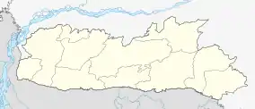
 Baghmara Location in Meghalaya, India  Baghmara Baghmara (India) | |
| Coordinates: 25°12′32″N 90°37′42″E | |
| Country | India |
| State | Meghalaya |
| District | South Garo Hills |
| Population (2011) | |
| • Total | 13,131 |
| Languages | |
| Time zone | UTC+5:30 (IST) |
| PIN | 794 102 |
| Telephone code | 91 03639 |
| Vehicle registration | ML-09 |
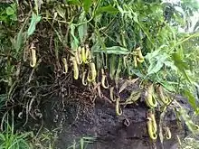
The famous Siju Cave is about 45 km away and to get to Siju one needs to go through Baghmara. The famous Balphakram National Park is 66 km away and one needs to pass through this town to get there. The modes of transport is limited to buses and jeeps. This place is famous for its tasty fish and has a historical sea trading connection with Bangladesh. It is also a native place of the first Chief Minister of Meghalaya Captain Williamson Sangma and he always represented Baghmara constituency. This place is home to the carnivorous pitcher plant and has the Pitcher plant sanctuary located at Dilsa Hill colony of Baghmara. The town viewpoint is also located on the same spot inside the tourist lodge where breathtaking scenery of Baghmara can be seen.
History
The name “Baghmara" derived from the fight that took place between Bong Lasker and a wild Bengal tiger where he killed the tiger by crushing the jaws. Hence, the name Baghmara, where, bagh means "tiger" and mara means "died". To remember Bong Lasker, a tomb was built in the heart of Baghmara town. This place was previously known as "Barokar", which means 12 streams. Here " Baro" or "বারো" meaning 12 is also a বাংলা word and "kar" or কার meaning stream in Bangla.
Demographics
As of 2001 India census,[1] Baghmara had a population of 8643. Males constitute 53% of the population and females 47%. Baghmara has an average literacy rate of 70%, higher than the national average of 59.5%; with 55% of the males and 45% of females literate. 16% of the population is under 6 years of age. AS per 2011 Census of India, the population of Baghmara municipality has increased to 13,131 persons.[2]
Places of interest

The site encloses the richest landscapes of the region.It is heaven for wildlife lovers! It comprises a wide range of flora, fauna and avifauna species unique to this place. The wonderful Siju cave made of limestone is very popular among travelers with thousands of bats inhabiting the cave. Planning a trip to this site will reward tourists with amazing memories.
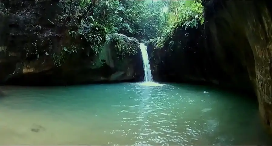
 Achak Chiring in Baghmara - a natural swimming pool.
Major Attractions :
A paradise for wildlife enthusiasts! The place has a lush forest expanse that houses several flora, fauna and avifauna species unique to this site. Another most famous site here is the Siju Cave made from limestone; it is better-known as the 'cave of bats' and 'Princess Di's Chamber' by its excavators.
- Balphakram National Park
- Siju Cave
- Pitcher Plant
- Simsang River
- Chitmang Peak (Second Highest Peak in Garo Hills)
- Pitcher Plant Sanctuary
- Bangladesh View
- Simsang Bridge (Longest Bridge in Garo Hills)
- Butterfly Spot
- Baghmara-Balpakram forest Reserve
- Nengkong cave
- Wari Chora
- Achak Chiring
- Simsang beach
- A•ginma Wari
- Dombe Wari
- Jawa wari
- Chonda Kyndam camping
- Badri waterfalls (Sangkining Khawbong)
- Siju Bird sanctuary
- Goera Ronggat
- Rompa dare
- Rongdong Falls
- A•changdap Dare (Waterfalls)
- Redingsni Dare (Waterfalls)
- A•wemong Zero Point
- Chekwe Rockspot, Nongalbibra
- Renang Dare (Waterfalls); Tallest waterfall in Garo Hills.
- Gongja Dare (Waterfalls)
- Kore Nokmong Dare (Waterfalls)
- Matrong Toleram Waterfall
- Matrong Man'pat Waterfalls
- Eman Nakama Cave (Nokat Chibe)
- Rekman Falls
- Katchi Nokpante Falls
- Dabat Wari, Siju
- Bamon Wari
- Rewak Hanging Bridge (Longest Suspension Bridge in Garo Hills)
- Jadisil Fish Sanctuary
- Jollong Wari
- Deoban Wari, Balpakram
- Rompa Dare (Waterfalls)
- Okpel Nawairam Waterfalls
- Nabat Nawairam Waterfalls
- Matdrong Dare (Waterfalls)
- Durabanda falls (Chokpot)
- Nosari-Bandari falls
- Rongsu village
References
- "Census of India 2001: Data from the 2001 Census, including cities, villages and towns (Provisional)". Census Commission of India. Archived from the original on 16 June 2004. Retrieved 1 November 2008.
- "Census 2011 - Baghmara, Meghalaya". Retrieved 12 November 2018.
3. https://www.incredibleindia.org/content/incredibleindia/en/destinations/baghmara.html