South Minahasa Regency
South Minahasa Regency is a regency in North Sulawesi, Indonesia. Its capital is Amurang. It covers an area of 1,456.46 km2, and had a population of 195,553 at the 2010 Census; this had risen to 204,832 at the 2015 Intermediate Census, and the latest official estimate (as at 1 July 2019) is 210,400.[3] It was originally part of the Minahasa Regency until it was established as a separate regency on 25 February 2003.[4]
South Minahasa Regency
(Kabupaten Minahasa Selatan) | |
|---|---|
 Coat of arms | |
 Location in North Sulawesi | |
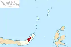
 South Minahasa Regency Location in Indonesia | |
| Coordinates: 0°35′N 124°18′E | |
| Country | Indonesia |
| Province | North Sulawesi |
| Established | 25 February 2003 |
| Capital | Amurang |
| Government | |
| • Regent | Christiany Paruntu |
| • Vice Regent | Sonny Tandaju |
| Area | |
| • Total | 1,456.46 km2 (562.34 sq mi) |
| Population (mid 2019)[2] | |
| • Total | 210,400 |
| • Density | 140/km2 (370/sq mi) |
| Time zone | UTC+8 (WITA) |
| Website | minselkab.go.id |
Administration
The regency is divided into seventeen districts (kecamatan), tabulated below with their areas and population totals from the 2010 Census[5] and the latest official estimates for mid 2018.[6] The table also includes the location of the administrative centre and the number of administrative villages (rural desa and urban kelurahan) in each district, and its postal codes.
| Name | Area in km2 | Population Census 2010[7] | Population Estimate mid 2018[8] | Admin centre | Number of villages | Post codes |
|---|---|---|---|---|---|---|
| Modoinding | 45.82 | 11,324 | 12,781 | Pinasungkulan | 10 | 95958 |
| Tompaso Baru | 133.75 | 11,774 | 12,009 | Tompaso Baru Dua | 10 | 95358 |
| Maesaan | 140.26 | 9,717 | 10,104 | Tumani Utara | 12 | 95357 |
| Ranoyapo | 101.58 | 11,832 | 12,622 | Pontak Satu | 12 | 95944 |
| Motoling | 25.90 | 7,191 | 7,343 | Motoling | 7 | 95941 |
| Kumelembuai | 31.67 | 6,650 | 6,451 | Kumelembuai Satu | 8 | 95956 |
| Motoling Barat (West Motoling) | 120.39 | 7,661 | 7,844 | Raanon Baru Dua | 8 | 95942 |
| Motoling Timur (East Motoling) | 52.01 | 8,673 | 9,621 | Wanga Amongena | 8 | 95943 |
| Sinonsayang | 102.95 | 15,203 | 15,544 | Ongkaw Dua | 13 | 95959 |
| Tenga | 125.34 | 17,184 | 18,023 | Pakuweru | 18 | 95355 |
| Amurang | 46.13 | 16,260 | 18,744 | Buyungon | 8 | 95957 |
| Amurang Barat (West Amurang) | 107.41 | 14,898 | 16,233 | Kapitu | 10 | 95955 |
| Amurang Timur (East Amurang) | 142.30 | 13,390 | 15,615 | Lopana | 10 | 95954 |
| Tareran | 57.25 | 12,129 | 12,583 | Rumoong Atas | 13 | 95953 |
| Suluun Tareran ("Sulta") | 36.63 | 7,098 | 7,501 | Suluun Empat | 9 | 95952 |
| Tumpaan | 75.32 | 15,434 | 17,274 | Tumpaan Satu | 10 | 95352 |
| Tatapaan (a) | 111.77 | 8,965 | 9,209 | Paslaten | 11 | 95351 |
| Totals | 1,456.46 | 195,553 | 209,501 | 177 |
Notes: (a) including 4 small offshore islands.
Climate
Amurang, the seat of the regency has a tropical rainforest climate (Af) with moderate rainfall from July to September and heavy rainfall in the remaining months.
| Climate data for Amurang | |||||||||||||
|---|---|---|---|---|---|---|---|---|---|---|---|---|---|
| Month | Jan | Feb | Mar | Apr | May | Jun | Jul | Aug | Sep | Oct | Nov | Dec | Year |
| Average high °C (°F) | 29.6 (85.3) |
29.6 (85.3) |
29.9 (85.8) |
30.9 (87.6) |
31.0 (87.8) |
30.9 (87.6) |
30.9 (87.6) |
31.5 (88.7) |
31.7 (89.1) |
31.8 (89.2) |
30.9 (87.6) |
30.2 (86.4) |
30.7 (87.3) |
| Daily mean °C (°F) | 26.0 (78.8) |
26.0 (78.8) |
26.2 (79.2) |
26.7 (80.1) |
26.9 (80.4) |
26.8 (80.2) |
26.7 (80.1) |
26.9 (80.4) |
26.8 (80.2) |
27.0 (80.6) |
26.7 (80.1) |
26.4 (79.5) |
26.6 (79.9) |
| Average low °C (°F) | 22.4 (72.3) |
22.4 (72.3) |
22.6 (72.7) |
22.5 (72.5) |
22.9 (73.2) |
22.7 (72.9) |
22.5 (72.5) |
22.4 (72.3) |
22.0 (71.6) |
22.2 (72.0) |
22.6 (72.7) |
22.7 (72.9) |
22.5 (72.5) |
| Average rainfall mm (inches) | 331 (13.0) |
263 (10.4) |
243 (9.6) |
205 (8.1) |
187 (7.4) |
170 (6.7) |
124 (4.9) |
97 (3.8) |
99 (3.9) |
138 (5.4) |
224 (8.8) |
280 (11.0) |
2,361 (93) |
| Source: Climate-Data.org[9] | |||||||||||||
References
- Badan Pusat Statistik Sulawesi Utara, 2014.
- Badan Pusat Statistik, Jakarta, 2019.
- Badan Pusat Statistik Sulawesi Utara, 2020.
- RI, Setjen DPR. "Dewan Perwakilan Rakyat". www.dpr.go.id. Archived from the original on 24 November 2009. Retrieved 27 June 2017.
- Biro Pusat Statistik, Jakarta, 2011.
- Badan Pusat Statistik Sulawesi Utara, 2020.
- Biro Pusat Statistik, Jakarta, 2011.
- Badan Pusat Statistik Sulawesi Utaraa, 2020.
- "Climate: Amurang". Climate-Data.org. Retrieved 22 November 2020.