Sreebardi Upazila
Sreebardi (Bengali: শ্রীবর্দি) is an upazila of Sherpur District[1] in the Division of Mymensingh, Bangladesh.
Sreebordi
শ্রীবরদী | |
|---|---|
 Sreebordi Location in Bangladesh | |
| Coordinates: 25°9′N 89°54.2′E | |
| Country | |
| Division | Mymensingh Division |
| District | Sherpur District |
| Area | |
| • Total | 270.34 km2 (104.38 sq mi) |
| Population (1991) | |
| • Total | 228,194 |
| • Density | 840/km2 (2,200/sq mi) |
| Time zone | UTC+6 (BST) |
| Website | sreebordi |
Geography
Sreebardi is located at 25.1500°N 89.9028°E. It has 47900 households and total area 270.34 km2.
Demographics
As of the 1991 Bangladesh census, Sreebardi has a population of 228194. Males constitute 50.88% of the population, and females 49.12%. This Upazila's eighteen up population is 109693. Sreebardi has an average literacy rate of 18.5% (7+ years), and the national average of 32.4% literate.[2]
Administration
Sreebardi Upazila is divided into Sreebardi Municipality and ten union parishads: Bhelua, Garjaripa, Gosaipur, Kakilakura, Kharia Kazirchar, Kurikahonia, Ranishimul, Singabaruna, Sreebordi, and Tatihati. The union parishads are subdivided into 81 mauzas and 142 villages.[3]
Sreebardi Municipality is subdivided into 9 wards and 20 mahallas.[3]
References
- Syed Marufuzzaman (2012), "Sreebardi Upazila", in Sirajul Islam and Ahmed A. Jamal (ed.), Banglapedia: National Encyclopedia of Bangladesh (Second ed.), Asiatic Society of Bangladesh
- "Population Census Wing, BBS". Archived from the original on 2005-03-27. Retrieved November 10, 2006.
- "District Statistics 2011: Sherpur" (PDF). Bangladesh Bureau of Statistics. Archived from the original (PDF) on 13 November 2014. Retrieved 14 July 2014.
| Upazila/Thana: | ||
|---|---|---|
Headquarters: Mymensingh | ||
| Jamalpur District | 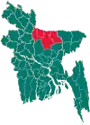 | |
| Mymensingh District | ||
| Netrokona District | ||
| Sherpur District | ||