Atpara Upazila
Atpara (Bengali: আটপাড়া) is the smallest upazila of Netrokona District, in the Division of Mymensingh, Bangladesh.[1]
Atpara Upazila
আটপাড়া উপজেলা | |
|---|---|
| Country | |
| Division | Mymensingh Division |
| District | Netrokona District |
| Atpara Thana | 1926 |
| Atpara Upazila | 2 July 1983 |
| Government | |
| • Upazila Chairman | Muhammad Khairul Islam Sripuri |
| Area | |
| • Upazila | 195 km2 (75 sq mi) |
| • Metro | 9.04 km2 (3.49 sq mi) |
| Population | |
| • Upazila | 144,624 |
| • Density | 740/km2 (1,900/sq mi) |
| Time zone | UTC+6 (BST) |
| Website | atpara |
History
When the Baro-Bhuiyans were in power in Bengal, Atpara was a part of the Sarkar Bazuhar. It later became part of the parganas of Sirujial and Mymensingh. The zamindar of Mymensingh Pargana, Brajendra Kishore Roy Chowdhury of Gouripur named this area as Brajer Bazar (Braj's market) after himself. It was later renamed to Atpara, although some locals may still refer to it today as Brajerbazar.[2]
During the Mughal period, a three domed mosque was constructed in between the villages of Shormushia and Haripur. An established Hindu zamindar family later formed in the village of Rameshwarpur. The remnants of the family palace (Roy Bari) remains a popular tourist site.
The village of Amati in Teligati Union, Atpara is quite notable. Social reformers such as Sonafor Uddin, Muktul Husayn Khan, Shariat Khan, Anfar Uddin, Manfar Uddin and Jafar Uddin were born in Amati. During British period, Shyam Biswas, a Bengali Hindu zamindar, was noted to be very cruel and abusive towards the local inhabitants. He had certain regulations such as no one being allowed to pass his front yard wearing shoes or slippers. The social reformers organised people against this humiliation, rising against Biswas. Their revolution was soon followed in other parts of the district. Amati became a symbol of revolution against tyrant landlords.
On 21 August 1917, Atpara was made a thana. During the Bangladesh Liberation War, freedom fighters attacked the Atpara Thana on 19 August 1971. They killed a number of Razakars as well as the Officer-in-Charge of the Thana; and they also looted arms and ammunition from the Thana. On 7 October, a battle was fought leading to the death of three more Razakars. Atpara was made an upazila on 2 July 1983.[1]
Demographics
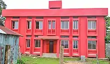
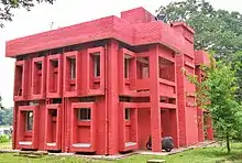
_%E0%A6%A8%E0%A6%BE%E0%A6%9C%E0%A6%BF%E0%A6%B0%E0%A6%97%E0%A6%9E%E0%A7%8D%E0%A6%9C_%E0%A6%AC%E0%A6%BE%E0%A6%9C%E0%A6%BE%E0%A6%B0%252C_%E0%A6%86%E0%A6%9F%E0%A6%AA%E0%A6%BE%E0%A6%A1%E0%A6%BC%E0%A6%BE%252C_%E0%A6%A8%E0%A7%87%E0%A6%A4%E0%A7%8D%E0%A6%B0%E0%A6%95%E0%A7%8B%E0%A6%A3%E0%A6%BE.jpg.webp)
According to 2011 Bangladesh census, Atpara had a population of 144,624. Males constituted 49.87% of the population and females 50.13%. Muslims formed 90.81% of the population, Hindus 9.09%, Christians 0.01%, and others 0.09%. Atpara had a literacy rate of 38.7% for the population 7 years and above.[3]
As of the 1991 Bangladesh census, Atpara has a population of 120491. Males constitute 51.15% of the population, and females 48.85%. This Upazila's eighteen up population is 60858. Atpara has an average literacy rate of 24% (7+ years), and the national average of 32.4% literate.[4]
Administration
Atpara Upazila is divided into seven union parishads: Baniyajan, Duoj, Lunesshor, Shormushia, Shunoi, Sukhari, and Teligati. The union parishads are subdivided into 139 mauzas and 177 villages.[5]
Chairmen
| Number | Name | Term |
|---|---|---|
| 01 | Zahirul Islam Khan Maju | 1985 - 1990 |
| 02 | Abul Husayn Master | 1990 - 1991 |
| 03 | Muhammad Khairul Islam Sripuri | Present |
References
- Bivuti Ranjan Ray (2012). "Atpara Upazila". In Islam, Sirajul; Miah, Sajahan; Khanam, Mahfuza; Ahmed, Sabbir (eds.). Banglapedia: the National Encyclopedia of Bangladesh (Online ed.). Dhaka, Bangladesh: Banglapedia Trust, Asiatic Society of Bangladesh. ISBN 984-32-0576-6. OCLC 52727562. Retrieved 25 January 2021.
- এক নজরে আটপাড়া. Atpara Upazila (in Bengali).
- "Bangladesh Population and Housing Census 2011: Zila Report – Netrakona" (PDF). Table P01 : Household and Population by Sex and Residence, Table P05 : Population by Religion, Age group and Residence, Table P09 : Literacy of Population 7 Years & Above by Religion, Sex and Residence. Bangladesh Bureau of Statistics (BBS), Ministry of Planning, Government of the People’s Republic of Bangladesh. Retrieved 14 December 2018.
- "Population Census Wing, BBS". Archived from the original on 2005-03-27. Retrieved November 10, 2006.
- "District Statistics 2011: Netrokona" (PDF). Bangladesh Bureau of Statistics. Archived from the original (PDF) on 13 November 2014. Retrieved 14 July 2014.
| Upazilas | ||
|---|---|---|
| Constituencies | ||
| Attractions and sites | ||
| History | ||
| Inhabited areas | ||
| Rivers | ||
| Educational institutions | ||
| Transport | ||
Headquarters: Mymensingh | ||
| Jamalpur District |  | |
| Mymensingh District | ||
| Netrokona District | ||
| Sherpur District | ||
