Trout Canyon, Nevada
Trout Canyon is an unincorporated community in Clark County, Nevada, United States.
Description
The community of Trout Canyon is named after and located in Trout Canyon of the Spring Mountains. The community has no commercial businesses or service buildings. Trout Canyon is located roughly 13 miles east of Pahrump and 60 miles west of Las Vegas.
History
From 1 July 2013 to 18 August 2013, the Carpenter 1 Fire took place in the Spring Mountains and impacted the Trout Canyon area after lightning struck the area. The wildfire damaged the over 50 years old water system of Trout Canyon, which used metal pipes constructed of World War II-era ammunition canisters that collected spring water to provide it to the community. On 19 August 2013, Las Vegas Valley Water District agreed to make repairs to the system for $35,000. The repairs were nearly complete when the pipeline was washed away by a flash flood.[1] As of 2018, multiple homes in the community still had dry taps.[2]
Trout Canyon Road
Trout Canyon is served by Trout Canyon Road, a roughly 11 mile unpaved road leading from Nevada State Route 160 in Nye County to the community.[3]
References
- Givens, Kelsey (13 September 2013). "After 75 days, Trout Canyon gets running water – for 1 hour". Retrieved 1 February 2021.
- Brean, Henry (14 July 2018). "Southern Nevada community without water 5 years after Carpenter 1 fire". Las Vegas Review-Journal. Retrieved 1 February 2021.
- https://www.trailsoffroad.com/trails/2875-trout-canyon-road
Municipalities and communities of Clark County, Nevada, United States | ||
|---|---|---|
| Cities | 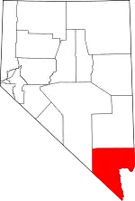 Clark County map | |
| CDPs | ||
| Unincorporated communities | ||
| Ghost towns | ||
| Indian reservations | ||
| Proposed communities | ||
| Footnotes | ‡This populated place also has portions in an adjacent county or counties | |
| ||