Uig, Snizort
Uig (Scottish Gaelic: Ùige) is a village at the head of Uig Bay on the west coast of the Trotternish peninsula on the Isle of Skye, Scotland.[1] In 2011 it had a population of 423.[2]
Uig
| |
|---|---|
 Uig Harbour and Pier | |
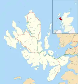 Uig Location within the Isle of Skye | |
| Area | 54 km2 (21 sq mi) |
| Population | 423 (2011) |
| • Density | 8/km2 (21/sq mi) |
| OS grid reference | NG396634 |
| Council area | |
| Lieutenancy area | |
| Country | Scotland |
| Sovereign state | United Kingdom |
| Post town | PORTREE |
| Postcode district | IV51 |
| Dialling code | 01470 |
| Police | Scotland |
| Fire | Scottish |
| Ambulance | Scottish |
| UK Parliament | |
| Scottish Parliament | |
Name
The name is thought to be derived from Old Norse vík, which means bay[3] or inlet. It was thus originally the same placename as Wick, Highland, Vik, Sogn og Fjordane and Vík í Mýrdal.
Geography
Uig is situated partly on the raised beach around the head of the bay and partly on the steep slopes behind it. Two watercourses enter the bay at Uig: the River Rha from the north and the River Conon which drains Glen Uig to the east. The lower courses of both of these small rivers are characterised by waterfalls.
Uig Tower is a prominent local landmark associated with the Highland Clearances.
Uigg, Prince Edward Island, Canada was named by settlers from Uig.

Transport

Road
Uig is served by the A87 road from Portree and Kyle of Lochalsh to the south and the A855 road which runs northwards around the end of the Trotternish peninsula before also turning south to Portree. As of August 2006, Uig is accessible via intercity buses on Skye, and Scottish Citylink buses, which travel as far south as Fort William and Glasgow.
Ferries
| Caledonian MacBrayne | |||||||||||||||||||||
|---|---|---|---|---|---|---|---|---|---|---|---|---|---|---|---|---|---|---|---|---|---|
| |||||||||||||||||||||
From its sheltered port, Caledonian MacBrayne ferries run to Tarbert on Harris and Lochmaddy on North Uist providing links with the Outer Hebrides.
| Preceding station | Ferry | Following station | ||
|---|---|---|---|---|
| Terminus | Caledonian MacBrayne North Uist Ferry |
Lochmaddy | ||
| Terminus | Caledonian MacBrayne Harris Ferry |
Tarbert |
References
- "Uig". The Gazetteer for Scotland. School of GeoSciences, University of Edinburgh and The Royal Scottish Geographical Society. Retrieved 18 June 2018.
- Highland Council 2011 census profile for Settlement Zones
- "Placenames P-Z" (PDF). Scottish Parliament. Retrieved 8 January 2021.