Harlosh Island
Harlosh Island is an island in Loch Bracadale just off the coast of the Minginish and Harlosh peninsulas of Skye in Scotland.[2][3]
| Scottish Gaelic name | Eilean Heàrrlois |
|---|---|
| Meaning of name | "river mouth island"? |
| Location | |
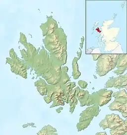 Harlosh Island Harlosh Island shown within Highland Scotland | |
| OS grid reference | NG278393 |
| Coordinates | 57.368°N 6.525°W |
| Physical geography | |
| Island group | Skye |
| Area | 28 ha[1] |
| Highest elevation | 51 m[2] |
| Administration | |
| Sovereign state | United Kingdom |
| Country | Scotland |
| Council area | Highland |
The island is about 28 hectares (69 acres) in extent and the coastline, which is largely cliff-lined, has a cave on the west coast. At low tide it is only about 100 metres (330 ft) from mainland Skye. Harlosh Skerry lies just offshore to the north west. At low tide on the northern coast there is a large sand bay, however, watercraft should take caution when attempting to land in the bay as several rock formations pose a navigational hazard at low tide.
The name "Harlosh" is of Old Norse origin and may refer to a river mouth, although the meaning is not clear.[4]
Notes
- Rick Livingstone’s Tables of the Islands of Scotland (pdf) Argyll Yacht Charters. Retrieved 12 Dec 2011.
- Ordnance Survey. OS Maps Online (Map). 1:25,000. Leisure.
- "Harlosh Island". Gazetteer for Scotland. Retrieved 9 December 2009.
- Mac an Tàilleir, Iain (2003) Ainmean-àite/Placenames. (pdf) Pàrlamaid na h-Alba. Retrieved 26 August 2012.
External links
| Wikimedia Commons has media related to Harlosh Island. |
This article is issued from Wikipedia. The text is licensed under Creative Commons - Attribution - Sharealike. Additional terms may apply for the media files.