Ukilla
Ukilla (Quechua for a medical plant whose seed is used to dye,[2] Hispanicized spelling Uquilla) is a 5,092-metre-high (16,706 ft) volcano[3] in the Bolivian Andes. It is situated in the Potosí Department, Nor Lípez Province, Quemes Municipality.[1][4] Ukilla lies south of the Uyuni salt flat in a volcanic field known as Pampa Luxsar.
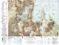
Map of the area showing the location of Ukilla
| Ukilla | |
|---|---|
 Ukilla Location in Bolivia | |
| Highest point | |
| Elevation | 5,092 m (16,706 ft) [1] |
| Coordinates | 20°50′59″S 68°11′54″W |
| Geography | |
| Location | Bolivia, Potosí Department |
| Parent range | Andes |
References
- Bolivian IGM map 1:250,000 Villa Martín SF-19-3
- Serie Sabiduría Amazónica, Sabiduría de la Cultura Kichwa de la Amazonía Ecuatoriana, Toma 1, Cuenca - Ecuador, 2012
- JOGMEC et al., Estudio sobre Recursos Geotérmico para Suministro de Calor y Energía en la Región de Uyuni del Estado Plurinacional de Bolivia, 2011
- "San Pedro de Quemes". INE, Bolivia. Retrieved October 9, 2014.
Capital: Potosí | ||
| Provinces |  | |
| Municipalities (and seats) |
| |
This article is issued from Wikipedia. The text is licensed under Creative Commons - Attribution - Sharealike. Additional terms may apply for the media files.