Urmston
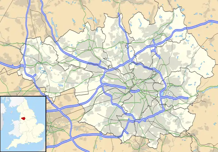
Urmston /ˈɜːrmstən/ (![]() listen) is a town in Trafford, Greater Manchester, England, which had a population of 41,825 at the 2011 Census.[1] Within the boundaries of the historic county of Lancashire, it is about five miles (8 km) southwest of Manchester city centre. The southern boundary is the River Mersey, with Stretford lying to the east and Flixton to the west. Davyhulme lies to the north of the town centre. Urmston covers an area of 4,799 acres (19 km2).
listen) is a town in Trafford, Greater Manchester, England, which had a population of 41,825 at the 2011 Census.[1] Within the boundaries of the historic county of Lancashire, it is about five miles (8 km) southwest of Manchester city centre. The southern boundary is the River Mersey, with Stretford lying to the east and Flixton to the west. Davyhulme lies to the north of the town centre. Urmston covers an area of 4,799 acres (19 km2).
| Urmston | |
|---|---|
 Urmston Location within Greater Manchester | |
| Population | 41,825 (2011 Census) Getopulation_density = 10,881/sq mi (4,201/km2) |
| OS grid reference | SJ766947 |
| • London | 165 miles (265 km) SE |
| Metropolitan borough | |
| Metropolitan county | |
| Region | |
| Country | England |
| Sovereign state | United Kingdom |
| Post town | MANCHESTER |
| Postcode district | M41 |
| Dialling code | 0161 |
| Police | Greater Manchester |
| Fire | Greater Manchester |
| Ambulance | North West |
| UK Parliament | |
The town has early medieval origins, and until the arrival of the railway in 1873 was a small farming community. The railway acted as a catalyst, transforming the town into a residence for the middle classes. Today, Urmston is one of the major urban areas in Trafford as it includes the areas of Davyhulme and Flixton.
History
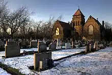
In 1983, during an excavation by South Trafford Archaeological Group, fragments of Roman pottery were found in the area now occupied by the cemetery – previously the site of Urmston Old Hall – suggesting that there may have been a Roman settlement on the site.[2] In the early 13th century, Lord Greenhalgh and his family lived at Highfield House (under what is now the M60 motorway).
Shortly after the Norman conquest of England, between 1069 and 1070, William the Conqueror led a military campaign against the Saxon Earl Edwin, who ruled England north of the River Mersey. On the campaign's successful conclusion, William gave his kinsman Roger de Poictou all of the land between the River Mersey and the River Ribble. Part of this land was in turn given to Albert de Greslet, who towards the end of the 12th century, bestowed as much land as a team of oxen could plough in one-year on Orme Fitz Seward, the son of Edward Aylward.[3] It is probable that the name Urmston is derived from Orme's Easton, or Ormestun, the "tun" or dwelling of Orme Fitz Seward.
The Manor of Urmston was rented by a family using the local surname. The earliest known member of the Urmston family is Richard de Urmston, who was recorded in 1193–94 as giving 40 shillings "for having the king's good will".[4] Orme Fitz Seward's land passed to Richard de Trafford in the 13th century.[5] The de Trafford family later lost the land, but won it back as the result of a duel.
Urmston Old Hall was the home of the manorial lord, and a centre of power in the area during the Middle Ages. The Old Hall was completely rebuilt in brick and timber in the late 16th century. New Croft Hall, also in Urmston, was the residence of a wealthy freeman and may have been moated. Urmston was only one of three manors in Trafford to have had two medieval halls, the others being Hale and Timperley. Neither of the halls has survived to the present day.[6]
Farming was the main occupation in Urmston until the early 19th century, when weaving became a significant source of employment, although this later declined due to competition from large industry. In 1848, the population was recorded as being 771, with around 80% of the land being farmed.[7] The opening of the Cheshire Lines Railway in 1873 allowed the town to grow as a commuter town: between 1871 and 1901 the population grew by over 650%, from 996 to 6,594. By 1901, farming had virtually died out, and the town became a residence for the middle classes.[8]
In 1948 the Minister for Health, Aneurin Bevan, conducted the symbolic inauguration of the National Health Service at Davyhulme's Park Hospital, now renamed Trafford General Hospital.[5] The area was home to the first District heating system in England. In operation by 1948, a boiler house supplied hot water to 200 homes on a newly built housing estate. The water was heated with low-grade fuels such as peat and coke, with houses built in groups of four for better efficiency.[9]
Governance
Once a township in the parish of Flixton, Urmston became an urban district of the administrative county of Lancashire, under the Local Government Act 1894. The Local Government Act 1972 abolished the Urban District of Urmston and in 1974 Urmston became a district of the Metropolitan Borough of Trafford, in the metropolitan county of Greater Manchester.
The parliamentary constituency of Stretford and Urmston was formed in 1997. Kate Green, a member of the Labour Party, became the MP at the 2010 General Election.
Urmston is one of the four major urban areas in Trafford, the other three being Altrincham, Sale and Stretford. In local elections for Trafford Council, Urmston is split into four wards: Davyhulme East, Davyhulme West, Flixton and Urmston.[5] Like every other ward in Trafford they are each represented by three local councillors, giving Urmston 12 of the 63 seats on Trafford Council.
Geography

Urmston occupies an area of 7.5 square miles (19.4 km2), at 53°26′55″N 2°22′29″W (53.4487, −2.3747); it is approximately 137 feet (42 m) above sea level at its highest point.[10] The land is relatively flat, sloping gently from north to south.[4] Urmston's climate is generally temperate, with few extremes of temperature or weather. The mean temperature is slightly above average for the United Kingdom. Annual rainfall and average amount of sunshine are both slightly below the average for the UK.[11]
Urmston comprises the areas of Davyhulme, Dumplington, Flixton and Urmston,[5] with the River Mersey forming the southern boundary.[12] For administrative reasons, Partington is sometimes considered to be part of Urmston. The most southerly part of Urmston lies within the flood plain of the River Mersey, an area known as Urmston Meadows, part of the Mersey Valley. Much work was carried out in the 1970s to canalise the Mersey, in an effort to speed up the flow of floodwater and thus reduce the risk of flooding.[13] Upstream emergency floodbasins such as Sale Water Park, lying just to the east of Urmston, have also been constructed.[13] The M60 Manchester orbital motorway passes through the northern half of Urmston, from southeast to northwest, and the M62 motorway lies just to the west. The Thirlmere Aqueduct also passes through the Urmston area.
Demography
| Urmston compared | |||
|---|---|---|---|
| 2001 UK Census | Urmston[14] | Trafford[15] | England |
| Total population | 40,964 | 210,145 | 49,138,831 |
| White | 96.8% | 91.6% | 90.9% |
| Asian | 1.0% | 4.1% | 4.6% |
| Black | 0.7% | 2.0% | 2.3% |
As of the 2001 UK census, Urmston had a population of 40,964. The population density was 10,881 inhabitants per square mile (4,201/km2), and for every 100 females, there were 93.0 males.[16] Of the 19,172 households in Urmston, 39.9% were married couples living together, 29.6% were one-person households, 7.7% were co-habiting couples and 8.9% were lone parents.[17] Of those aged 16–74 in Urmston, 25.5% had no academic qualifications, slightly high compared to 21.3% for all of Trafford but slightly lower than the 28.9% in England.[15][18]
| Population growth in Urmston since 1801 | |||||||||||||||||||||
|---|---|---|---|---|---|---|---|---|---|---|---|---|---|---|---|---|---|---|---|---|---|
| Year | 1801 | 1811 | 1821 | 1831 | 1841 | 1851 | 1861 | 1871 | 1881 | 1891 | 1901 | 1911 | 1921 | 1931 | 1939 | 1951 | 1961 | 1971 | 1981 | 1991 | 2001 |
| Population | 532 | 595 | 645 | 706 | 771 | 730 | 748 | 996 | 2,242 | 4,042 | 6,594 | 7,912 | 8,297 | 9,284 | 33,163 | 39,237 | 43,068 | 44,563 | 44,030 | 41,804 | 40,964 |
| Civil Parish 1861–1891[19] • Urban District 1901–1971[20] • Urban Subdivision 1981–2001[21][22][23] • Other Data[24] | |||||||||||||||||||||
Economy

The Trafford Centre, a large shopping and leisure complex, is at Dumplington, north of Urmston. Some locals felt that it brought about the decline of Urmston Precinct, the town's central shopping area – dating back to the 1960s – where many units closed or became "pound shops".[25][26] Beginning in 2007, Urmston Precinct was demolished and a £45 million redevelopment of the site got underway, to include 140,000 square feet (13,006 m2) of retail and leisure space and 144 apartments.[27] This redevelopment project is now known as Eden Square, open between 2009 and 2012 and includes shops such as Sainsburys, Aldi, Iceland, Quality Save, Greggs and Boots, along with independent retailers.[28]

As of the 2001 UK census, Urmston had a possible workforce of approximately 32,996 people. The economic activity of residents in Urmston was 46.1% in full-time employment, 12.6% in part-time employment, 6.9% self-employed, 2.1% unemployed, 2.5% students with jobs, 3.0% students without jobs, 14.7% retired, 4.5% looking after home or family, 5.4% permanently sick or disabled and 2.2% economically inactive for other reasons. Urmston has a low rate of unemployment (2.1%) compared with Trafford (2.7%) and England (3.3%).[29] The Office for National Statistics estimated that during the period of April 2001 to March 2002 the average gross weekly income of households in Urmston was £504 (£26,209 per year).[30]
According to the 2001 UK census, the industry of employment of residents in Urmston was 17.1% retail and wholesale, 14.0% health and social work, 13.9% manufacturing, 13.4% property and business services, 8.1% transport and communications, 7.2% education, 6.8% construction, 5.3% finance, 4.9% public administration and defence, 3.4% hotels and restaurants, 0.9% energy and water supply, 0.4% agriculture, 0.1% in mining, and 4.3% other. This was roughly in line with national figures.[31]
Culture
Cultural events and venues
Urmston Musical Theatre was formed as the Urmston and District Operatic Society in 1911. Its current president is actor Matthew Kelly, who was born in Urmston. It performs an adult main show in October with rehearsals running from June to October and a pantomime in January/February with rehearsals running from November to the date of the show. Both shows are performed at the Poolside Theatre within the Urmston Leisure Centre. Its youth section performs a show in May at St Antony's Catholic College in Urmston.[32]
Canterbury Players is a local amateur dramatic society. Performances are given on stage at the Davyhulme (Wesley) Methodist Church located in Brook Road, Flixton. In the mid-20th century there were 20 cinemas in Trafford, of which the only survivor is the New Curzon, in Princess Road. It opened in 1931 as the Curzon. It was converted to a twin cinema and bingo club in the 1970s, and re-opened under its present name of the New Curzon in 1980, after a £100,000 conversion.[33] Since 2003, the building has been shared with Flixton Dance Studio. Recently, due to financial reasons, the New Curzon has been forced to close down.
St Clements Church on Manor Avenue, as well as being a place of worship, is also a venue for concerts and other events and is often used by local musical bands, amateur and semi-professional; local societies, and local schools for their concerts and special events.
The Beatles
In 1963 the council booked the Beatles to play at the Urmston Show at Abbotsfield Park in Chassen Road on Monday 5 August. At the time of the booking, they were not well known, but had risen in popularity by the time of their appearance.[34] David Hamilton who was the compere, for which he received ten guineas (£10.50), commented: "The boys were smuggled in in a van ... screaming girls rushed the stage, trying to get hold of their idols ... it was certainly a hard day's night."[34]
Sport
Urmston Cricket Club was founded in 1846 as Urmston & Flixton Cricket Club. As well as serving as a social club, it expanded to include other sports including hockey, tennis, and bowls. The club has been located on Moorside Road since 1870.[35] Urmston Riding Club was established in 1956 on Southgate on the Urmston–Flixton border, and has approximately 150 members.[36] AFC Urmston provides football coaching facilities, and has teams ranging from under 7s to under 17s. The club was founded in 1977, as Meadowside Athletic FC, and has won the Manchester County FA Youth Cup.[37][38]
Urmston has two leisure centres: owned by Trafford Council: Move Urmston and George H Carnall.
'Move Urmston' originally opened in 1989 and has undergone a £7m expansion opening in 2020. Move Urmston's facilities include a glass façade with seven metre clip n’ climb wall, a large fitness suite with the latest cardio and strength equipment, a functional training zone, modern changing village, three fitness and wellbeing studios, a 25-metre L-shaped swimming pool, a five-court sports hall, brand new café.[39]
George H Carnall Centre will be transferred from Council operation to the community[40]
Transport
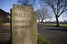
Urmston sits to the west of Junctions 9 and 10 on the outside of the M60 orbital motorway. A junction previously existed further east along the motorway under its old M63 designation, but was closed on the opening of the A6144(M) in 1987. A well known local landmark, opened in 1960, is the Barton High level motorway bridge, which spans the Manchester Ship Canal.[41]
Lostock Road, which connects Davyhulme Circle to Barton Road, was from 1936–37 widened to include two protected cycle tracks. The scheme, designed by borough surveyor Ernest Leeming and intended to improve transport connections between the neighbouring towns, was completed by October 1937.[42]
Urmston is connected to Liverpool and Manchester by the Cheshire Lines Committee railway line which passes through Warrington and Liverpool South Parkway (for Liverpool John Lennon Airport). There are three railway stations in the Urmston area (Urmston station in Urmston town centre, Chassen Road and Flixton stations in neighbouring Flixton). Trains stopping at these stations are operated by Northern. Urmston is not served by Metrolink at the nearby Trafford Centre and in neighbouring Stretford and Eccles.
Pre-1969, most bus services were provided by Manchester Corporation Transport and the North Western Road Car Company. North Western had a depot on Higher Road in Urmston town centre which is now owned by Trafford Council. The services of both undertakings transferred into SELNEC (South East Lancashire, North East Cheshire, later to become Greater Manchester) PTE, later renamed as GMPTE, and then on 1 April 2011 renamed to Transport for Greater Manchester.[43] Today, the area is generally well served by both commercially operated and tendered bus services. Some areas have a frequent service of every 10–15 minutes on some routes, with half-hourly frequencies on other routes. Services are run variously by Stagecoach Manchester, Diamond Bus, Go Goodwins and Arriva North West, providing transport to many parts of Greater Manchester including Manchester city centre, Eccles, Stockport, the Trafford Centre and Altrincham[44]
Education
Along with the rest of Trafford, Urmston maintains a selective education system assessed by the 11-plus examination.[45]
There are four primary, infant or junior schools in Urmston, including Urmston Primary School, together with an independent prep school, Abbotsford Preparatory School, in addition to four secondary schools, Urmston Grammar School, St Antony's Roman Catholic School, Wellacre and Flixton Girls School. Urmston Grammar School is a specialist science and language college;[46] the school was assessed as "outstanding" in its February 2006 Ofsted report.[47] St Antony's Catholic College is a specialist Business and Enterprise College.[48] In its October 2005 Ofsted report the school was assessed as "a good and improving school with some outstanding features".[49]
Religion
| Urmston Compared | |||
|---|---|---|---|
| 2001 UK Census | Urmston[50] | Trafford[15] | England |
| Total population | 40,964 | 210,145 | 49,138,831 |
| Christian | 81.5% | 75.8% | 71.7% |
| Muslim | 0.8% | 3.3% | 3.1% |
| Sikh | 0.1% | 0.5% | 0.7% |
| Hindu | 0.2% | 0.6% | 1.1% |
| Buddhist | 0.1% | 0.2% | 0.3% |
| Jewish | 0.1% | 1.1% | 0.5% |
| No religion | 11.2% | 12.0% | 14.6% |
As of the 2001 UK census, 82.3% of Urmston's residents reported themselves as being Christian, 0.8% Muslim, 0.2% Hindu, 0.1% Jewish, 0.1% Buddhist and 0.1% Sikh. The census recorded 10.5% as having no religion, 0.1% had an alternative religion and 6.6% did not state their religion.[50] Urmston is in the Catholic Diocese of Salford,[51] and the Church of England Diocese of Manchester.[52]
There are three listed churches in Urmston: the Church of St Clement (Grade II),[53] the Church of St Michael's (Grade II*),[54] and the Church of All Saints (Grade I).[55]
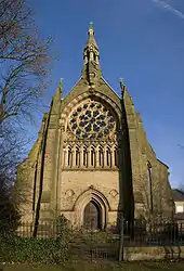
The Church of All Saints was built in 1867–68 by E. W. Pugin, in the Gothic Revival style; the church is said to be a "notably complete and unspoiled" example of Pugin's best work.[55] St Clement's Church was built in 1868 by J Medland Taylor, also in the Gothic Revival style.[53] The Church of St Michael was first mentioned in 1189–91 although may be even older. It was rebuilt in 1815, 1824, and 1888.[54][56] There are two listed structures in the grounds of the church, the sundial and the Jones Chest tomb.[57][58] The Church of St Michael is one of 11 Grade II* listed buildings in Trafford, and All Saints is one of six Grade I listed buildings in Trafford.[59]
Notable people
Suzanne Charlton, BBC weather presenter and daughter of Bobby Charlton, was born in Urmston,[60] as was Judy Loe, actress mother of Kate Beckinsale and wife of the late Richard Beckinsale.[61] Other people born in the town include actor and entertainer Matthew Kelly,[62] two former Manchester City footballers, David White and Michael Johnson,[63] Franklin Charles Buckley (more commonly known as Major Frank Buckley) an English football player and notable manager for both Blackpool and Wolverhampton Wanderers, Lynda Baron, best known for playing Nurse Gladys Emmanuel in Open All Hours,[64] and Jeremy "Jez" Kerr, singer and bassist of post-punk band A Certain Ratio.[65] Actor George Coulouris was partly brought up in Urmston.[66] Keith Hopwood, the rhythm guitarist of Herman's Hermits, attended Urmston Grammar School.[67] Former Manchester United player David Herd had a home in Urmston; Herd had owned a local garage that still bears his name.[68] Paul Stenning, ghostwriter and author, attended Urmston Grammar School and lived in the area for many years.[69] Debbie Moore, founder of Pineapple Dance Studios was born in the area and Danielle Hope, the winner of BBC TV's Over the Rainbow, was also a resident.[70]
The 18th-century caricaturist and satirical poet John Collier, who used the pseudonym Tim Bobbins, was born in Urmston in 1708. A self-styled Lancashire Hogarth, his first and most famous work, A View of the Lancashire Dialect, or, Tummus and Mary, appeared in 1746, the earliest significant piece of published Lancashire dialect.[71] A local public house, The Tim Bobbin, is named after him.
Ian McShane, actor, grew up in Urmston and attended Stretford Grammar School.
Peter Noone, Singer with Hermans Hermits.
Eileen Derbyshire, Actress who plays Emily Bishop and Faye Brookes who plays Kate Connor in Coronation Street.
Stephanie Waring actress in Hollyoaks.
Actor Cel Spellman grew up in Urmston from the age of 3.[72]
See also
References
- Notes
- "Town population 2011". Retrieved 9 January 2015.
- Nevell (1997), p. 17, 20.
- Urmston.Net, The Urmston Partnership, retrieved 20 April 2007
- Townships: Urmston, British History Online, retrieved 24 August 2007
- Urmston Area, Trafford MBC, archived from the original on 27 September 2007, retrieved 4 August 2007
- Nevell (1997), p. 49, 74.
- 'Urchfont – Uxbridge', A Topographical Dictionary of England (1848), pp. 424–28, British History Online, retrieved 26 April 2007
- Nevell (1997), p. 62, 86–87, 100.
- England's first District Heating System in action in Lancashire, The Illustrated London News, 31 January 1948, p. 121
- "Urmston, United Kingdom", Global Gazetteer, Version 2.1, Falling Rain Genomics, Inc, retrieved 2 July 2007
- Met Office (2007), Annual UK weather averages, Met Office, archived from the original on 5 July 2009, retrieved 23 April 2007
- Urmston, Trafford Council, archived from the original on 27 September 2007, retrieved 21 July 2007
- Mersey Bank Park and the River Mersey, Mersey Valley Countryside Warden Service, archived from the original on 28 September 2007, retrieved 2 July 2007
- "Census 2001 Key Statistics – Urban area results by population size of urban area", ons.gov.uk, Office for National Statistics, KS06 Ethnic group
 , 22 July 2004, retrieved 30 December 2008
 - Trafford Metropolitan Borough key statistics, Statistics.gov.uk, archived from the original on 26 December 2007, retrieved 30 December 2008
- "Census 2001 Key Statistics – Urban area results by population size of urban area", ons.gov.uk, Office for National Statistics, KS01 Usual resident population
 , 22 July 2004, retrieved 5 August 2008
 - "Census 2001 Key Statistics – Urban area results by population size of urban area", ons.gov.uk, Office for National Statistics, KS20 Household composition
 , 22 July 2004, retrieved 5 August 2008
 - "Census 2001 Key Statistics – Urban area results by population size of urban area", ons.gov.uk, Office for National Statistics, KS13 Qualifications and students
 , 22 July 2004, retrieved 5 August 2008
 - Urmston Tn/CP: Total Population, Vision of Britain, archived from the original on 24 October 2012, retrieved 23 December 2008
- Urmston UD: Total Population, Vision of Britain, archived from the original on 26 May 2008, retrieved 23 December 2008
- 1981 Key Statistics for Urban Areas GB Table 1, Office for National Statistics, 1981
- Greater Manchester Urban Area 1991 Census, National Statistics, archived from the original on 5 February 2009, retrieved 24 July 2008
- "Census 2001 Key Statistics – Urban area results by population size of urban area", ons.gov.uk, Office for National Statistics, KS01 Usual resident population
 , 22 July 2004, retrieved 24 July 2008
 - Nevell, (1997), p. 87
- Giants end shop's reign, ThisisTrafford.co.uk, 8 June 2000, retrieved 13 August 2007
- Ask Developments – Urmston Town Centre (PDF), Trafford.gov.uk, 2005, retrieved 13 August 2007
- Ask about Urmston, Ask Developments, retrieved 4 May 2009
- "Eden Square Shopping Complex: Urmston". www.edensquare-shopping.co.uk. Retrieved 13 April 2016.
- "Census 2001 Key Statistics – Urban area results by population size of urban area", ons.gov.uk, Office for National Statistics, KS09a Economic activity – all people
 , 22 July 2004, retrieved 30 December 2008
 - Model-Based Estimates of Income for the Bucklow-St. Martin, Statistics.gov.uk, retrieved 4 August 2007
•Model-Based Estimates of Income for the Davyhulme East ward, Statistics.gov.uk, retrieved 4 August 2007
•Model-Based Estimates of Income for the Davyhulme West ward, Statistics.gov.uk, retrieved 4 August 2007
•Model-Based Estimates of Income for the Flixton ward, Statistics.gov.uk, retrieved 4 August 2007
•Model-Based Estimates of Income for the Urmston ward, Statistics.gov.uk, retrieved 4 August 2007 - "Census 2001 Key Statistics – Urban area results by population size of urban area", ons.gov.uk, Office for National Statistics, KS11a Industry of employment – all people
 , 22 July 2004, retrieved 30 December 2008
 - The Urmston Musical Theatre, retrieved 8 August 2007
- Rendell, Cinemas of Trafford, p. 67.
- Harry (2000), pp. 5–6.
- Urmston Cricket, Hockey, Bowls, Tennis & Social Club, retrieved 4 July 2007
- Urmston Riding Club, retrieved 13 August 2007
- About AFC Urmston Meadowside, archived from the original on 9 August 2007, retrieved 13 August 2007
- AFC Urmston Meadowside history, archived from the original on 9 August 2007, retrieved 13 August 2007
- "Excitement builds over new-look leisure centre opening in 2020". Messenger Newspapers. Retrieved 13 August 2020.
- "Council to discuss plans to transfer leisure centre to community". www.trafford.gov.uk. Retrieved 13 August 2020.
- Eddie Little, The Building of the Barton High-Level Bridge (PDF), Manchester Centre for Regional History, archived from the original (PDF) on 21 February 2007, retrieved 13 August 2007
- Road Reconstruction at Urmston, The Manchester Guardian, 20 October 1937
- http://manchestertransport.wordpress.com/2011/04/01/goodbye-gumpty-hello-tufgum/
- Urmston bus services (PDF), GMPTE, archived from the original (PDF) on 11 October 2007, retrieved 13 August 2007
- 11 Plus in North West England, retrieved 13 August 2007
- About us, Urmston Grammar School, retrieved 21 December 2010
- Urmston Grammar School, Ofsted, 5 September 2006, archived from the original on 28 October 2007, retrieved 10 May 2007
- St Antony's Catholic College, Specialist School and Academies Trust, retrieved 8 August 2007
- St Antony's Catholic College (PDF), Ofsted, 5 October 2005, archived from the original (PDF) on 20 October 2007, retrieved 8 August 2007
- "Census 2001 Key Statistics – Urban area results by population size of urban area", ons.gov.uk, Office for National Statistics, KS07 Religion
 , 22 July 2004, retrieved 30 December 2008
 - Catholic Diocese of Salford, archived from the original on 8 August 2007, retrieved 12 August 2007
- The Church of England Diocese of Manchester, archived from the original on 27 December 2007, retrieved 12 August 2007
- Historic England, "Church of St Clement (1162878)", National Heritage List for England, retrieved 12 August 2007
- Historic England, "Church of St Michael's (1067876)", National Heritage List for England, retrieved 12 August 2007
- Historic England, "Church of All Saints (1067879)", National Heritage List for England, retrieved 12 August 2007
- Nevell (1997), p. 29, 106.
- Historic England, "Sundial at Church of St Michael (1356521)", National Heritage List for England, retrieved 12 August 2007
- Historic England, "Tomb at Church of St Michael (1162835)", National Heritage List for England, retrieved 12 August 2007
- Planning and building control: listed buildings, Trafford MBC, archived from the original (PDF) on 16 July 2011, retrieved 14 December 2007
- Suzanne Charlton, BBC Online, retrieved 14 August 2007
- Judy Loe, retrieved 14 August 2007
- Ducker, James (28 October 2004), "Tonight, Matthew is a TV killer", Manchester Evening News, M.E.N. Media, retrieved 15 August 2007
- Michael Johnson, Skysport.com, retrieved 14 August 2007
- Lynda Baron, retrieved 29 August 2007
- George Coulouris, 1989, retrieved 14 August 2007
- Keith Hopwood, retrieved 15 August 2007
- Dykes, Garth (1994), The United Alphabet, Polar Print Group Ltd, ISBN 0-9514862-6-8
- Live Preston & Fylde http://www.live-magazines.co.uk/regions/preston-fylde/ magazine interview 2014, Pg. 117 Arts & Culture.
- "Danielle Hope wins Over the Rainbow". The Telegraph. London: Telegraph Media Group. 22 May 2010. Retrieved 28 May 2010.
- Poole, Robert (2004), "Collier, John (1708–1786)", Oxford Dictionary of National Biography, Oxford University Press, retrieved 28 April 2008
- "Cel Spellman says playing a Manchester United fan is his best acting in Cold Feet". Manchester Evening News. Manchester. 5 September 2016. Retrieved 14 November 2019.
- Bibliography
- Harry, Bill (2000), The Beatles Encyclopaedia (2000 paperback edition; first published 1992), London: Virgin Publishing, pp. 5–6, ISBN 0-7535-0481-2
- Nevell, Mike (1997), The Archaeology of Trafford, Trafford Metropolitan Borough with University of Manchester Archaeological Unit, ISBN 1-870695-25-9
- Rendell, Douglas (1998), Cinemas of Trafford, Jarvis Print Group Limited, ISBN 0-9512560-1-7
External links
| Wikimedia Commons has media related to Urmston. |
External maps and images
- Map of the Borough of Trafford from Trafford MBC
- Map of Urmston Town Centre from Trafford MBC
- Urmston from the air