Grade II* listed buildings in Greater Manchester
There are 236 Grade II* listed buildings in Greater Manchester, England. In the United Kingdom, the term listed building refers to a building or other structure officially designated as being of special architectural, historical or cultural significance; Grade II* structures are those considered to be "particularly significant buildings of more than local interest".[1] In England, the authority for listing under the Planning (Listed Buildings and Conservation Areas) Act 1990[2] rests with English Heritage, a non-departmental public body sponsored by the Department for Culture, Media and Sport.

The metropolitan county of Greater Manchester is made up of 10 metropolitan boroughs: Bolton, Bury, Manchester, Oldham, Rochdale, Salford, Stockport, Tameside, Trafford and Wigan. The Grade II* buildings in each borough are listed separately. Manchester, the world's first industrialised city,[3] has 77 of Greater Manchester's 238 Grade II* listed buildings, the highest number of any borough. Bury has the least, with only eight. The River Irwell forms the boundary between Salford and Trafford, so one listed structure, Barton Swing Aqueduct, has been listed under both Salford and Trafford.
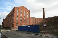
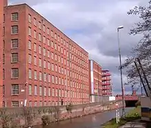
Most of Greater Manchester's listed buildings date from the Victorian and Edwardian periods.[1] According to an Association for Industrial Archaeology publication, Greater Manchester is "one of the classic areas of industrial and urban growth in Britain, the result of a combination of forces that came together in the 18th and 19th centuries: a phenomenal rise in population, the appearance of the specialist industrial town, a transport revolution, and weak local lordship".[4] Much of the region, historically a part of Lancashire, was at the forefront of textile manufacturing from the early 19th century until the early 20th century, and the county includes several former mill towns.[5][6] Greater Manchester has a wealth of industrial heritage, represented by industrial architecture found throughout the county,[6] but many of its Grade II* listed buildings have a municipal, ecclesiastic or other cultural heritage.
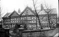
It is uncertain which Grade II* listed structure in Greater Manchester is the oldest. However, three of the 238 buildings date from the 13th century, making them the oldest. Brandlesholme Old Hall in Bury was once an open-hall cruck-framed house, originating in the 13th century, although altered and extended in the 16th century and completely remodelled in 1849.[7] The Church of St Chad in Rochdale has a 13th-century tower (with an 1870 extension).[8] And Mab's Cross in Wigan, the stump of a boundary cross, is probably 13th century in origin.[9] The newest Grade II* listed building in Greater Manchester is the Daily Express Building, designed by Sir Owen Williams in 1939.[10] Due to the heavy impact of the Industrial Revolution on Greater Manchester, just under half of its Grade II* listed buildings (112, 47%) were completed in the 19th century.
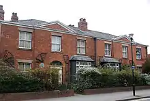
Bolton


.JPG.webp)
Bury
| Name | Location | Type | Architect | Completed [note 1] | Date designated | Grid ref.[note 2] Geo-coordinates |
Entry number [note 3] | Image | Ref. |
|---|---|---|---|---|---|---|---|---|---|
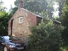
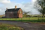
| Brandlesholme Old Hall | Brandlesholme Road, Bury | Open Hall House | 13th century | 29 January 1985 | SD7877213210 53°36′54″N 2°19′20″W |
1067287 |  | [11] | |
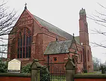
| Christ Church | High Street, Walshaw | Church | Lawrence Booth | 1888 | 29 January 1985 | SD7766611564 53°36′01″N 2°20′20″W |
1163417 | [12] | |
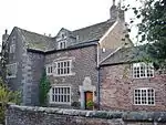
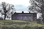
| Dearden Fold Farmhouse | Bury Old Road, Radcliffe | House | 16th century | 29 January 1985 | SD7582010176 53°35′15″N 2°22′00″W |
1356793 |  Dearden Fold Farmhouse | [13] | |
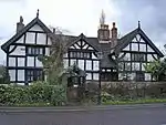
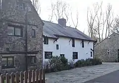
| Hey House | Holcombe Old Road, Ramsbottom | Hunting Lodge | c. 1616 | 9 August 1966 | SD7768815915 53°38′21″N 2°20′20″W |
1067269 |  Hey House | [14] | |
| Lower Chesham | Bell Lane, Bury | House | 1713 | 26 May 1976 | SD8151111357 53°35′54″N 2°16′51″W |
1067281 | | [15] | |
| Monument to John Brooks to west of Parish Church of St Mary the Virgin | Church Lane, Prestwich | Commemorative Monument | John Thomas | c. 1851 | 29 January 1985 | SD8104303665 53°31′45″N 2°17′15″W |
1067254 | 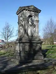 Monument to John Brooks to west of Parish Church of St Mary the Virgin | |
| Presbyterian Chapel | Knowsley Road, Ainsworth | Presbyterian Chapel | 16th century | 29 July 1966 | SD7629510322 53°35′20″N 2°21′34″W |
1163487 | _-_geograph.org.uk_-_448023.jpg.webp) Presbyterian Chapel | [16] | |
| Radcliffe Cenotaph | Blackburn Street, Radcliffe | Cenotaph | Sydney Marsh | 1922 | 10 March 1992 | SD7837107362 53°33′45″N 2°19′41″W |
1067192 | 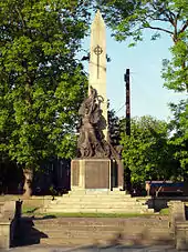 Radcliffe Cenotaph | [17] |
| War Memorial to the Lancashire Fusiliers, Gallipoli Gardens | Gallipoli Gardens, Bury | War memorial | Sir Edwin Lutyens | 1922 | 2 September 1992 | SD8032510670 53°35′32″N 2°17′55″W |
1250814 | ||
| Bury War Memorial | Bury | War memorial | 1924 | 7 April 2017 | SD8040810841 53°35′38″N 2°17′51″W |
1444845 | .jpg.webp) Bury War Memorial |
.JPG.webp)
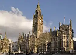
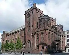
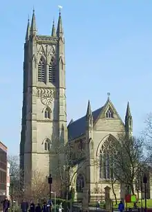
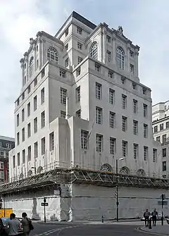
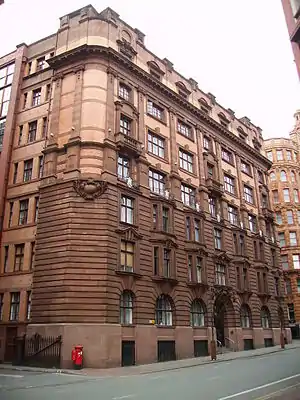
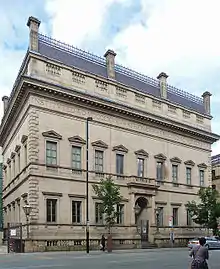
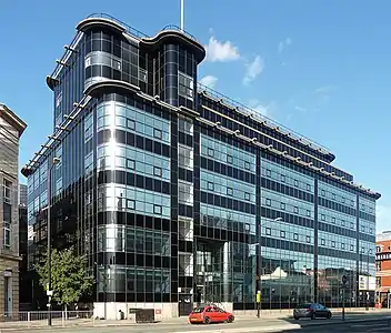
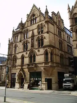
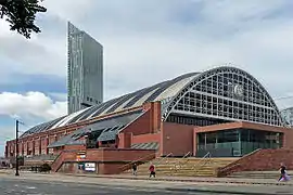
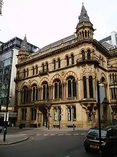
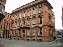
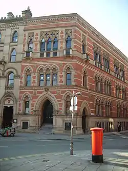
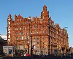
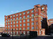
Manchester


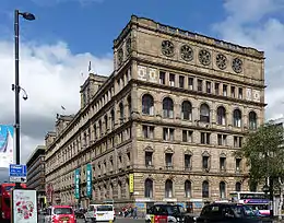


.jpg.webp)


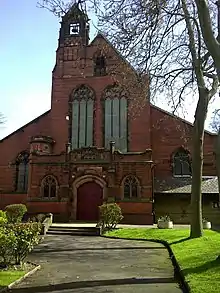
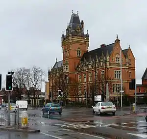
Oldham
| Name | Location | Type | Architect | Completed [note 1] | Date designated | Grid ref.[note 2] Geo-coordinates |
Entry number [note 3] | Image | Ref. |
|---|---|---|---|---|---|---|---|---|---|
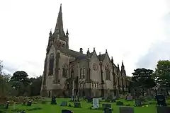
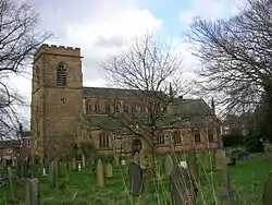
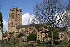
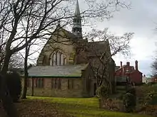
| Church of St Chad | Church Lane, Uppermill | Church | 1746 | 19 June 1967 | SE0075706405 53°33′15″N 1°59′24″W |
1162501 | _(geograph_2670491).jpg.webp) Church of St Chad | [97][98] | |
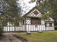
| Grotton Hall | Platting Road, Lydgate | House | 1686 | 3 July 1986 | SD9719904854 53°32′25″N 2°02′37″W |
1068157 | | ||
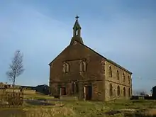
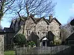
| Heights Chapel, St Thomas Old Church | Broad Lane, Saddleworth | Church | 1765 | 19 June 1967 | SD9821209061 53°34′41″N 2°01′43″W |
1356677 | [99] | ||
| Higher Kinders | Kinder's Lane, Saddleworth | House | 1642 | 19 June 1967 | SE0001404660 53°32′19″N 2°00′05″W |
1068176 |  Higher Kinders | [100][101] | |
| Shore Mill | Delph, Saddleworth | Carding Mill | 1780s | 3 July 1986 | SD9860207943 53°34′05″N 2°01′21″W |
1067445 | | [102] | |
| Church of St Anne | St Anne's Avenue, Royton | Church | Temple Moore | 1909 | 6 May 1987 | SD9199007049 53°33′36″N 2°07′21″W |
1356418 | 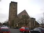 Church of St Anne | [103][104] |
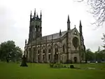
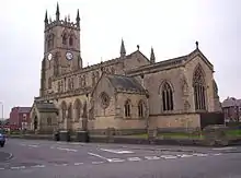
| Church of St Mary with St Peter | Church Street, Oldham | Parish Church | Richard Lane | 1830 | 23 January 1973 | SD9272905112 53°32′33″N 2°06′40″W |
1292310 | [105] | |
| Church of St Thomas | West Street, Lees | Church | E. H. Shellard | 1848 | 22 August 1967 | SD9528604454 53°32′12″N 2°04′21″W |
1068071 | 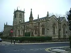 Church of St Thomas | [106] |
| Foxdenton Hall | Foxdenton Lane, Chadderton | House | 1730 | 30 May 1963 | SD8944404665 53°32′19″N 2°09′39″W |
1356429 | [107] | ||
| Independent Methodist Chapel | George Street, Oldham | Methodist Chapel | 1815 | 2 August 1983 | SD9239104861 53°32′25″N 2°06′59″W |
1201672 | 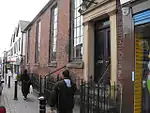 Independent Methodist Chapel | [108] | |
| 1–5 Ηοllins Road - also known as Hathershaw Hall | Hollins Road, Oldham | House | 17th century | 24 December 1970 | SD9223903234 53°31′33″N 2°07′07″W |
1217873 | 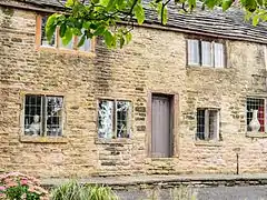 1–5 Ηοllins Road - also known as Hathershaw Hall | [109] | |
| Oldham War Memorial | Church Street, Oldham | War memorial | Albert Toft | 1923 | 23 January 1973 | SD9272905071 53°32′32″N 2°06′40″W |
1210137 | .jpg.webp) Oldham War Memorial |
.JPG.webp)

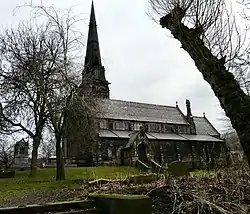
Rochdale
| Name | Location | Type | Completed [note 1] | Date designated | Grid ref.[note 2] Geo-coordinates |
Entry number [note 3] | Image |
|---|---|---|---|---|---|---|---|
| Alkrington Hall | Middleton | Apartment | By 1957 | 15 March 1957 | SD8659005179 53°32′35″N 2°12′14″W |
1068499 | |
| Birchinley Manor Farmhouse | Rochdale | House | 1631 | 24 January 1967 | SD9300213778 53°37′14″N 2°06′26″W |
1334330 | .jpg.webp) Birchinley Manor Farmhouse |
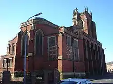
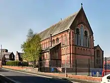
| Church of Saint Aidan | Rochdale | Church | 1913–1915 | 12 February 1985 | SD8832511642 53°36′04″N 2°10′40″W |
1084241 | 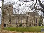 Church of Saint Aidan |
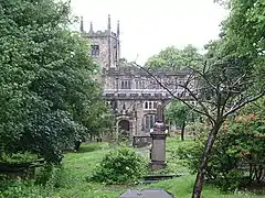
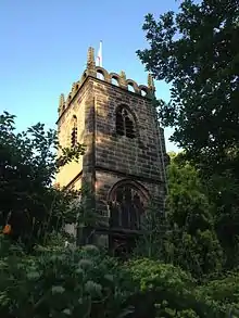
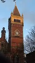
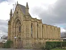
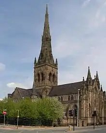
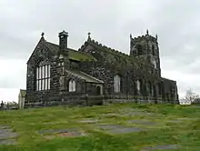
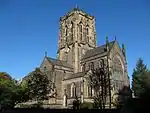
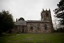
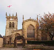
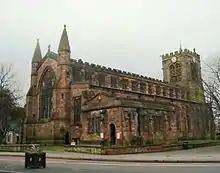
| Church of Saint Chad | Rochdale | Church | 13th century | 25 October 1951 | SD8966613145 53°36′53″N 2°09′28″W |
1045812 |  Church of Saint Chad |
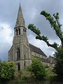
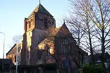
| Church of Saint Luke | Heywood | Church | 1860–62 | 12 February 1985 | SD8563710769 53°35′36″N 2°13′07″W |
1346240 |  Church of Saint Luke |
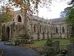
| Church of Saint Mary, Wardleworth | Wardleworth | Church | 1740 | 3 December 1975 | SD8960713606 53°37′08″N 2°09′31″W |
1025294 | .jpg.webp) Church of Saint Mary, Wardleworth |
| Clegg Hall | Littleborough | House | c. 1610 | 10 August 1951 | SD9224214490 53°37′37″N 2°07′08″W |
1309615 | |
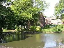
| Crimble Mill | Heywood | Cotton Mill | Late 1820s | 15 December 1967 | SD8648911658 53°36′05″N 2°12′20″W |
1187124 | 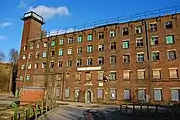 Crimble Mill |
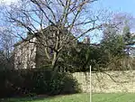
| Dearnley Old Hall | Littleborough | House | Early to mid 17th century | 2 January 1967 | SD9221215819 53°38′20″N 2°07′09″W |
1309691 |  Dearnley Old Hall |
| Elm Street School (County Primary School) | Middleton | School | 1908–1910 | 19 September 1969 | SD8838205948 53°33′00″N 2°10′37″W |
1356229 | |
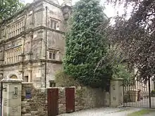
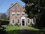
| Former Queen Elizabeth Old Grammar School and adjoining Schoolmaster's House | Middleton | Teachers House | 1835–1839 | 15 March 1957 | SD8741206354 53°33′13″N 2°11′29″W |
1356228 |  Former Queen Elizabeth Old Grammar School and adjoining Schoolmaster's House |
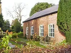
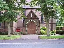
| Hope Chapel and Parsons House | Rochdale | House | 1985 | 12 February 1985 | SD8964213919 53°37′18″N 2°09′29″W |
1057694 |  Hope Chapel and Parsons House |
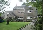
| Hopwood Hall | Middleton | House | 17th century | 15 March 1957 | SD8748308299 53°34′16″N 2°11′26″W |
1068466 | |
| Long Street Methodist Church | Middleton | Gate | 1899 | 19 September 1969 | SD8704006201 53°33′08″N 2°11′50″W |
1068504 |  Long Street Methodist Church |
| Old Bent House and Bent House Farmhouse | Littleborough | House | 1691 | 2 January 1967 | SD9462417012 53°38′58″N 2°04′58″W |
1356234 | |
| Rough Bank Farmhouse | Newhey | Farmhouse | 1607 | 24 January 1967 | SD9471812318 53°36′27″N 2°04′53″W |
1240266 | |
| Shore Hall | Littleborough | House | 1605 | 2 January 1967 | SD9229117224 53°39′05″N 2°07′05″W |
1068515 |  Shore Hall |
| Stubley Old Hall | Stubley Brow, Rochdale | House | 15th century | 2 January 1967 | SD9278316057 53°38′28″N 2°06′38″W |
1162360 | |
| Tonge Hall | Middleton | House | 1580s | 15 March 1957 | SD8775605821 53°32′56″N 2°11′11″W |
1068469 | |
| Windy Bank | Blackstone Edge | House | Early 16th century | 2 January 1967 | SD9445016659 53°38′47″N 2°05′08″W |
1068536 |  Windy Bank |
| Ye Olde Boars Head Public House | Middleton | Public House | Early 17th century | 15 March 1957 | SD8705206266 53°33′10″N 2°11′49″W |
1162256 | .jpg.webp) Ye Olde Boars Head Public House |
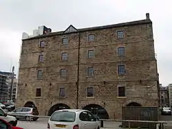
Salford
| Name | Location | Type | Architect | Completed [note 1] | Date designated | Grid ref.[note 2] Geo-coordinates |
Entry number [note 3] | Image | Ref. |
|---|---|---|---|---|---|---|---|---|---|
| Barton Bridge, Barton Aqueduct and Control Tower (that Part in Eccles) | Salford | Aqueduct | Sir Edward Leader Williams | c. 1894 | 16 July 1987 | SJ7663397602 53°28′29″N 2°21′13″W |
1162870 | ||
| Cathedral of St John and Attached Cathedral House | Salford | House | Matthew Ellison Hadfield | 1980 | 18 January 1980 | SJ8278998598 53°29′02″N 2°15′39″W |
1386115 | ||
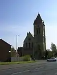
| Church of St Andrew | Eccles | Church | 1877–79 | 16 July 1987 | SJ7740098764 53°29′06″N 2°20′31″W |
1309482 | 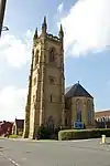 Church of St Andrew | ||
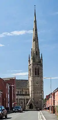
| Church of St Luke | Pendleton, Salford | Parish Church | George Gilbert Scott | 1865 | 18 January 1980 | SJ8001398621 53°29′02″N 2°18′10″W |
1386145 | ||
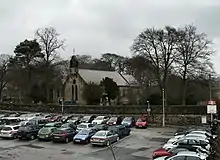
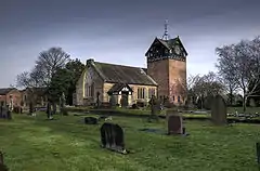
| Church of St Peter | Swinton | Parish church | 1869 | 30 March 1966 | SD7745501745 53°30′43″N 2°20′29″W |
1067510 |  Church of St Peter | ||
| Church of St Philip | Salford | Anglican Church | Sir Robert Smirke | 1825 | 31 January 1952 | SJ8264098619 53°29′02″N 2°15′47″W |
1386165 | ||
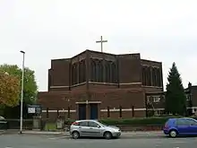
| Church of the Sacred Trinity | Salford | Anglican Church | By 1952 | 31 January 1952 | SJ8348698704 53°29′05″N 2°15′01″W |
1386185 | 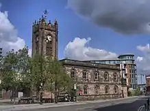 Church of the Sacred Trinity | ||
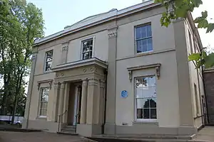
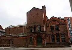
| Former Public Baths | Salford | Indoor Swimming Pool | 1855 | 18 January 1980 | SJ8341399003 53°29′15″N 2°15′05″W |
1386123 | | ||
| Former United Reformed Church | Salford | Congregational Chapel | 1872–1874 | 18 January 1980 | SD8319602138 53°30′56″N 2°15′18″W |
1386187 | | ||
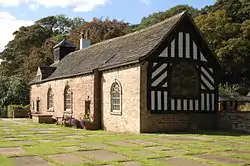
| Kersal Cell | Salford | Cruck House | 16th century | 31 January 1952 | SD8095801536 53°30′37″N 2°17′19″W |
1386144 | 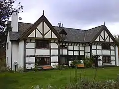 Kersal Cell | ||
| Manchester Tennis and Racquet Club | Salford | Squash Court | George Tunstal Redmayne | 1925 | 21 January 1996 | SJ8334798832 53°29′09″N 2°15′09″W |
1386080 | ||
| Monton Unitarian Church | Monton | Church | 1873–75 | 9 July 1979 | SJ7650499638 53°29′35″N 2°21′20″W |
1067501 | .jpg.webp) Monton Unitarian Church | ||
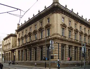
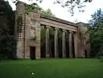
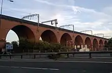
| Southern Railway Viaduct and Colonnade | Salford | Viaduct & Colonnade | 1844 | 18 January 1980 | SJ8321198497 53°28′59″N 2°15′16″W |
1386162 |  Southern Railway Viaduct and Colonnade |

Stockport
| Name | Location | Type | Completed [note 1] | Date designated | Grid ref.[note 2] Geo-coordinates |
Entry number [note 3] | Image |
|---|---|---|---|---|---|---|---|
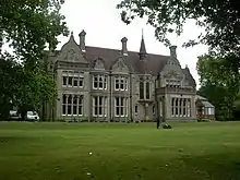
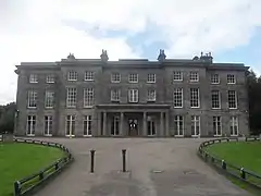
| Abney Hall | Cheadle, Stockport | House | 1847 | 30 June 1975 | SJ8595389237 53°23′59″N 2°12′46″W |
1241730 | |
| Chadkirk Chapel | Bredbury, Stockport | Chapel | 16th century | 29 March 1966 | SJ9400390218 53°24′31″N 2°05′30″W |
1259981 | |
| Church of St Martin | Marple Bridge, Stockport | Church | 1869–70 | 11 October 1985 | SJ9634989345 53°24′03″N 2°03′23″W |
1241823 | |
| Former Plaza Cinema | Stockport | Theatre | By 1997 | 12 March 1997 | SJ8937290272 53°24′33″N 2°09′41″W |
1257697 | |
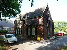
| Former Rectory | Stockport | House | Mid 18th century | 14 May 1952 | SJ8991690344 53°24′35″N 2°09′11″W |
1356827 |  Former Rectory |
| Gateway to Parish Church of St Mary and Fountain to Side | Stockport | Gate | 1812 | 10 March 1975 | SJ8973690516 53°24′41″N 2°09′21″W |
1067202 | .jpg.webp) Gateway to Parish Church of St Mary and Fountain to Side |
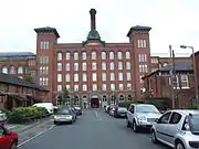
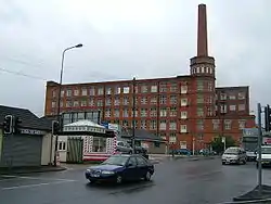
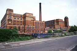
| Houldsworth Mill | Reddish, Stockport | Fireproof Factory | 1865 | 10 March 1975 | SJ8907393324 53°26′12″N 2°09′57″W |
1067171 | |
| Houldsworth School | Stockport | School | 1874 | 30 October 1973 | SJ8924493588 53°26′20″N 2°09′48″W |
1067180 | 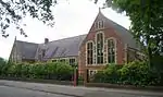 Houldsworth School |
| Houldsworth Working Men's Club | Houldsworth, Stockport | Working Man's Club | 1874 | 30 October 1973 | SJ8930493459 53°26′16″N 2°09′45″W |
1067173 | |
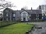
| Mellor Hall and Mellor Hall Farmhouse | Mellor, Stockport | Farmhouse | 1985 | 20 December 1967 | SJ9857589287 53°24′01″N 2°01′22″W |
1241992 | |
| Moseley Old Hall | Cheadle, Stockport | Box Frame House | 1666 | 24 March 1950 | SJ8642188905 53°23′48″N 2°12′20″W |
1260364 | |
| New Hall Cottage & New Hall Farmhouse | Woodford, Stockport | Farmhouse | 1630 | 9 August 1966 | SJ8957281405 53°19′46″N 2°09′29″W |
1260441 | |
| Old Manor Farm | Marple, Stockport | Farmhouse | 15th century | 20 December 1967 | SJ9397988679 53°23′42″N 2°05′31″W |
1242469 | |
| Pear New Mill | Bredbury, Stockport | Fireproof Factory | 1908–1912 | 20 June 1991 | SJ9119690793 53°24′50″N 2°08′02″W |
1240634 | |
| Railway Viaduct | Stockport | Railway Viaduct | Opened 1840 | 10 March 1975 | SJ8910590246 53°24′32″N 2°09′55″W |
1356861 | |
| Rectory to Church of St Elisabeth | Stockport | Vicarage | 1874 | 30 October 1973 | SJ8923593536 53°26′19″N 2°09′49″W |
1067181 | |
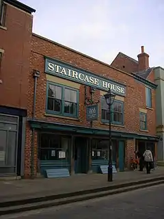
| Staircase House | Stockport | Timber Framed House | Late 15th century | 10 March 1975 | SJ8970490552 53°24′42″N 2°09′23″W |
1356855 | |
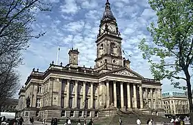
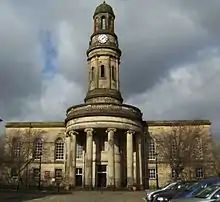
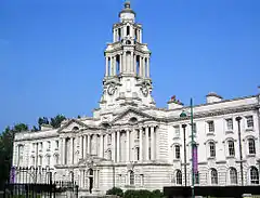
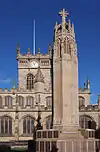
| Stockport Town Hall | Stockport | Town Hall | 1904–08 | 10 March 1975 | SJ8956489920 53°24′22″N 2°09′30″W |
1067166 | |
| Wall to the West and South of Church of St Elizabeth | Reddish, Stockport | Gate | 1882-3 | 10 March 1975 | SJ8924593445 53°26′16″N 2°09′48″W |
1067172 |  Wall to the West and South of Church of St Elizabeth |
| Wall to West of Church of St Elisabeth | Reddish, Stockport | Gate | 1874 | 10 March 1975 | SJ8921593535 53°26′19″N 2°09′50″W |
1356853 |  Wall to West of Church of St Elisabeth |
| Wall to West of Houldsworth School | Reddish, Stockport | Wall | 1874 | 10 March 1975 | SJ8921693580 53°26′20″N 2°09′50″W |
1162583 |  Wall to West of Houldsworth School |
| War Memorial & Art Gallery | Stockport | Art Gallery | 1925 | 11 July 2007 | SJ8953289777 53°24′17″N 2°09′32″W |
1392091 |  War Memorial & Art Gallery |
| Woodbank Villa and Entrance Portico | Stockport | Villa | 1812–1814 | 10 March 1975 | 53°24′36″N 2°07′52″W | 1162994 | |
| 10 Great Underbank | Stockport | Manor House/Natwest Bank | 16th century | 14 May 1952 | SJ8956790445 53°24′39″N 2°09′30″W |
1356829 |

.jpg.webp)


.jpg.webp)

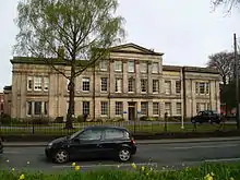
Tameside
| Name | Location | Type | Completed [note 1] | Date designated | Grid ref.[note 2] Geo-coordinates |
Entry number [note 3] | Image |
|---|---|---|---|---|---|---|---|
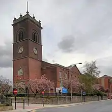
| Albion Congregational Church | Ashton-under-Lyne | Church | 1890–1895 | 12 January 1967 | SJ9432699003 53°29′16″N 2°05′13″W |
1356460 | 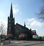 Albion Congregational Church |
| Albion Warehouse | Ashton-under-Lyne | Warehouse | By 1987 | 12 January 1967 | SJ9431599253 53°29′24″N 2°05′14″W |
1068001 |  Albion Warehouse |
| Apethorn Farmhouse | Hyde | Farmhouse | 17th century to 19th century | 22 December 1969 | SJ9447893479 53°26′17″N 2°05′05″W |
1068079 |  Apethorn Farmhouse |
| Broadbottom Hall | Tameside | House | 1680 | 1 November 1966 | SJ9948593629 53°26′22″N 2°00′33″W |
1068052 | |
| Buckley Hill Farmhouse | Tameside | House | 17th century | 17 November 1966 | SJ9180799671 53°29′37″N 2°07′30″W |
1163826 | |
| Cavendish Mill | Ashton-under-Lyne | Spinning Mill | 1884-5 | 24 September 1990 | SJ9364098581 53°29′02″N 2°05′50″W |
1067948 | |
| Church of St Lawrence | Denton | Church | c. 1530 | 27 November 1967 | SJ9264095055 53°27′08″N 2°06′44″W |
1067971 | |
| St Michael and All Angels Church, Mottram | Mottram-in-Longdendale | Church | 15th century | 1 November 1966 | SJ9943195293 53°27′16″N 2°00′36″W |
1356436 | |
| Church of St Peter | Ashton-under-Lyne | Church | 1821–1824 | 12 January 1967 | SJ9306798585 53°29′02″N 2°06′21″W |
1067994 | |
| Cross | Mottram-in-Longdendale | Sundial | Medieval | 6 February 1986 | SJ9940295234 53°27′14″N 2°00′38″W |
1068028 |  Cross |
| Dukinfield Old Chapel | Dukinfield | Unitarian Chapel | 1840–1841 | 17 December 1970 | SJ9435997963 53°28′42″N 2°05′11″W |
1068077 |  Dukinfield Old Chapel |
| Fairfield Moravian Church | Droylsden | House | c. 1785 | 17 November 1966 | SJ9016197617 53°28′31″N 2°08′59″W |
1067981 | |
| Former Municipal Baths | Ashton-under-Lyne | Industrial Building | By 1987 | 2 April 1975 | SJ9335298687 53°29′05″N 2°06′06″W |
1067992 |  Former Municipal Baths |
| Hyde Hall | Denton | Farmhouse | 1967 | 27 November 1967 | SJ9180594273 53°26′43″N 2°07′29″W |
1318129 | |
| Old Hall Chapel | Dukinfield | Church | 1872 | 17 December 1970 | SJ9349497026 53°28′12″N 2°05′58″W |
1356422 | |
| Old Hall Fold | Ashton-under-Lyne | Farmhouse | 16th century | 12 January 1967 | SD9268900389 53°30′01″N 2°06′42″W |
1067997 | |
| St Anne's Rectory | Ashton-under-Lyne | Vicarage | 1882 | 20 July 1977 | SJ9341195603 53°27′26″N 2°06′03″W |
1067970 | |
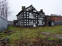
| Stayley Hall and Adjoining West Wing | Ashton-under-Lyne | Jettied House | Late 16th century | 9 August 1966 | SJ9756299706 53°29′39″N 2°02′18″W |
1163021 |  Stayley Hall and Adjoining West Wing |
| War Memorial | Stalybridge | War Memorial | c1920 after World War I | 6 February 1986 | SJ9634198565 53°29′02″N 2°03′24″W |
1163074 | 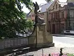 War Memorial |
| 20–23 and 23a Fairfield Square | Droylsden | House | 1785 | 17 November 1966 | SJ9014997672 53°28′32″N 2°09′00″W |
1356489 | .JPG.webp) 20–23 and 23a Fairfield Square |
.jpg.webp)

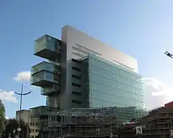
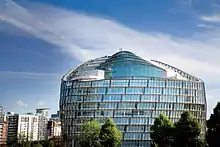
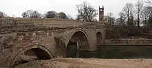
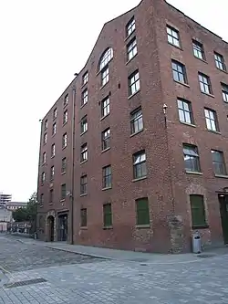
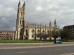
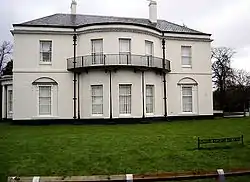
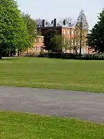
Trafford

.jpg.webp)
.jpg.webp)
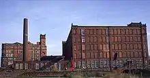
Wigan


.JPG.webp)

.jpg.webp)

See also
Notes
- The date given is the date used by Historic England as significant for the initial building or that of an important part in the structure's description.
- Sometimes known as OSGB36, the grid reference is based on the British national grid reference system used by the Ordnance Survey.
- The "List Entry Number" is a unique number assigned to each listed building and scheduled monument by Historic England.
References
- "What is a listed building?". Manchester City Council. Retrieved 8 December 2007.
- "Planning (Listed Buildings and Conservation Areas) Act 1990 (c. 9)". Ministry of Justice. Archived from the original on 2010-04-18. Retrieved 2007-12-17.
- Kidd, Alan (2006). Manchester: A History. Lancaster, Lancashire: Carnegie Publishing Ltd. ISBN 1-85936-128-5.
- McNeil and Nevell (2000), A Guide to the Industrial Archaeology of Greater Manchester, p. 2.
- Cowhig, W.T. (1976). It Happened Round Greater Manchester; Textiles. Greater Manchester Council.
- McNeil and Nevell (2000), A Guide to the Industrial Archaeology of Greater Manchester, p. 2–3.
- "Brandlesholme Old Hall, Bury". historicengland.org.uk. Retrieved 2008-07-06.
- "Church of St Chad, Rochdale". historicengland.org.uk. Retrieved 2008-07-06.
- "Mab's Cross, Wigan". historicengland.org.uk. Retrieved 2008-07-06.
- "Daily Express Building, Manchester". historicengland.org.uk. Retrieved 2008-07-06.
- "Brandlesholme Old Hall". historicengland.org.uk. Retrieved 2008-02-23.
- "Christ Church, Walshaw". historicengland.org.uk. Retrieved 2008-02-23.
- "Dearden Fold Farmhouse". historicengland.org.uk. Retrieved 2008-02-23.
- Historic England. "Hey House (44308)". PastScape. Retrieved 2008-02-23.
- "Lower Chesham". historicengland.org.uk. Retrieved 2008-02-23.
- "Presbyterian Chapel, Radcliffe". historicengland.org.uk. Retrieved 2008-02-23.
- "Radcliffe Cenotaph". historicengland.org.uk. Retrieved 2008-02-23.
- "25 St Ann Street, Manchester". historicengland.org.uk. Retrieved 2008-05-30.
- "38 and 42 Mosley Street, Manchester". historicengland.org.uk. Retrieved 2008-05-28.
- "Mrs Gaskell's House, 84 Plymouth Grove, Manchester". historicengland.org.uk. Retrieved 2008-05-29.
- "Midland Bank, Manchester". historicengland.org.uk. Retrieved 2008-05-27.
- "Asia House, Manchester". historicengland.org.uk. Retrieved 2008-05-29.
- "The Athenaeum, Manchester". historicengland.org.uk. Retrieved 2008-05-29.
- "Barton's Building including Barton Arcade, Manchester". historicengland.org.uk. Retrieved 2008-05-24.
- "Beehive Mill, Manchester". historicengland.org.uk. Retrieved 2008-05-27.
- "Britannia Hotel, Manchester". historicengland.org.uk. Retrieved 2008-05-29.
- "GMB National College, Manchester". historicengland.org.uk. Retrieved 2008-05-24.
- "Brookfield Unitarian Church, Manchester". historicengland.org.uk. Retrieved 2008-05-24.
- "Brownfield Mill, Manchester". historicengland.org.uk. Retrieved 2008-05-24.
- "Christ Church, Moss Side, Manchester". historicengland.org.uk. Retrieved 2008-05-28.
- "Church and Friary of St Francis, Manchester". historicengland.org.uk. Retrieved 2008-05-24.
- "Church of St. Cross, Manchester". historicengland.org.uk. Retrieved 2008-05-24.
- "Church of St. George, Chester Road, Hulme". historicengland.org.uk. Retrieved 2008-05-24.
- "Church of St James, Manchester". historicengland.org.uk. Retrieved 2008-05-30.
- "Church of St John the Evangelist, Manchester". historicengland.org.uk. Retrieved 2008-05-30.
- "Church of St Mary, Manchester". historicengland.org.uk. Retrieved 2008-05-30.
- "Church of St. Michael and All Angels, Manchester". historicengland.org.uk. Retrieved 2008-05-29.
- "Church of St Nicholas, Manchester". historicengland.org.uk. Retrieved 2008-05-27.
- "Listed buildings in Manchester by street (O)". Manchester City Council. Retrieved 2008-07-02.
- "Church of St Peter, Manchester". historicengland.org.uk. Retrieved 2008-07-02.
- "Church of St. Wilfrid, Northenden". historicengland.org.uk. Retrieved 2008-05-24.
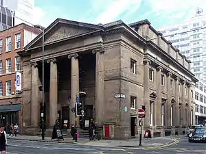
- "City Police Courts, Manchester". historicengland.org.uk. Retrieved 2008-05-28.
- "Clayton Hall, Manchester". historicengland.org.uk. Retrieved 2008-05-24.
- "Colonnade by lake to south of Heaton Hall, Manchester". historicengland.org.uk. Retrieved 2008-05-24.
- "County Court, Manchester". historicengland.org.uk. Retrieved 2008-05-29.
- "Daily Express Building, Manchester". historicengland.org.uk. Retrieved 2008-05-24.
- "Dale Warehouse, Manchester". historicengland.org.uk. Retrieved 2008-05-24.
- "Manchester Polytechnic, Didsbury School of Education, Manchester". historicengland.org.uk. Retrieved 2008-05-30.
- "Doubling Mill and Fireproof Mill, Manchester". historicengland.org.uk. Retrieved 2008-05-29.
- "Brookfield Unitarian Church, Manchester". historicengland.org.uk. Retrieved 2008-05-24.
- "Church of St. Wilfrid, Manchester". historicengland.org.uk. Retrieved 2008-05-24.
- "Former National Westminster Bank, Manchester". historicengland.org.uk. Retrieved 2008-05-30.
- "Free Trade Hall, Manchester". historicengland.org.uk. Retrieved 2008-05-29.
- "Deansgate Goods Station And attached carriage Ramp, Manchester". historicengland.org.uk. Retrieved 2008-05-30.
- "Student Health Centre, Manchester". historicengland.org.uk. Retrieved 2008-05-29.
- "Grand Lodge, Manchester". historicengland.org.uk. Retrieved 2008-05-24.
- "Temple north east of Heaton Hall, Manchester". historicengland.org.uk. Retrieved 2008-05-24.
- "Church of Holy Trinity, Manchester". historicengland.org.uk. Retrieved 2008-05-29.
- "Hough End Hall, Manchester". historicengland.org.uk. Retrieved 2008-05-28.
- "India House, Manchester". historicengland.org.uk. Retrieved 2008-05-30.
- "Former Rochdale Canal Warehouse". historicengland.org.uk. Retrieved 2011-05-14.
- "Lancaster House, Manchester". historicengland.org.uk. Retrieved 2008-05-30.
- "Lawrence Buildings, Manchester". historicengland.org.uk. Retrieved 2008-05-28.
- "London Road Fire Station, Manchester". historicengland.org.uk. Retrieved 2008-05-28.
- "War Memorial, Manchester". historicengland.org.uk. Retrieved 2008-05-30.
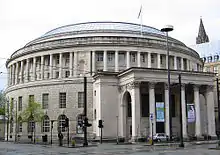
- "Manchester Central Library, Manchester". historicengland.org.uk. Retrieved 2008-05-30.
- "G-Mex, Manchester". historicengland.org.uk. Retrieved 2008-05-30.
- "Manchester Jewish Museum, Manchester". historicengland.org.uk. Retrieved 2008-05-24.
- "Manchester Law Library, Manchester". historicengland.org.uk. Retrieved 2008-05-27.
- "Former Reform Club, Manchester". historicengland.org.uk. Retrieved 2008-05-27.
- "Manchester Town Hall Extension, Manchester". historicengland.org.uk. Retrieved 2008-05-27.
- "103 Princess Street, Manchester". historicengland.org.uk. Retrieved 2008-05-29.
- "Memorial Hall, Manchester". historicengland.org.uk. Retrieved 2008-05-30.
- "Midland Hotel, Manchester". historicengland.org.uk. Retrieved 2008-05-29.
- "New Mill, Manchester". historicengland.org.uk. Retrieved 2008-05-27.
- "Doubling Mill and Fireproof Mill, Manchester". historicengland.org.uk. Retrieved 2008-05-29.
- "The Pankhurst Centre, Manchester". historicengland.org.uk. Retrieved 2008-05-28.
- "New Mill, Manchester". historicengland.org.uk. Retrieved 2008-05-27.
- "Parrs Wood House, Manchester". historicengland.org.uk. Retrieved 2008-05-30.
- "Peacock Mausoleum, Manchester". historicengland.org.uk. Retrieved 2008-05-27.
- "Platt Hall, Manchester". historicengland.org.uk. Retrieved 2008-05-29.
- "Portico Library, Manchester". historicengland.org.uk. Retrieved 2008-05-28.
- "Refuge Assurance Company Offices, Manchester". historicengland.org.uk. Retrieved 2008-05-29.
- "Rose Hill, Manchester". historicengland.org.uk. Retrieved 2008-05-28.
- "Royal Mill, Manchester". historicengland.org.uk. Retrieved 2008-05-30.
- "Slade Hall, Manchester". historicengland.org.uk. Retrieved 2008-05-30.
- "Smithy Lodge, Manchester". historicengland.org.uk. Retrieved 2008-05-24.
- "Church of St James, Manchester". historicengland.org.uk. Retrieved 2008-05-30.
- "The Towers (Shirley Institute), Manchester". historicengland.org.uk. Retrieved 2008-05-30.
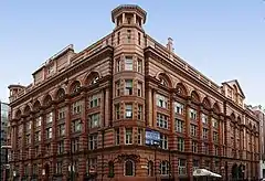
- "Tootal, Broadhurst and Lee Building, Manchester". historicengland.org.uk. Retrieved 2008-05-29.
- "Islamic Academy, Manchester". historicengland.org.uk. Retrieved 2008-05-30.
- "Victoria Baths, Manchester". historicengland.org.uk. Retrieved 2008-05-24.
- "Victoria Mill, Manchester". historicengland.org.uk. Retrieved 2008-05-28.
- "Victoria University of Manchester including Christie Library, Whitworth Hall, Manchester". historicengland.org.uk. Retrieved 2008-05-29.
- The Buildings of England - Lancashire: Manchester and the South-East, p. 498
- "Wythenshawe Hall, Manchester". historicengland.org.uk. Retrieved 2008-05-30.
- "Church of St Chad, Uppermill". historicengland.org.uk. Retrieved 2008-02-24.
- Oldham Metropolitan Borough Council. "Church of St Chad, Uppermill". Oldham.gov.uk. Retrieved 2008-02-24.
- "Heights Chapel, Saddleworth". historicengland.org.uk. Retrieved 2008-02-24.
- "Higher Kinders". historicengland.org.uk. Retrieved 2008-02-24.
- Oldham Metropolitan Borough Council. "Higher Kinders". Oldham.gov.uk. Retrieved 2008-02-24.
- "Shore Mill". historicengland.org.uk. Retrieved 2008-02-24.
- "Church of St Anne's, Royton". historicengland.org.uk. Retrieved 2008-02-24.
- Oldham Metropolitan Borough Council. "Church of St Anne, Royton". Oldham.gov.uk. Retrieved 2008-02-24.
- "Church of St Mary and St Peter, Oldham". historicengland.org.uk. Retrieved 2008-02-24.
- "Church of St Thomas, Lees". historicengland.org.uk. Retrieved 2008-02-24.
- "Foxdenton Hall". historicengland.org.uk. Retrieved 2008-02-24.
- "Independent Methodist Chapel, Oldham". historicengland.org.uk. Retrieved 2008-02-24.
- "1-5 Hollins Road, previously Hathershaw Hall". historicengland.org.uk. Retrieved 2008-02-24.
- The Barton Swing Aqueduct crosses the Manchester Ship Canal and is in the boroughs of both Salford and Trafford. "Barton Swing Aqueduct". historicengland.org.uk. Retrieved 2008-02-23.
- "Ackhurst Hall, Wigan". historicengland.org.uk. Retrieved 2008-05-18.
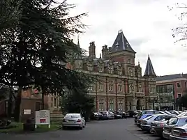
- "Administration block at Astley Hospital, Wigan". historicengland.org.uk. Retrieved 2008-05-18.
- "Astley Vicarage, Wigan". historicengland.org.uk. Retrieved 2008-05-23.
- "Alder House, Wigan". historicengland.org.uk. Retrieved 2008-05-18.
- "Chanters Farmhouse, Wigan". historicengland.org.uk. Retrieved 2008-05-18.
- "Church of St Michael and All Angels, Wigan". historicengland.org.uk. Retrieved 2008-05-18.
- "Chowbent Unitarian Chapel, Wigan". historicengland.org.uk. Retrieved 2008-05-18.
- "Barn and stable to east of Winstanley Hall and two attached gateways, Wigan". historicengland.org.uk. Retrieved 2008-05-23.
- "Bispham Hall, Wigan". historicengland.org.uk. Retrieved 2008-05-23.
- "Bradley Hall Public House, Wigan". historicengland.org.uk. Retrieved 2008-05-18.
- "Church of All Saints, Wigan". historicengland.org.uk. Retrieved 2008-05-18.
- "Church of St James with St Thomas, Wigan". historicengland.org.uk. Retrieved 2008-05-23.
- "Church of St John, Wigan". historicengland.org.uk. Retrieved 2008-05-18.
- "Listed Buildings in Wigan Metropolitan Borough Council" (PDF). Wigan Metropolitan Borough Coulcil. Archived from the original (PDF) on 2009-03-27. Retrieved 2007-12-14.
- "Church of St Mary, Wigan". historicengland.org.uk. Retrieved 2008-05-18.
- "Church of St Mary, Wigan". historicengland.org.uk. Retrieved 2008-05-18.
- "Church of St Matthew, Wigan". historicengland.org.uk. Retrieved 2008-05-23.
- "Church of St Michael, Wigan". historicengland.org.uk. Retrieved 2008-05-18.
- "Church of St Peter, Wigan". historicengland.org.uk. Retrieved 2008-05-18.
- "Giant's Hall Farmhouse, Wigan". historicengland.org.uk. Retrieved 2008-05-18.
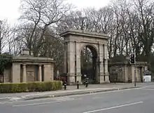
- "Gateway and Lodges to Haigh Hall Park, Wigan". historicengland.org.uk. Retrieved 2008-05-18.
- "Kirkless Hall and Kirkless Hall farmhouse, Wigan". historicengland.org.uk. Retrieved 2008-05-18.
- "Leigh Mill, Wigan". historicengland.org.uk. Retrieved 2008-05-18.
- "Light Oaks Hall, Wigan". historicengland.org.uk. Retrieved 2008-05-18.
- "Lightshaw Hall, Wigan". historicengland.org.uk. Retrieved 2008-05-18.
- "Mab's Cross, Wigan". historicengland.org.uk. Retrieved 2008-05-18.
- "Manor House, Wigan". historicengland.org.uk. Retrieved 2008-05-18.
- "Morley's Hall, Wigan". historicengland.org.uk. Retrieved 2008-05-23.
- "War Memorial south of Church of All Saints with encircling railings, Wigan". historicengland.org.uk. Retrieved 2008-05-18.
- "Winstanley Hall, Wigan". historicengland.org.uk. Retrieved 2008-05-23.
- "Worthington Hall, Wigan". historicengland.org.uk. Retrieved 2008-05-18.
External links
 Media related to Grade II* listed buildings in Greater Manchester at Wikimedia Commons