Grade I listed buildings in Greater Manchester
There are 48 Grade I listed buildings in Greater Manchester, England. In the United Kingdom, the term listed building refers to a building or other structure officially designated as being of special architectural, historical or cultural significance; Grade I structures are those considered to be "buildings of exceptional interest".[1] In England, the authority for listing under the Planning (Listed Buildings and Conservation Areas) Act 1990[2] rests with Historic England, a non-departmental public body sponsored by the Department for Culture, Media and Sport.
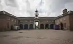
.png.webp)
The metropolitan county of Greater Manchester is made up of 10 metropolitan boroughs: Bolton, Bury, Manchester, Oldham, Rochdale, Salford, Stockport, Tameside, Trafford and Wigan. The Grade I buildings in each borough are listed separately. Manchester, the world's first industrialised city,[3] has 15 of Greater Manchester's 45 Grade I listed buildings, the highest number of any borough. Oldham is the only borough to have no listed buildings with a Grade I rating.[4] The River Irwell forms the boundary between Manchester and Salford, so one listed structure, the railway bridge over the Irwell, has been listed under both Manchester and Salford.
Most of Greater Manchester's listed buildings date from the Victorian and Edwardian periods.[1] According to an Association for Industrial Archaeology publication, Greater Manchester is "one of the classic areas of industrial and urban growth in Britain, the result of a combination of forces that came together in the 18th and 19th centuries: a phenomenal rise in population, the appearance of the specialist industrial town, a transport revolution, and weak local lordship".[5] Much of the region, historically a part of Lancashire, was at the forefront of textile manufacturing from the early 19th century until the early 20th century, and the county includes several former mill towns.[6][7] Greater Manchester has a wealth of industrial heritage, represented by industrial architecture found throughout the county,[7] but most of its Grade I listed buildings have a municipal, ecclesiastic or other cultural heritage.
The oldest Grade I listed structure in Greater Manchester is the Parish Church of St Mary the Virgin in Eccles, completed in the 13th century but greatly expanded since then. There are eight listed manor houses, the earliest of which date from the 14th century; Wardley Hall, still in use today as the residence of the Roman Catholic Bishop of Salford, has the preserved skull of St Ambrose Barlow – one of the Forty Martyrs of England and Wales – on display in a niche at the top of the main staircase.[8] Three buildings are attributed to engineer George Stephenson. One of them, Liverpool Road railway station, is the oldest surviving railway station in the world.[9] The newest Grade I listed building in Greater Manchester is Royd House, built and designed by Edgar Wood in 1916 as his residence.[10] Twenty-two buildings, almost half of the total, were completed in the 19th century.
Bolton
| Name | Location | Type | Architect | Completed [note 1] | Date designated | Grid ref.[note 2] Geo-coordinates |
Entry number [note 3] | Image | Ref. |
|---|---|---|---|---|---|---|---|---|---|
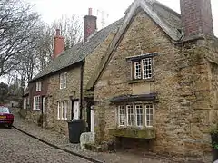
| 10 Firwood Fold | Firwood Fold, Bolton | House | c. 16th century (probably) | 23 April 1952 | SD7321811106 53°35′45″N 2°24′22″W |
1388038 | [11] | ||
| Smithills Hall | Smithills Dean Road, Bolton | House | 14th century | 23 April 1952 | SD6994611871 53°36′09″N 2°27′20″W |
1388279 | [12] | ||
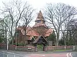
| Hall i' th' Wood | Hall i' th' Wood Lane, Bolton | House | 16th century | 23 April 1952 | SD6994611871 53°36′09″N 2°27′20″W |
1388279 | [13] |
Bury
| Name | Location | Type | Architect | Completed [note 1] | Date designated | Grid ref.[note 2] Geo-coordinates |
Entry number [note 3] | Image | Ref. |
|---|---|---|---|---|---|---|---|---|---|
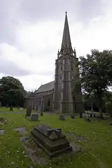
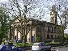
| All Saints' Church | Church Lane, Whitefield | Church | Charles Barry | 1826 | 15 August 1966 | SD8031605987 53°33′01″N 2°17′55″W |
1356818 | [14][15] | |
| Church of St Mary and St Bartholomew | Church Green, Radcliffe | Church | 14th century | 29 July 1966 | SD7969107580 53°33′52″N 2°18′29″W |
1163125 | [16] | ||
| Parish Church of St Mary the Virgin | Church Lane, Prestwich | Church | 15th century | 30 June 1966 | SD8110003664 53°31′45″N 2°17′12″W |
1067252 | [17][18] | ||
| Radcliffe Tower | Church Street East, Radcliffe | Fortified manor house | 1403 | 29 July 1966 | SD7957607508 53°33′50″N 2°18′35″W |
1309271 | [19] |

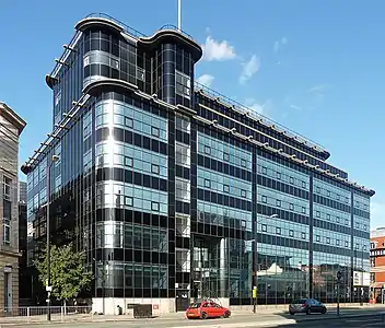
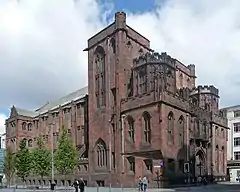
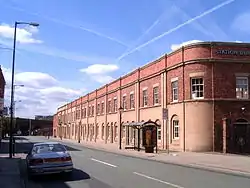
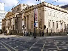
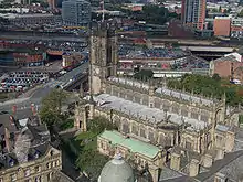
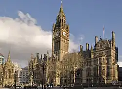
Manchester

Rochdale
| Name | Location | Type | Architect | Completed [note 1] | Date designated | Grid ref.[note 2] Geo-coordinates |
Entry number [note 3] | Image | Ref. |
|---|---|---|---|---|---|---|---|---|---|
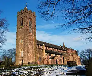
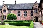
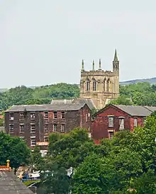
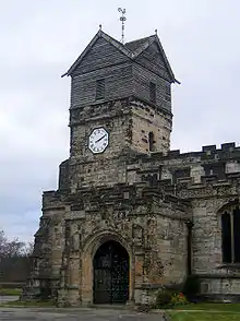
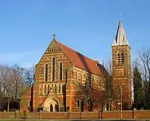
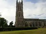
| Church of St Edmund | Edmund Street, Rochdale | Church | James Medland and Henry Taylor | 1873 | 12 February 1985 | SD8913213832 53°37′15″N 2°09′57″W |
1084273 | [39] | |
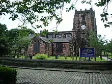
| Church of St Leonard | New Lane, Middleton | Church | 1524[40] | 15 March 1957 | SD8720806307 53°33′12″N 2°11′40″W |
1162332 | [41][42] | ||
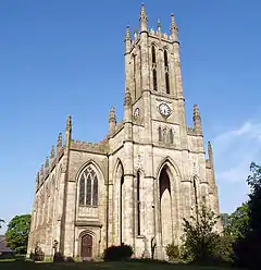
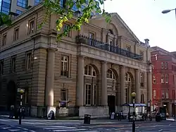
| Rochdale Town Hall | The Esplanade, Rochdale | Town hall | Alfred Waterhouse | 1871 | 25 October 1951 | SD8958413253 53°36′57″N 2°09′32″W |
1084275 | [43][44] | |
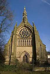
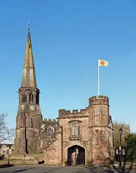
| Rochdale Cenotaph | The Esplanade, Rochdale | Memorial | Edwin Lutyens | 1922 | 12 February 1985 (upgraded 28 October 2015) | SD8953013314 | 1084274 | [45][46] |

.JPG.webp)
Salford
| Name | Location | Type | Architect | Completed [note 1] | Date designated | Grid ref.[note 2] Geo-coordinates |
Entry number [note 3] | Image | Ref. |
|---|---|---|---|---|---|---|---|---|---|
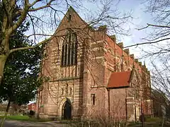
| St Augustine's Church | Bolton Road, Pendlebury | Church | George Frederick Bodley | 1874 | 30 March 1966 | SD7871901606 53°30′39″N 2°19′21″W |
1067508 | [47] | |
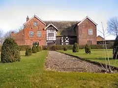
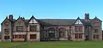
| Ordsall Hall | Taylorson Street, Ordsall | House | 16th century | 31 January 1952 | SJ8167196987 53°28′09″N 2°16′39″W |
1386169 | [48] | ||
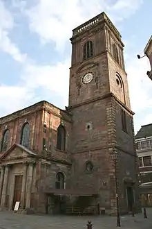
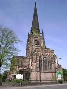
| St Mary the Virgin Church | Church Street, Eccles | Church | 13th century | 24 February 1964 | SJ7789498669 53°29′03″N 2°20′05″W |
1067498 | [47][49] | ||
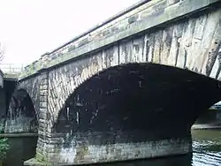
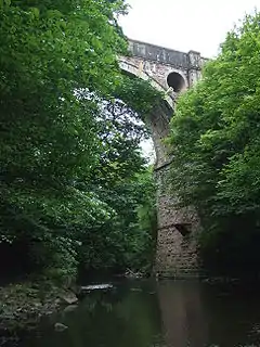
| River Irwell Railway Bridge[37] | Water Street, Salford | Bridge | George Stephenson | 1830 | 20 February 2007 | SJ8282897950 53°28′41″N 2°15′37″W[37]) |
1391927 | [38] | |
| St Mark's Church | Worsley Brow, Worsley | Church | George Gilbert Scott | 1846 | 29 July 1966 | SD7456600695 53°30′08″N 2°23′06″W |
1227895 | [47][50][51] | |
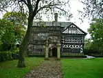
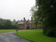
| Wardley Hall | Wardley Hall Road, Wardley | House | c. 1500 | 29 July 1966 | SD7456600695 53°30′08″N 2°23′06″W |
1215022 | [52] |

Stockport
| Name | Location | Type | Architect | Completed [note 1] | Date designated | Grid ref.[note 2] Geo-coordinates |
Entry number [note 3] | Image | Ref. |
|---|---|---|---|---|---|---|---|---|---|
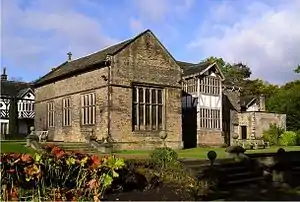
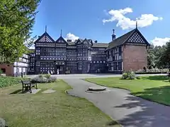
| Bramall Hall | Bramhall | House | 14th century | 9 August 1966 | SJ8901386363 53°22′26″N 2°10′00″W |
1260476 | [53] | ||
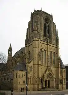
| St. Elisabeth's Church | Leamington Road, Reddish | Church | Alfred Waterhouse | 1883 | 30 October 1973 | SJ8924993476 53°26′17″N 2°09′48″W |
1356851 | [54][55] | |
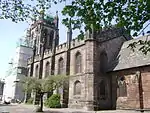
| Church of St George | Buxton Road, Heaviley | Church | Hubert Austin and Edward Graham Paley | 1897 | 10 March 1975 | 1067194 | [56][57][58] | ||
| Marple Aqueduct | Aqueduct | Benjamin Outram and Thomas Brown | 1794–1801 | 29 March 1966 | SJ9552190052 53°24′26″N 2°04′08″W |
1242267 | |||
| Church of St Thomas | St Thomas' Place, Stockport | Church | George Basevi | 1897 | 14 May 1952 | SJ8979089648 53°24′13″N 2°09′18″W |
1067160 | [59][60][61] | |
| St Mary's Parish Church | Churchgate, Stockport | Church | Lewis Wyatt | 1817 | 14 May 1952 | SJ8977890502 53°24′40″N 2°09′19″W |
1309701 | [62] | |
| St Mary's Church | High Street, Cheadle | Church | 24 March 1950 | SJ8563588616 53°23′39″N 2°13′03″W |
1241643 | [63][64] |
Tameside
| Name | Location | Type | Architect | Completed [note 1] | Date designated | Grid ref.[note 2] Geo-coordinates |
Entry number [note 3] | Image | Ref. |
|---|---|---|---|---|---|---|---|---|---|
| St Anne' Church | St Anne's Road, Denton | Church | J. Medland Taylor | 1881 | 20 July 1977 | SJ9337895584 53°27′25″N 2°06′04″W |
1309251 | [65][66] | |
| St Michael and All Angels' Church | Stamford Street, Ashton-under-Lyne | Church | 15th century | 12 January 1967 | SJ9414098997 53°29′16″N 2°05′23″W |
1162800 | [67] |
Trafford
| Name | Location | Type | Architect | Completed [note 1] | Date designated | Grid ref.[note 2] Geo-coordinates |
Entry number [note 3] | Image | Ref. |
|---|---|---|---|---|---|---|---|---|---|
| All Saints' Church | Redclyffe Road, Urmston | Church | E. W. Pugin | 1867–68 | 9 May 1978 | SJ7666897467 53°28′24″N 2°21′11″W |
1067879 | [68] | |
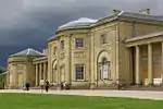
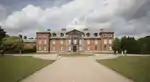
| Dunham Hall | Dunham Massey | House | 1732–40 | 5 March 1959 | SJ7348887422 53°22′59″N 2°24′00″W |
1356512 | [69] | ||
| Dunham Massey carriage house | Dunham Massey | Carriage house | 1721 | 5 March 1959 | SJ7344487349 53°22′56″N 2°24′03″W |
1067942 | [70] | ||
| Dunham Massey stables (south of hall) | Dunham Massey | Stables | 1721 | 12 July 1985 | SJ7346287303 53°22′55″N 2°24′02″W |
1356495 | [71] | ||
| St. Werburgh's Church | Wigsey Lane, Warburton | Church | c. 14th century | 5 March 1959 | SJ6969489576 53°24′08″N 2°27′26″W |
1067865 | [72] | ||
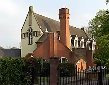
| Royd House | 224 Hale Road, Hale | House | Edgar Wood | 1916 | 13 October 1975 | SJ7834886681 53°22′36″N 2°19′37″W |
1067922 | [10] |

Wigan
| Name | Location | Type | Architect | Completed [note 1] | Date designated | Grid ref.[note 2] Geo-coordinates |
Entry number [note 3] | Image | Ref. |
|---|---|---|---|---|---|---|---|---|---|
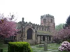
| St. Wilfrid's Church | Market Place, Standish | Church | L. Shipway (probably) | 1584 | 9 August 1966 | SD5631810265 53°35′14″N 2°39′41″W |
1287160 | [73] |
See also
Notes
- The date given is the date used by Historic England as significant for the initial building or that of an important part in the structure's description.
- Sometimes known as OSGB36, the grid reference is based on the British national grid reference system used by the Ordnance Survey.
- The "List Entry Number" is a unique number assigned to each listed building and scheduled monument by Historic England.
References
Citations
- "What is a listed building?". Manchester City Council. Retrieved 8 December 2007.
- "Planning (Listed Buildings and Conservation Areas) Act 1990 (c. 9)". Ministry of Justice. Archived from the original on 18 April 2010. Retrieved 17 December 2007.
- Kidd, Alan (2006). 'Manchester: A History'. Carnegie Publishing. ISBN 1-85936-128-5. Archived from the original on 27 December 2007.
- "Statistics by County". Images of England. Archived from the original on 26 December 2007. Retrieved 22 December 2007.
- McNeil & Nevell (2000), p. 2.
- Cowhig, W. T. (1976). It Happened Round Greater Manchester; Textiles. Greater Manchester Council.
- McNeil & Nevell (2000), pp. 2–3.
- Historic England. "Wardley Hall (1215022)". National Heritage List for England. Retrieved 22 January 2008.
- "About us". Science and Industry Museum.
- Historic England. "Royd House (1067922)". National Heritage List for England. Retrieved 19 July 2013.
- Historic England. "10, Firwood Fold (1388038)". National Heritage List for England. Retrieved 21 July 2013.
- Historic England. "Smithills Hall (1388279)". National Heritage List for England. Retrieved 21 July 2013.
- Historic England. "Hall i th Wood (1388052)". National Heritage List for England. Retrieved 21 July 2013.
- Historic England. "Church of All Saints (1356818)". National Heritage List for England. Retrieved 21 July 2013.
- Barnet, Stewart. "The Parish Church of All Saints' Stand, Whitefield". allsaintsmanchester.org. Archived from the original on 12 September 2010. Retrieved 13 February 2010.
- Historic England. "Church of St Mary and St Bartholomew (1163125)". National Heritage List for England. Retrieved 21 July 2013.
- "Church of St Mary". bury.gov.uk. Archived from the original on 26 October 2007. Retrieved 23 December 2007.
- Historic England. "Church of St Mary (1067252)". National Heritage List for England. Retrieved 21 July 2013.
- Historic England. "Radcliffe Tower (1309271)". National Heritage List for England. Retrieved 21 July 2013.
- Historic England. "Albert Memorial (1197820)". National Heritage List for England. Retrieved 3 April 2015.
- Historic England. "Baguley Hall (1291962)". National Heritage List for England. Retrieved 3 April 2015.
- Canniffe (1998), p. 77.
- "History of Cathedral conservation area". Manchester City Council. Retrieved 14 December 2007.
• "Chetham's Hospital School". Manchester City Council. Retrieved 14 December 2007.
• "Listed buildings in Manchester by street (L)". Manchester City Council. Retrieved 14 December 2007.
• "Chetham's Library, Manchester". Bridgeman Art Library. Archived from the original on 3 October 2006. Retrieved 14 December 2007.
• Historic England. "Chetham's Hospital and Attached Wall (1283015)". National Heritage List for England. Retrieved 23 July 2013. - Historic England. "Roman Catholic Church of the Holy Name of Jesus (1271296)". National Heritage List for England. Retrieved 23 July 2013.
- Historic England. "Church of St Ann (1247612)". National Heritage List for England. Retrieved 3 April 2015.
- Historic England. "The Edgar Wood Centre (1197770)". National Heritage List for England. Retrieved 3 April 2015.
- Canniffe (1998), pp. 6, 35.
- "Listed buildings in Manchester by street (K)". Manchester City Council. Retrieved 14 December 2007.
- Historic England. "Former Bank of England (1282404)". National Heritage List for England. Retrieved 23 July 2013.
- Historic England. "Heaton Hall (1200809)". National Heritage List for England. Retrieved 23 July 2013.
- Historic England. "John Rylands Library and Attached Railings, Gate and Lamp Standards (1217800)". National Heritage List for England. Retrieved 23 July 2013.
- Historic England. "Former Liverpool Road Railway Station Masters House (1291477)". National Heritage List for England. Retrieved 24 July 2013.
- Historic England. "City Art Gallery (1282980)". National Heritage List for England. Retrieved 24 July 2013.
- Historic England. "Cathedral Church of St Mary (1218041)". National Heritage List for England. Retrieved 24 July 2013.
- Historic England. "Town Hall (1207469)". National Heritage List for England. Retrieved 24 July 2013.
- Historic England. "Old Warehouse to North of Former Liverpool Road Railway Station (1282991)". National Heritage List for England. Retrieved 24 July 2013.
- The River Irwell is the boundary between Manchester and Salford, so one end of this bridge is in Manchester, the other is in Salford. Historic England. "Railway bridge over the River Irwell (1270603)". National Heritage List for England. Retrieved 24 December 2007.
- Historic England. "Railway bridge Over River Irwell to Former Liverpool Road Station (1270603)". National Heritage List for England. Retrieved 24 July 2013.
- "Church of Saint Edmund and Associated Boundary Wall, Railings and Gates". English Heritage. Archived from the original on 17 July 2013. Retrieved 25 July 2013.
- The church has parts dating from 1120 and 1412, but substantially from 1524. The wooden steeple, built in 1667 on top of the stone tower, is believed to be one of three remaining in the country. "Church of St Leonard". vmims.com. Archived from the original on 29 August 2007. Retrieved 24 December 2007.
- "Church of St Leonard". vmims.com. Archived from the original on 29 August 2007. Retrieved 24 December 2007.
- Historic England. "Church of St Leonard (1162332)". National Heritage List for England. Retrieved 25 July 2013.
- Cunningham, Colin (1981). Victorian and Edwardian Town Halls. Routledge. ISBN 9780710007230.
- Historic England. "Town Hall (1084275)". National Heritage List for England. Retrieved 25 July 2013.
- "National Collection of Lutyens' War Memorials Listed". Historic England. Retrieved 9 November 2015.
- Historic England. "Rochdale Cenotaph (1084274)". National Heritage List for England. Retrieved 9 November 2015.
- "Index to the List of Buildings, Structures and Features of Architectural, Archaeological or Historic Interest in Salford". Salford City Council. Archived from the original on 4 October 2008. Retrieved 22 December 2007.
- Historic England. "Ordsall Hall (1386169)". National Heritage List for England. Retrieved 22 December 2007.
- Historic England. "St Mary's Church (1067498)". National Heritage List for England. Retrieved 22 December 2007.
- "St Mark's Church, Worsley". GENUKI.org.uk. Retrieved 13 January 2008.
- Hyde, O'Rourke & Portland (2004), p. 77.
- Historic England. "Wardley Hall (1215022)". National Heritage List for England. Retrieved 22 December 2007.
- Historic England. "Bramall Hall (1260476)". National Heritage List for England. Retrieved 21 July 2013.
- Pevsner, Nikolaus (1969). The Buildings of England: South Lancashire. Penguin Books. pp. 371–72. ISBN 0-14-071036-1.
- Historic England. "Church of St Elisabeth (1356851)". National Heritage List for England. Retrieved 21 July 2013.
- Historic England. "Church of St George, Stockport (1067194)". National Heritage List for England. Retrieved 10 October 2011.
- Hartwell et al. (2011), p. 609.
- Historic England. "Church of St George (1067194)". National Heritage List for England. Retrieved 21 July 2013.
- "Statutory Listing - St Thomas' Church St Thomas' Place". Stockport Historic Environment Database. Stockport Metropolitan Borough Council. Archived from the original on 20 August 2011. Retrieved 5 April 2010.
- Historic England. "Church of St Thomas (1067160)". National Heritage List for England. Retrieved 23 December 2007.
- Arrowsmith, Peter (1997). Stockport: a history. Stockport Metropolitan Borough Council. ISBN 0-905164-99-7.
- Historic England. "Church of St Mary (1309701)". National Heritage List for England. Retrieved 22 December 2007.
- Historic England. "Church of St Mary, Cheadle (1241643)". National Heritage List for England. Retrieved 21 July 2013.
- Pevsner, Nikolaus; Hubbard, Edward (2003) [1971]. The Buildings of England: Cheshire. Yale University Press. p. 127. ISBN 0-300-09588-0.
- Historic England. "Church of St Anne (1309251)". National Heritage List for England. Retrieved 19 July 2013.
- "Church of St Anne". Tameside Metropolitan Borough Council. Retrieved 22 December 2007.
- Historic England. "Church of St Michael and All Angels (1162800)". National Heritage List for England. Retrieved 19 July 2013.
- Historic England. "Church of All Saints (1067879)". National Heritage List for England. Retrieved 3 April 2015.
- Historic England. "Dunham Hall (1356512)". National Heritage List for England. Retrieved 3 April 2015.
- Historic England. "Carriage House Immediately to South of Kitchen Courtyard (1067942)". National Heritage List for England. Retrieved 3 April 2015.
- Historic England. "Stables to South of Hall (1356495)". National Heritage List for England. Retrieved 3 April 2015.
- Historic England. "Old Church of St Werburg (1067865)". National Heritage List for England. Retrieved 3 April 2015.
- Historic England. "Church of St Wilfrid (1287160)". National Heritage List for England. Retrieved 3 April 2015.
Sources
- Canniffe, Eamonn (1998). Manchester Architecture Guide. University of Manchester. ISBN 1-900756-06-4.
- Hartwell, Clare; Hyde, Matthew; Pevsner, Nikolaus (2004). Lancashire: Manchester and the South-East. The Buildings of England. Yale University Press. ISBN 0-300-10583-5.
- Hartwell, Clare; Hyde, Matthew; Hubbard, Edward; Pevsner, Nikolaus (2011) [1971]. Cheshire. The Buildings of England. Yale University Press. ISBN 978-0-300-17043-6.
- Hyde, M.; O'Rourke, A; Portland, P. (2004). Around the M60: Manchester's Orbital Motorway. AMCD (Publishers). ISBN 1-897762-30-5.
- Kidd, Alan (2006). Manchester: A History. Carnegie Publishing. ISBN 1-85936-128-5. Archived from the original on 27 December 2007.
- McNeil, Robina; Nevell, Michael (2000). A Guide to the Industrial Archaeology of Greater Manchester. Association for Industrial Archaeology. ISBN 0-9528930-3-7.
- Wyke, Terry (2005). Public Sculpture of Greater Manchester. Liverpool University Press. ISBN 0-85323-567-8.
External links
 Media related to Grade I listed buildings in Greater Manchester at Wikimedia Commons