Wakefield Parish, New Brunswick
Wakefield is a civil parish in Carleton County, New Brunswick, Canada,[2] located north on the west bank of the Saint John River north of Woodstock. It comprises two local service districts and part of a third, all of which are members of the Western Valley Regional Service Commission (WVRSC).[3]
Wakefield | |
|---|---|
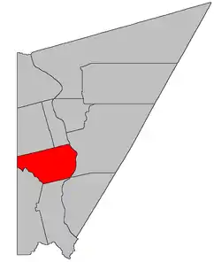 Location within Carleton County, New Brunswick | |
| Coordinates: 46.225°N 67.52°W | |
| Country | |
| Province | |
| County | Carleton |
| Error | 1803 |
| Area | |
| • Land | 196.43 km2 (75.84 sq mi) |
| Population (2016)[1] | |
| • Total | 2,767 |
| • Density | 14.1/km2 (37/sq mi) |
| • Pop 2011-2016 | |
| • Dwellings | 1,181 |
| Time zone | UTC-4 (AST) |
| • Summer (DST) | UTC-3 (ADT) |
The Census subdivision of Wakefield Parish shares the civil parish's borders.[1]
History
Wakefield was erected in 1803 within York County from unassigned lands north of Woodstock Parish and Northampton Parish.[5] It included Brighton, Simonds, and Wilmot Parishes, along with part of Wicklow Parish.
In 1830 all of Wakefield east of the channel of the Saint John River was erected as Brighton Parish.[6]
In 1842 the northern part of Wakefield was erected as Simonds Parish.[7] Simonds included Wilmot Parish and part of Wicklow.
Boundaries
Wakefield Parish is bounded on the north by the southern line of a land grant at the mouth of the Little Presque Isle Stream and its prolongation to the international border; on the east by the Saint John River; on the south by the southern line of a land grant on the Saint John River, opposite the junction of Route 105 and Newburg Road, prolonged to the Meduxnekeag River, and then the river to the international border; and on the west by Maine. It also includes all islands in front of it in the Saint John River.[2] Whether the southern boundary extends through Pine Island or around it is not made clear by either the Territorial Division Act[2] or the New Brunswick cadastral grant map of the area.[8]
Local service districts
All local service districts assess for the basic LSD services of fire protection, police services, land use planning, emergency measures, and dog control.[9]
Wakefield Parish
The local service district of the parish of Wakefield originally comprised the entire parish. Today the LSD is divided into two taxing authorities, the larger Wakefield (Inside) including most of the LSD[10] and Wakefield (Outside) in the northeastern part of the LSD, containing the communities of Victoria Corner and Waterville.
The parish LSD was established in 1966[11] to assess for fire protection. Community services were added in 1967.[12] Recreational services were added in 1985 to the new taxing authority of Wakefield Inside.[13]
Today both taxing authorities assess for community & recreational services.[9] The taxing authorities are 215.00 Wakefield (Inside) and 215.01 Wakefield (Outside).
LSD advisory committee: Unknown.
Somerville
Somerville comprises a rough triangle around Route 103, Route 130, and the Somerville Road with an extension south along Route 103.[10]
Somerville was established in 1971[14] to add street lighting and first aid & ambulance services; community services were removed, probably in error. Community services were restored and first aid & ambulance services removed in the rewrite of the LSD regulation in 1974.[15]
Today Somerville addesses for street lighting.[9] The taxing authority is 222.00 Somerville.
LSDAC: Unknown.
Communities
|
|
|
Bodies of water
Bodies of water at least partly in the parish
- Saint John River
Demographics
Population
|
LanguageMother tongue (2016)[1]
|
See also
References
- "Census Profile, 2016 Census Wakefield, Parish [Census subdivision], New Brunswick". Statistics Canada. Retrieved September 6, 2019.
- "Chapter T-3 Territorial Division Act". Government of New Brunswick. Retrieved 13 November 2020.
- "Communities in each of the 12 Regional Service Commissions (RSC) / Les communautés dans chacune des 12 Commissions de services régionaux (CSR)" (PDF), Government of New Brunswick, July 2017, retrieved 1 February 2021
- Ganong, William F. (1896). A Monograph of the Place-Nomenclature of the Province of New Brunswick. Royal Society of Canada. p. 279.
- "43 Geo. III c. 5 An Act for erecting the Upper part of the County of York into a distinct Town and Parish.". Acts of the General Assembly of His Majesty's Province of New-Brunswick. Passed in the Year 1803. Saint John, New Brunswick: Government of New Brunswick. 1803. p. 480.
- "10 & 11 Geo. IV c. 6 An Act for erecting a part of the Parish of Wakefield, in the County of York, into a separate and distinct Town or Parish.". Acts of the General Assembly of His Majesty's Province of New Brunswick, Passed in the Year 1830. Fredericton: Government of New Brunswick. 1830. pp. 5–6.
- "5 Vic. c. 17 An Act to erect the upper part of the Parish of Wakefield, in the County of Carleton, into a separate and distinct Town or Parish.". Acts of the General Assembly of Her Majesty's Province of New Brunswick, Passed in the Year 1842. Fredericton: Government of New Brunswick. 1842. p. 13.
- "No. 101". Provincial Archives of New Brunswick. Retrieved 16 January 2021.
- "2020 Local Government Statistics for New Brunswick" (PDF). Department of Environment and Local Government. p. 55. Retrieved 16 January 2021.
- "New Brunswick Regulation 84-168 under the Municipalities Act (O.C. 84-582)". Government of New Brunswick. Retrieved 16 January 2021.
- "Regulation 66–41 under the Municipalities Act (O. C. 66–968)". The Royal Gazette. Fredericton. 124: 604–605. 21 December 1966.
- "Regulation 67–130 under the Municipalities Act (O. C. 67–1196)". The Royal Gazette. Fredericton. 126: 10–11. 3 January 1968.
- New Brunswick Regulation 96-76.
- "Regulation 71–101 under the Municipalities Act (O. C. 71–690)". The Royal Gazette. Fredericton. 129: 736. 27 October 1971.
- "Regulation 74–102 under the Municipalities Act (O. C. 74–651)". New Brunswick Regulations 1974. Fredericton: 811–904. 1975.
- Statistics Canada: 1996, 2001, 2006 census
- 2011 Statistics Canada Census Profile: Wakefield Parish, New Brunswick
Places adjacent to Wakefield Parish, New Brunswick | |
|---|---|
| Subdivisions | |
|---|---|
| Cities | |
| Counties | |
| |