Woodstock Parish, New Brunswick
Woodstock is a civil parish in Carleton County, New Brunswick, Canada,[2] surrounding the town of the same name on its landward side. It comprises one town, one Indian reserve, part of one village, and parts of three local service districts, all of which except the Indian reserve are members of the Western Valley Regional Service Commission (WVRSC).[3].
Woodstock | |
|---|---|
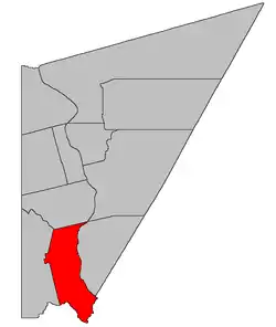 Location within Carleton County, New Brunswick | |
| Coordinates: 46.06°N 67.6°W | |
| Country | |
| Province | |
| County | Carleton |
| Erected | 1786 |
| Area | |
| • Land | 195.62 km2 (75.53 sq mi) |
| Population (2016)[1] | |
| • Total | 2,220 |
| • Density | 11.3/km2 (29/sq mi) |
| • Pop 2011-2016 | |
| • Dwellings | 930 |
| Time zone | UTC-4 (AST) |
| • Summer (DST) | UTC-3 (ADT) |
The Census subdivision of the same name includes all of the parish except the municipalities and Indian reserve.[1]
Origin of name
The parish's name is of uncertain origin. William F. Ganong considered the proximity of Woodstock, England and Northampton, England to be the more probable explanation for its use, but mentions William Odbur Raymond's opinion that it was a descriptive name taken from the supply of wood in the area.[4]
History
Woodstock was erected in 1786 as one York County's original parishes.[5] The parish extended downriver to opposite the modern boundary between Southampton and Queensbury Parishes but only extended twelve miles inland.
In 1831 Carleton County was separated from York,[6] with the county line running through Woodstock Parish.
In 1833 the York County portion of Woodstock was included in the newly erected Dumfries Parish.[7]
In 1834 the boundary with York County was altered to run along grant lines as it neared the Saint John River.[8] An error of omission appeared in the 1850[9] and 1854[10] boundary descriptions.
In 1838 Woodstock annexed unassigned territory between the Meduxnekeag River and the parish and another area between the parish's western line and the international border.[11]
In 1853 all of Woodstock west of the first two tiers of grants was erected as Richmond Parish.[12]
In 1877 the error in the York County line was corrected, restoring the original line along the Eel River.[13]
Boundaries
Woodstock Parish is bounded on the east by the Saint John River; on the north by the northern line of a grant nearly opposite the mouth of Shaws Creek and its prolongation westerly; on the west by the rear or western line of the second tier of lots west of the Saint John River, prolonged to the Eel River; and on the south and southeast by the Eel River. The parish also includes any islands in front of it in the Saint John River.[2] The Territorial Division Act and cadastral map of the area[14] are both moot on whether the northern boundary runs around or through Pine Island.
Municipalities
The town of Woodstock sits at the mouth of the Meduxnekeag River, near the northeastern corner of the parish.[15]
The village of Meductic sits at the mouth of the Eel River, straddling the York County line.[15]
Indian reserve
The Woodstock 23 Indian reserve stretches inland from the Saint John River, starting along Hodgdon Road and extending inland to King Road. The reserve belongs to the Woodstock First Nation, a Wəlastəkwewiyik band.
Local service districts
All LSDs assess for the basic LSD services of fire protection, police services, land use planning, emergency measures, and dog control.[16]
Woodstock Parish
The local service district of the parish of Woodstock originally contained all of the parish except Woodstock, Meductic, and Debec. The Indian reserve is under federal administration but not explicitly excluded from the LSD.[17] A small wetland area west of the mouth of Fish Creek in Richmond Parish was added to this LSD in 2014.[18]
The LSD was established in 1966 to assess for fire protection following the elimination of county government under the new Municipalities Act.[19] Community services were added in 1967[20] and recreational facilities in 1995.[21]
Today Woodstock Parish assesses for the additional service of community & recreational services.[16] The taxing authority is 218.00 Woodstock.
LSD advisory committee? Yes. Chair Brian Hayden has sat on the WVRSC board of directors since at least 2015.[22][23][24][25][26][27]
Debec
Debec occupies an irregular area along the western side of the parish.
Benton
Benton straddles the county line at the bend of the Eel River, extending along the Benton, Lewin, and Caldwell Roads.
The LSD was established in 1967 to add community planning and street lights.[28] Community services were added in 1968.[29]
Today Benton additionally assesses for street lighting and community & recreation services.[16] The taxing authority is 219.00 Benton.
LSDAC? Unknown.
Communities
Parish population total does not include incorporated municipalities (in bold):
|
|
|
Bodies of water
Bodies of water at least partly in the parish
- Saint John River
Demographics
Population
|
LanguageMother tongue (2016)[1]
|
See also
References
- "Census Profile, 2016 Census: Woodstock, Parish [Census subdivision], New Brunswick". Statistics Canada. Retrieved September 7, 2019.
- "Chapter T-3 Territorial Division Act". Government of New Brunswick. Retrieved 28 January 2021.
- "Communities in each of the 12 Regional Service Commissions (RSC) / Les communautés dans chacune des 12 Commissions de services régionaux (CSR)" (PDF), Government of New Brunswick, July 2017, retrieved 1 February 2021
- Ganong, William F. (1896). A Monograph of the Place-Nomenclature of the Province of New Brunswick. Royal Society of Canada. p. 2280.
- "26 Geo. III Chapter I. An Act for the better ascertaining and confirming the Boundaries of the several Counties within this Province, and for subdividing them into Towns or Parishes.". Acts of the General Assembly of His Majesty's Province of New-Brunswick, passed in the year 1786. Saint John, New Brunswick: Government of New Brunswick. 1786. pp. 3–12.
- "1 Wm. IV c. 50 An Act for the Division of the County of York into Two Counties, and to provide for the Government and Representation of the new County.". Acts of the General Assembly of His Majesty's Province of New Brunswick, Passed in the Year 1833. Fredericton: Government of New Brunswick. 1833. pp. 183–187.
- "3 Wm. IV c. 38 An Act to alter the Names of certain Parts of Three Parishes in the County of York, and to erect Two separate Parishes therein.". Acts of the General Assembly of His Majesty's Province of New Brunswick, Passed in the Year 1833. Fredericton: Government of New Brunswick. 1833. pp. 181–182.
- "4 Wm. IV c. 28 An Act to alter the Division Line between the Counties of York and Carleton.". Acts of the General Assembly of His Majesty's Province of New Brunswick, Passed in the Year 1834. Fredericton: Government of New Brunswick. 1834. pp. 71–72.
- "13 Vic. c. 51 An Act to consolidate all the Laws now in force for the division of the Province into Counties, Towns and Parishes.". Acts of the General Assembly of Her Mjaesty's Province of New Brunswick, Passed in the Year 1850. Fredericton: Government of New Brunswick. 1850. pp. 142–152, 145–149. Book was poorly proofread, resulting in title typo and reuse of page numbers 145–152.
- "Chapter 1.". The Revised Statutes of New Brunswick Volume 1. Fredericton: Government of New Brunswick. 1854. pp. 2–19.
- "1 Vic. c. 31 An Act to enlarge and define the Boundaries of the Parish of Woodstock.". Acts of the General Assembly of Her Majesty's Province of New Brunswick, Passed in the Year 1838. Fredericton: Government of New Brunswick. 1838. p. 76.
- "16 Vic. c. 42 An Act to erect a part of the Parish of Woodstock, in the County of Carleton, into a separate and distinct Town or Parish.". Acts of the General Assembly of Her Majesty's Province of New Brunswick, Passed in the Month of October, 1852, and in the Months of April and May, 1853. Fredericton: Government of New Brunswick. 1853. pp. 75–76.
- "Chapter 2 The Division of the Province into Counties, Towns, and Parishes.". The Consolidated Statutes of New Brunswick. Fredericton: Government of New Brunswick. 1877. pp. 56–85.
- "No. 101". Provincial Archives of New Brunswick. Department of Natural Resources and Energy Development. Retrieved 28 January 2021.
- "New Brunswick Regulation 85-6 under the Municipalities Act (O.C. 85-45)". Government of New Brunswick. Retrieved 28 January 2021.
- "2020 Local Government Statistics for New Brunswick" (PDF). Department of Environment and Local Government. p. 55. Retrieved 28 January 2021.
- "New Brunswick Regulation 84-168 under the Municipalities Act (O.C. 84-582)". Government of New Brunswick. Retrieved 28 January 2021.
- "Regulation 2014-22 under the Municipalities Act (O. C. 2014-41)" (PDF). The Royal Gazette. Fredericton. 172: 361–362. 12 March 2014. ISSN 1714-9428.
- "Regulation 66–41 under the Municipalities Act (O. C. 66–968)". The Royal Gazette. Fredericton. 124: 604–605. 21 December 1966.
- "Regulation 67–130 under the Municipalities Act (O. C. 67–1196)". The Royal Gazette. Fredericton. 126: 10–11. 3 January 1968.
- New Brunswick Regulation 95-151.
- "2015 Annual Report" (PDF). Western Valley Regional Service Commission. 2016. p. 2. Retrieved 27 January 2021.
- "2016 Annual Report" (PDF). Western Valley Regional Service Commission. 2017. p. 2. Retrieved 27 January 2021.
- "2017 Annual Report" (PDF). Western Valley Regional Service Commission. 2018. p. 2. Retrieved 27 January 2021.
- "2018 Annual Report" (PDF). Western Valley Regional Service Commission. 2019. p. 2. Retrieved 27 January 2021.
- "2019 Annual Report" (PDF). Western Valley Regional Service Commission. 2020. p. 2. Retrieved 27 January 2021.
- "Board of Directors Meeting: Minutes of Meeting" (PDF). Western Valley Regional Service Commission. 3 September 2020. Retrieved 27 January 2021.
- "Regulation 67–112 under the Municipalities Act (O. C. 67–1058)". The Royal Gazette. Fredericton. 125: 597. 22 November 1967.
- "Regulation 68–44 under the Municipalities Act (O. C. 68–376)". The Royal Gazette. Fredericton. 126: 267–269. 15 May 1968.
- Statistics Canada: 1951, 1996, 2001, 2006 census
- 2011 Statistics Canada Census Profile: Woodstock Parish, New Brunswick
Places adjacent to Woodstock Parish, New Brunswick | ||||||||||
|---|---|---|---|---|---|---|---|---|---|---|
| ||||||||||
| Subdivisions | |
|---|---|
| Cities | |
| Counties | |
| |