Westfield Parish, New Brunswick
Westfield is a civil parish in Kings County, New Brunswick, Canada.[2]
Westfield | |
|---|---|
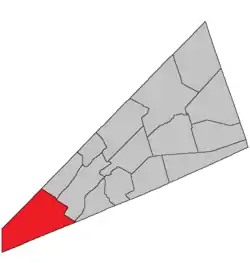 Location within Kings County, New Brunswick. | |
| Country | |
| Province | |
| County | Kings County |
| Erected | 1786 |
| Area | |
| • Land | 295.70 km2 (114.17 sq mi) |
| Population (2016)[1] | |
| • Total | 1,962 |
| • Density | 6.6/km2 (17/sq mi) |
| • Change 2011-2016 | |
| • Dwellings | 952 |
| Time zone | UTC-4 (AST) |
| • Summer (DST) | UTC-3 (ADT) |
For governance purposes it is divided between the town of Grand Bay-Westfield and the local service district of the parish of Westfield,[3] both of which are members of the Fundy Regional Service Commission (FRSC).[4] Westfield includes the taxing authorities of Westfield East and Westfield West, which are sometimes erroneously described as LSDs in their own right.
Origin of name
The parish may have been named for the town of Westfield in Massachusetts.
History
Westfield was erected in 1786 as one of the original parishes of the county.[5]
The 1795 reorganisation of the county[6] affected the boundary on the Kingston Peninsula.
In 1896 the boundary on the Long Reach side of the Kingston Peninsula was altered slightly.[7]
Delineation
Westfield Parish is defined in the Territorial Division Act[8] as being bounded:
- On the northwest, south and west, by the boundary line of the County; and on the northeast by a line beginning on the County line between Kings and Queens, intersected by the northwestern prolongation of the line dividing lots number twenty-three and number twenty-four at Devils Back, on the Long Reach; thence southeasterly along said prolongation and line to the northwestern shore of the Long Reach; thence southeasterly in a direct line across the Saint John River to the line dividing lots number twenty-five and number twenty-six, granted to Robert and Caleb Merritt; thence southeasterly along said line and its southeastern prolongation to the rear line of lots fronting on the northwest side of Kennebecasis Bay; thence southwesterly along said line to the northeast line of lot number twenty-eight, granted to Dennis Coombe; thence southeasterly along said line and its southeastern prolongation to the County line, including Kennebecasis Island.
Communities
Parish population total does not include incorporated municipalities (in bold):
|
|
|
Bodies of water & Islands
This is a list of rivers, lakes, streams, creeks, marshes and Islands that are at least partially in this parish
- Eagle Lake
- Kennebecasis Island
- Loch Alva
- Saint John River
- Seven Mile Lake
Demographics
Access Routes
Highways and numbered routes that run through the parish, including external routes that start or finish at the parish limits:[11]
See also
References
- "Census Profile, 2016 Census: Westfield, Parish [Census subdivision], New Brunswick". Statistics Canada. Retrieved September 18, 2019.
- "Chapter T-3 Territorial Division Act". Government of New Brunswick. Retrieved 13 November 2020.
- "New Brunswick Regulation 84-168 under the Municipalities Act (O.C. 84-582)". Government of New Brunswick. Retrieved 19 July 2020.
- "Communities in each of the 12 Regional Service Commissions (RSC) / Les communautés dans chacune des 12 Commissions de services régionaux (CSR)" (PDF), Government of New Brunswick, July 2017, retrieved 2 February 2021
- "26 Geo. III Chapter I. An Act for the better ascertaining and confirming the Boundaries of the several Counties within this Province, and for subdividing them into Towns or Parishes.". Acts of the General Assembly of His Majesty's Province of New-Brunswick, passed in the year 1786. Saint John, New Brunswick: Government of New Brunswick. 1786. pp. 3–12.
- "35 Geo. III c. 3 An Act in addition to an Act intitled, 'An Act for the better Ascertaining and Confirming the Boundaries of the several Counties within this Province, and for subdividing them into Towns or Parishes.'". Acts of the General Assembly of His Majesty's Province of New-Brunswick, Passed in the Year 1795. Fredericton: Government of New Brunswick. 1795. pp. 338–340.
- "59 Vic. c. 8 An Act to Revise and Codify an Act to Provide for the Division of the Province into Counties, Towns and Parishes.". Acts of the General Assembly of Her Majesty's Province of New Brunswick. Passed in the Month of March, 1896. Fredericton: Government of New Brunswick. 1896. pp. 86–123.
- "Territorial Division Act (R.S.N.B. 1973, c. T-3)". Government of New Brunswick website. Retrieved 30 August 2016.
- Statistics Canada: 2001, 2006 census
- 2011 Statistics Canada Census Profile: Westfield Parish, New Brunswick
- Atlantic Canada Back Road Atlas ISBN 978-1-55368-618-7
External links
Places adjacent to Westfield Parish, New Brunswick | |
|---|---|
| Subdivisions | |
|---|---|
| Cities | |
| Counties | |
| |