Petersville Parish, New Brunswick
Petersville is a civil parish in Queens County, New Brunswick, Canada.[2]
Petersville | |
|---|---|
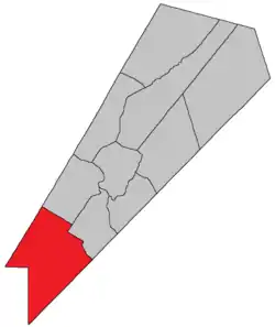 Location within Queens County, New Brunswick. | |
| Country | |
| Province | |
| County | Queens County |
| Erected | 1838 |
| Area | |
| • Land | 590.14 km2 (227.85 sq mi) |
| Population (2016)[1] | |
| • Total | 681 |
| • Density | 1.2/km2 (3/sq mi) |
| • Change 2011-2016 | |
| • Dwellings | 325 |
| Time zone | UTC-4 (AST) |
| • Summer (DST) | UTC-3 (ADT) |
For governance purposes it is divided between CFB Gagetown and the local service districts of Wirral-Enniskillen and the parish of Petersville.[3] Wirral-Enniskillen is part of Regional Service Commission 11 (RSC11) and Petersville Parish is part of the Fundy Regional Service Commission (FRSC).[4]
Origin of name
William Francis Ganong states that the parish was named in honour of Harry Peters, then Speaker of the House of Assembly.[5] Peters' tenure as Speaker actually ended in 1827 but he continued to serve as MLA until 1843. Harry's brother Charles Jeffery Peters was Attorney General of New Brunswick when the parish was erected.
History
Petersville was erected in 1838 from Gagetown and Hampstead Parishes.[6]
Much of the parish was expropriated in 1953 for the creation of CFB Gagetown.
Delineation
Petersville Parish is defined in the Territorial Division Act[2] as being bounded:
- Being all that part of the County southwest of a line beginning where the road from Jones' mill[lower-alpha 1] crosses the County line; thence northerly along the said road to the northwest line of lot number one, granted to John Short; thence northeasterly along the same to the northeast line of lot number five, granted to Sylvanus Haviland; thence northwesterly along the same and its northwestern prolongation to the southeast line of lands granted to James Corbett; thence northeasterly along the same to the southwest line of the grant to Henry Appleby; thence northwesterly along the same to the Gagetown Road;[lower-alpha 2] thence northeasterly along the same to the northeast line of lot number twenty-five, granted to T.T. Hewlett, and thence northwesterly along the same and its northwestern prolongation to the Sunbury County line.
Communities
Parish population total does not include incorporated municipalities (in bold).
|
|
|
Demographics
Access Routes
Highways and numbered routes that run through the parish, including external routes that start or finish at the parish limits:[9]
Notes
- Olinville Road
- Lawfield Road, within CFB Gagetown
References
- "Census Profile, 2016 Census: Petersville, Parish [Census subdivision], New Brunswick". Statistics Canada. Retrieved September 27, 2019.
- "Chapter T-3 Territorial Division Act". Government of New Brunswick. Retrieved 13 November 2020.
- "New Brunswick Regulation 84-168 under the Municipalities Act (O.C. 84-582)". Government of New Brunswick. Retrieved 19 July 2020.
- "Communities in each of the 12 Regional Service Commissions (RSC) / Les communautés dans chacune des 12 Commissions de services régionaux (CSR)" (PDF), Government of New Brunswick, July 2017, retrieved 2 February 2021
- Ganong, William F. (1896). A Monograph of the Place-Nomenclature of the Province of New Brunswick. Royal Society of Canada. p. 261.
- "1 Vic. c. 35 An Act to erect a part of the Parishes of Gagetown and Hampstead, in Queen's County, into a separate and distinct Town or Parish.". Acts of the General Assembly of Her Majesty's Province of New Brunswick, Passed in the Year 1838. Fredericton: Government of New Brunswick. 1838. p. 78.
- Statistics Canada: 2001, 2006 census
- 2011 Statistics Canada Census Profile: Petersville Parish, New Brunswick
- Atlantic Canada Back Road Atlas ISBN 978-1-55368-618-7
External links
Places adjacent to Petersville Parish, New Brunswick | |
|---|---|
| Subdivisions | |
|---|---|
| Cities | |
| Counties | |
| |