Woburn Sands
Woburn Sands (/ˈwoʊbərn/) is a town and civil parish[2] in the Borough of Milton Keynes, England, and part of the Milton Keynes urban area.[3] It is south-east of Milton Keynes proper, near Wavendon. The boundary of the Borough with Bedfordshire is also that with the neighbouring parishes of Aspley Guise and Aspley Heath (in Central Bedfordshire); together the three settlements are a contiguous built-up area.[1] Not all of Woburn Sands built-up area is in the civil parish which has its name: the meandering boundary between Buckinghamshire and Bedfordshire means the Primary and Middle Schools named after the town are both across the border in Aspley Guise. At the 2011 Census, the population of the civil parish (only) was 2,916,[1] that of the built-up area (including much of Aspley Guise) was 5,959.[4]
| Woburn Sands | |
|---|---|
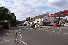 Woburn Sands High Street | |
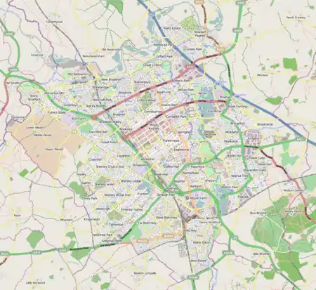 Woburn Sands Mapping © OpenStreetMap 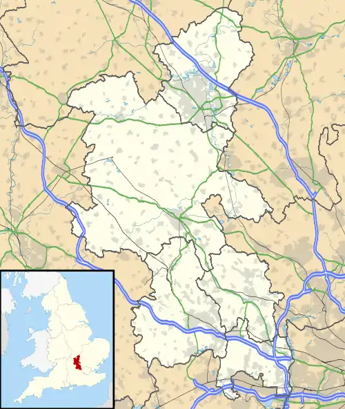 Woburn Sands Location within Buckinghamshire | |
| Population | 2,916 (2011 Census)[1] |
| OS grid reference | SP927360 |
| Civil parish |
|
| Unitary authority | |
| Ceremonial county | |
| Region | |
| Country | England |
| Sovereign state | United Kingdom |
| Post town | Milton Keynes |
| Postcode district | MK17 |
| Dialling code | 01908 |
| Police | Thames Valley |
| Fire | Buckinghamshire |
| Ambulance | South Central |
| UK Parliament | |
| Website | Woburn Sands Town Council |
History
The earliest evidence of settlement is an Iron Age hill fort dating from around 500 BC, called Danesborough Camp which is located to the southwest of the present town.[5] Later when the settlement had developed into a hamlet, it was part of the parish of Wavendon, becoming a separate civil parish in 1907. Under the Local Government Act 1972 the parish council has adopted the status of a town in its own right. It has separated from Wavendon parish which is just to the north of the Marston Vale line.
The village name was originally Hogsty End, one of Wavendon's four 'ends' (along with Church End, Cross End and Lower End) but by Victorian times, this un-picturesque name had fallen out of favour, and Woburn Sands had taken over as the accepted name. The modern name is credited to a schoolmaster unable to attract business to his "Hogsty End Academy", and was one of the first to promote the use of the new name.[6] The modern place name is related to nearby Woburn in Bedfordshire, and to the sandy local soil resulting from its proximity to the Greensand Ridge, an escarpment of Greensand that is part of the Woburn Sands Formation.
Transport
The town is served by Woburn Sands railway station which co-serves the near end of Wavendon which, unlike Wavendon Gate, is separated by fields from Milton Keynes. The station is on the Marston Vale line, three closely placed stops east of a main line junction station.
References
- UK Census (2011). "Local Area Report – Woburn Sands civil parish (E04012196)". Nomis. Office for National Statistics. Retrieved 26 April 2019.
- "Parishes in Milton Keynes". Milton Keynes Council. Archived from the original on 8 June 2009.
- UK Census (2011). "Local Area Report – Milton Keynes Built-up area (E34005056)". Nomis. Office for National Statistics. Retrieved 29 March 2019. See map.
- UK Census (2011). "Local Area Report – Woburn Sands Built-up area sub division (E35000347)". Nomis. Office for National Statistics. Retrieved 1 October 2019.
- "Danesborough Hill Fort, Aspley Heath". Milton Keynes Heritage Association. Retrieved 26 April 2019.
- "How 'Hogsty End' became 'Woburn Sands'". Milton Keynes Heritage Association. Retrieved 26 April 2019.
External links
- Woburn Sands Town Council
- Woburn Sands local history site
- The Hogsty End Handbook local community magazine
- Cyclone Mountain Bike Club – MTB around local forest trails
- Woburn Sands Folk Festival
| Unitary authorities | |
|---|---|
| Major settlements | |
| Rivers | |
| Topics |
|
| Authority control |
|---|
