Wudu District
Wudu District (simplified Chinese: 武都区; traditional Chinese: 武都區; pinyin: Wǔdū Qū) is a district and the political and cultural centre of Longnan, Gansu province, China.[1] It borders the provinces of Shaanxi and Sichuan to the southeast. It has a population of 590,000, of which 110,00 in the urban area.[2]
Wudu
武都区 | |
|---|---|
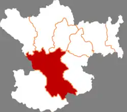 Wudu in Longnan | |
.png.webp) Longnan in Gansu | |
| Coordinates: 33°22′13″N 104°57′37″E | |
| Country | People's Republic of China |
| Province | Gansu |
| Prefecture-level city | Longnan |
| Area | |
| • District | 4,683 km2 (1,808 sq mi) |
| Population (2019) | |
| • District | 590,000 |
| • Density | 130/km2 (330/sq mi) |
| • Urban | 110,000 |
| • Rural | 480,000 |
| Time zone | UTC+8 (China Standard) |
| Postal code | 746000 |
| Website | www |
Located along the Bailong River near the borders with Sichuan and Shaanxi, it has been the site of many historic battles. A town has existed at the current county seat since at least 448. In 572 this town was named Wuzhou (武州), in 892 it was named Jiezhou. Since 1260 it was part of Shaanxi province, becoming part of Gansu in 1729. In 1913, Wudu County was established. The current district was established from Wudu County in 2004.[3]
The epicentre of the 1879 Gansu earthquake was located in the district.
Wudu is one of the top tourist destinations in Gansu, receiving over 2 million tourists in 2016.[4] The Wanxiang karst cave is located 10 km from the city.[5] Its agricultural output includes olive cultivation, traditional Chinese medicine crops and Sichuan pepper.[6][7][8][9]
Administrative divisions
Wudu District is divided to 4 subdistricts, 26 towns, 8 townships and 2 ethnic townships.[10][11]
- Subdistricts
|
|
- Towns
|
|
|
- Townships
|
|
- Ethnic townships
- Pingya Tibetan Township (坪垭藏族乡)
- Moba Tibetan Township (磨坝藏族乡)
Transport
References
- 毛树林; 赵殷; 三道 (2010-09-01). 大爱:深圳援建陇南纪实 (in Chinese). Beijing Book Co. Inc. ISBN 978-7-999022-56-5.
- "武都区人民政府—魅力武都". www.gslnwd.gov.cn. Retrieved 2021-01-23.
- "历史沿革". www.gslnwd.gov.cn. Retrieved 2021-01-23.
- "甘肃省陇南市武都区-新华网". www.xinhuanet.com. Retrieved 2021-01-23.
- "甘肃武都万象洞:神秘罕见的西北喀斯特溶洞". www.sohu.com. Retrieved 2021-01-23.
- "马营镇:中药材成为脱贫路上的新"方剂"". www.gslnwd.gov.cn. Retrieved 2021-01-23.
- "武都:花椒产业助推脱贫攻坚". www.gslnwd.gov.cn. Retrieved 2021-01-23.
- "武都油橄榄产业实现经济生态效益双丰收". www.gslnwd.gov.cn. Retrieved 2021-01-23.
- 王义 (2013-05-01). 甘肃省城乡一体化试点成就纪实 (in Chinese). Beijing Book Co. Inc. ISBN 978-7-226-04441-4.
- "统计用区划代码 www.stats.gov.cn" (in Chinese). XZQH. Retrieved 2012-05-26.
- "武都区人民政府—内容页". www.gslnwd.gov.cn. Retrieved 2021-01-23.
| Authority control |
|---|