1812 Ventura earthquake
The 1812 Ventura earthquake (also known as the Santa Barbara earthquake) occurred on the morning of December 21 at UTC 19:00 or 10:00 Pacific Standard Time (PST), on Monday. The 7.1–7.5 magnitude earthquake had a Mercalli intensity scale rating of VIII (Severe), and its resulting tsunami caused great implications to what was at the time a territory of the Spanish Empire, where Catholic missions were settling, present-day Santa Barbara and Ventura County, in California.[1][2] One person was killed as a result of the earthquake (and another from the aftershock). At the time of the earthquake, the region was recovering from another earthquake on the 8th of December the same year.
.jpg.webp) | |
 San Buenaventura San Gabriel San Juan Capistrano San Diego | |
| UTC time | 1812-12-21 19:00:00 |
|---|---|
| USGS-ANSS | ComCat |
| Local date | 21 December, 1812 |
| Local time | 10:15:00 PST (UTC-07:00) |
| Magnitude | 7.0–7.25 Mw 7.1 ml M 7.5–7.7 |
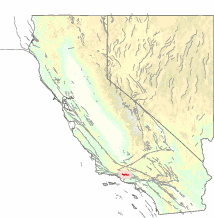
| Epicenter | 34.2°N 119.9°W |
| Areas affected | Alta California, New Spain Present day Santa Barbara and Ventura County |
| Max. intensity | VIII (Severe) |
| Tsunami | 3.4 m (11.2 ft) |
| Foreshocks | Yes |
| Aftershocks | Yes |
| Casualties | 2 |
Geological setting
see also: Thrust tectonics and Transverse Range
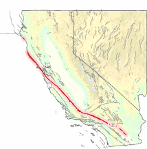
The San Andreas is the "master fault" of California, it is the main plate boundary in the San Andreas Fault System, consisting of other major active faults. This zone of interaction between the Pacific and North American Plates have resulted in hundreds of faults crisscrossing California. There are several strike-slip, reverse and thrust faults hidden under the Santa Barbara Channel that could produce devastating earthquakes and tsunamis, including a thrust fault that runs along the base of the Santa Monica Mountains.[3] These faults are a result of the "Big Bend" in the San Andreas Fault when it meets with the Garlock Fault, exerting compression in the crust, forcing thrust and reverse faults to push crustal blocks upwards.
Earthquake
The first earthquake may have been a foreshock, it occurred at around 10:00 to 10:15 a.m. At Mission La Purisima, residents; padres, soldiers, and Indians ran out of buildings and never returned.[4] Fifteen minutes later, the foreshock was accompanied by the mainshock. This time, the shaking intensity was much more violent. Bells of the mission church started ringing and the adobe walls began to fracture and collapse.
The captain of the Thomas Newland, a ship that was in Refugio Bay, watched as the sea receded, and later returned in a wave that lifted the ship and dumped it at Refugio Canyon, before taking it back out to sea.[5][6] A run-up height of 3–4 meters was recorded at Gaviota, although eyewitness said the tsunami may have been up to 15.2 meters (50 feet).[7][8] The tsunami was also recorded at San Francisco.
Damage and aftermath
.jpg.webp)
Bells of the mission church started ringing and the adobe walls began to fracture and collapse. Damage was reported at Mission Santa Ines, Mission Santa Barbara, Santa Barbara Presidio, Mission San Buenaventura (Ventura), and Mission San Fernando as well.[9] One person was killed by a falling boulder at Agua Caliente. At the various missions, many houses, churches, chapels, and other structures totally collapsed.[10][11] Three adobe buildings were destroyed by the advancing tsunami. At Mission San Buenaventura and Mission Santa Barbara, the destruction was great, and a native man died when a building collapsed on him because of an aftershock. At Mission La Purisima, a large fissure carved through the slopes of a hill erupted mud and water.[10]
The low death toll for this large earthquake was attributed to a foreshock 15 minutes before the mainshock which had driven many people out of buildings that would collapse later.[12]
Devastation from this earthquake was comparable to the 1906 San Francisco and 1857 Fort Tejon earthquake, but over a much smaller area. Frightened Chumash people on Santa Cruz and Santa Rosa islands fled to the mainland in their canoes and relocated there.[13][14] For fear of another tsunami and aftershocks persisting, the missions were abandoned until April of 1813.[6]
Source fault
Studies have placed the source of this earthquake on two faults. The location and source have not been agreed on, with some researchers providing the epicenter north of Wrightwood or in the Santa Barbara channel.
San Andreas Fault
Based on tree-ring sampling, forests were found to have suffered some form of trauma and was experiencing a slow growth rate dating back to 1812. They were found to have been missing rings and crowns.[15] The trees took several years or decades to fully recover and return to their normal stage. Those affected trees however were found to be in close proximity to the San Andreas Fault, and not anywhere else; in an event of a strong quake, trees at a considerable distance should show signs of trauma. A plausible cause might be that during slippage, the roots of these trees were severed, thus reducing the intake of nutrients and water required for growth. The violent shaking might also knock branches and parts off the trees off.[15]
It is believed that the San Juan Capistrano earthquake on December 8 triggered the second rupture on December 21.[16] The earthquake on December 21 began from the south and broke northwards to Fort Tejon. Both events ruptured a total length of 170 km on the fault.[16] The northern end of the rupture is still uncertain because of the overlapping southern rupture end of the 1857 Fort Tejon earthquake, 44 years later.[16][17]
However, if the earthquake was sourced from the San Andreas Fault, the aftershocks should not be felt around the coastal regions of California. The documented aftershocks were felt locally, and there were reports of "odd disturbances" in the sea. Another challenge to the San Andreas source is the lack of damage at Santa Barbara during the much more powerful 1857 earthquake. The section involved in the 1857 quake was closer to Santa Barbara and Ventura but were not felt severely like in the 1812 earthquake.[15][17]
As for claims of a tsunami and odd disturbances in the sea, a quake triggered landslide may have generated the large waves.[6][18]
San Cayetano Fault
The San Cayetano Fault is a 40 km long, north dipping reverse fault that extends from Ventura to the Sespe Mountains.
The Santa Barbara Channel epicenter is based on reports of the large tsunami that flooded the coastal communities.[15] Trenching done in Ventura County along the San Cayetano Fault revealed evidence of a fresh slip dating between 1660 and 1813 and has been interpreted as a powerful earthquake that was generated by the fault.[19] Two large slip events were found at the trench dating back to the past 350 years along the fault. The magnitude of these events was estimated at greater than Mw 7.0 and likely ruptured the entire length of the fault.[20]
Santa Barbara would later be damaged by another earthquake in 1925, that earthquake triggered a moderate, non-destructive tsunami. That earthquake may have occurred along the Mesa Fault or the Santa Ynez Fault System.
See also
References
- "The December 21, 1812 Earthquake". Southern California Earthquake Data Center. 31 January 2013. Retrieved 23 November 2020.
- "Significant Earthquake Information". NOAA NCEI. Retrieved 24 November 2020.
- Fisher, Michael A.; Sorlien, Christopher C.; Sliter, Ray W. (1 January 2009). "Potential earthquake faults offshore Southern California, from the eastern Santa Barbara Channel south to Dana Point". In Lee, H.J.; Normark, W.R. (eds.). Earth Science in the Urban Ocean: The Southern California Continental Borderland. Geological Society of America. Geological Society of America Special Papers. 454. doi:10.1130/2009.2454(4.4). ISBN 9780813724546 – via GeoScienceWorld.
- "The 1812 Santa Barbara Earthquake: In Brief". UCSB. Retrieved 23 November 2020.
- "The 1812 Santa Barbara Earthquake: Tsunami!". UCSB. Retrieved 23 November 2020.
- Rasmussen, Cecilia (9 January 2005). "1812 California Tsunami Carried a Ship Inland". Los Angeles Times. Retrieved 23 November 2020.
- Legg, Mark R.; Borrero, Jose C.; Synolakis, Costas E. (2004). "Tsunami Hazards Associated with the Catalina Fault in Southern California" (PDF). Earthquake Spectra. 20 (3): 917–950. doi:10.1193/1.1773592. S2CID 110051107.
- "Tsunami Event Information". NOAA NCEI. Retrieved 24 November 2020.
- Devich, Mike (21 Dec 2012). "1812 quake destroyed original mission". Lompoc Record. Retrieved 14 December 2020.
- "large ground crack". UCSB. Retrieved 23 November 2020.
- "21 December 1812 M7.1". UCSB. Retrieved 23 November 2020.
- Carl W Stover, Jerry L Coffman (1993). "Seismicity of the United States, 1568-1989 (revised)". U.S. Government Printing Office.
- Meyers, Talya (2 August 2017). "Potential Earthquake Worries in Santa Barbara Channel". Santa Barbara Independent. Retrieved 23 November 2020.
- The Editor of Watch Our City (28 November 2019). "The Great 1812 Santa Barbara Earthquake and Tsunami". WatchOutCity. Retrieved 20 December 2020.
- GORDON C. JACOBY JR., PAUL R. SHEPPARD, KERRY E. SIEH (8 July 1988). "Irregular Recurrence of Large Earthquakes Along the San Andreas Fault: Evidence from Trees" (PDF). Science. 241 (4862): 196–199. doi:10.1126/science.241.4862.196. PMID 17841050. S2CID 28944224.CS1 maint: multiple names: authors list (link)
- Toppozada, Branum, Tousson, David (2004). "California earthquake history". Annals of Geophysics. 47.
- T. R. Toppozada, D. M. Branum, M. S. Reichle, and C. L. Hallstrom (October 2002). "San Andreas Fault Zone, California: M>=5.5 Earthquake History" (PDF). Bulletin of the Seismological Society of America. 92 (7): 2555–2601. doi:10.1785/0120000614.CS1 maint: multiple names: authors list (link)
- Lloyd, Jonathan (23 January 2018). "List: Historic Tsunamis on California's Coast". NBC Los Angeles. Retrieved 23 November 2020.
- Dolan, James F.; Rockwell, Thomas K. (1 December 2001). "Paleoseismologic Evidence for a Very Large (Mw >7), Post-A.D. 1660 Surface Rupture on the Eastern San Cayetano Fault, Ventura County, California: Was This the Elusive Source of the Damaging 21 December 1812 Earthquake?". Bulletin of the Seismological Society of America. 91 (6): 1417–1432. Bibcode:2001BuSSA..91.1417D. doi:10.1785/0120000602. ISSN 1943-3573. Wikidata Q97924725.
- Dolan, James F. "Paleoseismology and Seismic Hazards of the San Cayetano Fault Zone" (PDF). 02Hqgr0041.
Municipalities and communities of Ventura County, California, United States | ||
|---|---|---|
| Cities |  Ventura County map | |
| CDPs | ||
| Unincorporated communities | ||
| Footnotes | ‡This populated place also has portions in an adjacent county or counties | |
| ||
Municipalities and communities of Santa Barbara County, California, United States | ||
|---|---|---|
| Cities |  Santa Barbara County map | |
| CDPs | ||
| Unincorporated communities | ||
| Indian reservation | ||
| Ghost towns | ||
| ||