Ajmiriganj Upazila
Ajmiriganj (Bengali: আজমিরিগঞ্জ) is an upazila of Habiganj District in the Division of Sylhet, Bangladesh.[1]
Ajmiriganj
আজমিরিগঞ্জ | |
|---|---|
 Ajmiriganj Location in Bangladesh | |
| Coordinates: 24°32.8′N 91°15′E | |
| Country | |
| Division | Sylhet Division |
| District | Habiganj District |
| Area | |
| • Total | 223.98 km2 (86.48 sq mi) |
| Population (1991) | |
| • Total | 86,810 |
| • Density | 388/km2 (1,000/sq mi) |
| Demonym(s) | Ajmiriganji, Ajmirigonji |
| Time zone | UTC+6 (BST) |
| Website | ajmiriganj |
History
In 1254, the Governor of Bengal Malik Ikhtiyaruddin Iuzbak invaded the Azmardan Raj (present-day Ajmiriganj). He defeated the local Raja. This was long before the Conquest of Sylhet in 1303.[2] Jalsukha Krishna Govinda Public High School was established in 1876. In the 1800s, a Sufi saint who was stationed at the Ajmer Sharif Dargah of Moinuddin Chishti, migrated to modern-day Ajmiriganj. His name was Syed Ishaq Chishti, and the locals referred to him as Ajmiri Baba (Baba of Ajmer). After the death of Ishaq, a government gazette notified that Abidabad thana would be renamed Ajmiriganj (Ganj of Ajmiri) in honour of Ishaq in circa 1907.[3] Ajmiriganj amalgamated Bir Charan Govt Pilot High School was established in 1930. In 1983, Ajmiriganj thana was turned into an upazila. The names were changed from Aijadam > Ajmardan > Aijmadam > Abidabaad > Ajmiriganj.
During the Bangladesh Liberation War of 1971, an eighteen hour long encounter between the freedom fighters and the Pakistan Army took place on 16 November. 11 innocent villagers as well as freedom fighter Jagat Joity Das were killed.
Geography
Ajmiriganj is located at 24.5472°N 91.2500°E. It has 14713 households and total area 223.98 km2. Ajmiriganj Bazar (main town), on the other hand, consists of 2 mouzas, with an area of 5.73 km2. The town has one Dak-Bungalow and a number of buildings dating from as early as the 1800s; some financed by the Maharaja of Tripura.
Demographics
As of the 1991 Bangladesh census, Ajmiriganj has a population of 86810. Males constitute 51.11% of the population, and females 48.89%. This Upazila's eighteen up population is 43762. Ajmiriganj has an average literacy rate of 22.4% (7+ years), and the national average of 32.4% literate.[4]
Administration
Ajmiriganj Upazila is divided into Ajmiriganj Municipality and five union parishads: Ajmiriganj, Badalpur, Jolsuka, Kakailsao, and Shibpasha. The union parishads are subdivided into 68 mauzas and 133 villages.[5]
Ajmiriganj is part of the Habiganj-2 constituency in the Bangladesh Parliament.
References
- Chanda, Jiban Kumar (2012). "Ajmiriganj Upazila". In Islam, Sirajul; Miah, Sajahan; Khanam, Mahfuza; Ahmed, Sabbir (eds.). Banglapedia: the National Encyclopedia of Bangladesh (Online ed.). Dhaka, Bangladesh: Banglapedia Trust, Asiatic Society of Bangladesh. ISBN 984-32-0576-6. OCLC 52727562. Retrieved 23 January 2021.
- Stewart, Charles (1813). The History of Bengal. London.
- "Ajmiriganj Upazila Background". Ajmiriganj Upazila (in Bengali).
- "Population Census Wing, BBS". Archived from the original on 2005-03-27. Retrieved November 10, 2006.
- "District Statistics 2011: Habiganj" (PDF). Bangladesh Bureau of Statistics. Archived from the original (PDF) on 13 November 2014. Retrieved 14 July 2014.
Capital: Habiganj | ||
| Upazilas | ||
| Constituencies | ||
| Attractions and sites | ||
| Rivers | ||
| Educational institutions | ||
| History | ||
| Transport | ||
Capital: Sylhet | ||
| Habiganj District | 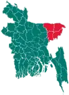 | |
| Moulvibazar District | ||
| Sunamganj District | ||
| Sylhet District | ||