Al Themaid
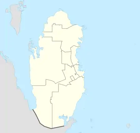
Al Themaid (Arabic: الثميد, romanized: Ath Thumayd; also spelled Al Thumaid) is a district in Qatar, located in the municipality of Al Rayyan.[3][4]
Al Themaid
الثميد | |
|---|---|
District | |
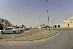 Dohat Salwa Street in Al Themaid | |
 Al Themaid | |
| Coordinates: 25.35383°N 51.377567°E | |
| Country | |
| Municipality | Al Rayyan |
| Zone | Zone 51 |
| District no. | 53 |
| Area | |
| • Total | 7.4 km2 (2.9 sq mi) |
| Elevation | 32 m (105 ft) |
In the 2015 census, it was listed as a district of zone no. 51 which has a population of 56,027 and also includes Izghawa, Gharrafat Al Rayyan, Al Gharrafa, Rawdat Egdaim, Bani Hajer and Al Seej.[3]
It borders Rawdat Egdaim to the south and south-east, Izghawa 71 in Umm Salal Municipality to the east, Al Froosh in Umm Salal Municipality to the north, and Rawdat Al Jahhaniya to the west.[4]
Etymology
An Arabic term, "thumaid" roughly translates to "shallow area that holds water". This name was given in recognition of a shallow well found here.[4] This historic well is found in the district's southern portion in a rawda (depression).[5]
References
- "District Area Map". Ministry of Development Planning and Statistics. Retrieved 12 February 2019.
- "Al Themaid, Zone 51, Qatar on the Elevation Map". elevationmap.net. Retrieved 3 January 2019.
- "2015 population census" (PDF). Ministry of Development Planning and Statistics. Retrieved 3 January 2019.
- "District map". The Centre for Geographic Information Systems of Qatar. Retrieved 3 January 2019.
- "Dalila Services". Ministry of Municipality and Environment. Retrieved 6 January 2019.
Capital: Al Rayyan City | |
| Zone 51 | |
| Zone 52 | |
| Zone 53 | |
| Zone 54 | |
| Zone 55 |
|
| Zone 56 |
|
| Zone 81 | |
| Zone 83 |
|
| Zone 96 |
|
| Zone 97 | |