Alas Strait
The Alas Strait is a strait that separates Lombok and Sumbawa, two islands of Indonesia in West Nusa Tenggara province.
| Alas Strait | |
|---|---|
 The Alas Strait with Mount Rinjani on Lombok in the background. | |
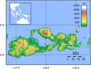 Alas Strait Sumbawa island and Alas Strait | |
| Coordinates | 8°40′S 116°40′E |
| Type | strait |
| Native name | Indonesian: Selat Alas |
| Basin countries | Indonesia |
| References | Selat Alas: Indonesia National Geospatial-Intelligence Agency, Bethesda, MD, USA |
The strait was bridged by land until about 14,000 years before present when sea level rose to about 75 meters below present sea level, [1] unlike Lombok Strait and Alor Strait which continued to be water gaps even during the Last Glacial Maximum, at each end of a 400-mile-long island including present-day Lombok, Sumbawa, Komodo, Flores, Solor, Adonara, and Lembata.

Color infrared view of Rinjani Volcano on Lombok Island, May 1992. Lombok Strait and Bali is on the top, Alas Strait and Sumbawa Island is on the bottom.
See also
- Lombok Strait, on the opposite side (west) of Lombok
- Makassar Strait
- Sunda Strait
- Wallacea
References
- "Pleistocene Sea Level Maps". The Field Museum.
Indonesian seas | |
|---|---|
| Ocean | |
| Sea | |
| Strait |
|
| Gulf | |
This article is issued from Wikipedia. The text is licensed under Creative Commons - Attribution - Sharealike. Additional terms may apply for the media files.