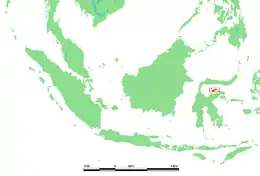
Gulf of Tomini
The Gulf of Tomini[1] (Indonesian: Teluk Tomini), also known as the Bay of Tomini, is the equatorial gulf which separates the Minahassa (Northern) and East Peninsulas of the island of Sulawesi (Celebes) in Indonesia. The Togian Islands lie near its center. To the east, the Gulf opens onto the Molucca Sea.
| Gulf of Tomini | |
|---|---|
| also known as the Bay of Tomini | |
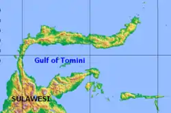 The gulf of Tomini lies in the north-eastern part of Sulawesi. | |
 Gulf of Tomini | |
| Location | Southeast Asia |
| Coordinates | 0°0′00″N 121°0′00″E |
| Type | Bay |
| Native name | Indonesian: Teluk Tomini |
| Basin countries | Indonesia |
| Settlements | Gorontalo, Poso |
Extent
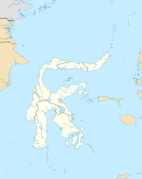
Map showing the Togian Islands highlighted in the Gulf of Tomini.
The International Hydrographic Organization (IHO) defines the Gulf of Tomini as being one of the divisions of the East Indian Archipelago.[2] It is defined as the waters west of the "Western limit of the Molukka Sea",[1] which is elsewhere defined as the line running from "Tg. Pasir Pandjang (0°39′S 123°25′E)... across to Tg. Tombalilatoe (123° 21′ E) on the opposite coast".[3]
References
| Wikimedia Commons has media related to Gulf of Tomini. |
Citations
- IHO (1953), §48 (d).
- IHO (1953), §48.
- IHO (1953), §48 (c).
Bibliography
- Limits of Oceans and Seas, 3rd ed. (PDF), International Hydrographic Organization, 1953, archived from the original (PDF) on 2018-10-05, retrieved 2015-10-06.
Indonesian seas | |
|---|---|
| Ocean | |
| Sea | |
| Strait |
|
| Gulf | |
This article is issued from Wikipedia. The text is licensed under Creative Commons - Attribution - Sharealike. Additional terms may apply for the media files.