Aloguinsan
Aloguinsan, officially the Municipality of Aloguinsan (Cebuano: Lungsod sa Aloguinsan; Tagalog: Bayan ng Aloguinsan), is a 4th class municipality in the province of Cebu, Philippines. According to the 2015 census, it has a population of 32,100 people. [3]
Aloguinsan | |
|---|---|
| Municipality of Aloguinsan | |
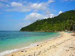 Cantabugon, Aloguinsan | |
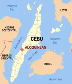 Map of Cebu with Aloguinsan highlighted | |
OpenStreetMap 
| |
.svg.png.webp) Aloguinsan Location within the Philippines | |
| Coordinates: 10°13′22″N 123°32′57″E | |
| Country | |
| Region | Central Visayas (Region VII) |
| Province | Cebu |
| District | 3rd District |
| Founded | 1886 |
| Barangays | 15 (see Barangays) |
| Government | |
| • Type | Sangguniang Bayan |
| • Mayor | Cesare Ignatius G. Moreno |
| • Vice Mayor | Raisa G. Moreno |
| • Representative | Pablo John F. Garcia |
| • Electorate | 21,787 voters (2019) |
| Area | |
| • Total | 61.92 km2 (23.91 sq mi) |
| Elevation | 36 m (118 ft) |
| Population | |
| • Total | 32,100 |
| • Density | 520/km2 (1,300/sq mi) |
| • Households | 6,886 |
| Economy | |
| • Income class | 4th municipal income class |
| • Poverty incidence | 29.46% (2015)[4] |
| • Revenue | ₱74,289,485.03 (2016) |
| Time zone | UTC+8 (PST) |
| ZIP code | 6040 |
| PSGC | |
| IDD : area code | +63 (0)32 |
| Climate type | tropical rainforest climate |
| Native languages | Cebuano Tagalog |
By road it is 93 kilometres (58 mi) southwest of Cebu City. Aloguinsan public market is held at the top of the beach.
History
Aloguinsan was formerly a barrio of Pinamungajan. It was created a town by the Royal Decree of the Kingdom of Spain in 1886.[5]
Bulwarte, a historic landmark, still stands as mute testimony to the courage of the early inhabitants of Aloguinsan. Because of the frequent Moro attacks, the natives, under the supervision of the Spaniards, constructed a watchtower on top of a hill at the mouth of a river. From this vantage point, they could see incoming Moro vintas.
One night (a full moon and favorable winds), the Muslim invaders approached the village. With old people, women, and children safe behind the hills, the men began firing their cannons and did not stop until the pirates had been annihilated. It was the end of Moro assaults.
The historic hill of Villona between the barrios of Olango and Cawasan was also the site of a battle between the American forces and Filipino revolutionaries. The rebels under the leadership of Anastacio de la Cruz encountered the forces of Lt. Walker on Holy Thursday, April 1903. Lt. Walker and a number of his men were killed. The following day, Good Friday, Lt. McCoy took over the command of the American troops and outfought the Pulahanes (the rebels were so called because of their red headbands) who were defeated.
The courage and patriotism of the Aloguinsan were again tested in World War II. Cebuano guerillas resisted Japanese invaders, and joined Allied and Filipino troops of the 3rd, 8th, 82nd and 83rd Infantry Division of the Philippine Commonwealth Army.
Geography
Aloguinsan is bordered to the north by the town of Pinamungajan, to the west is the Tañon Strait, to the east is the city of Carcar, and to the south is the town of Barili.
Barangays
Aloguinsan comprises 15 barangays:
| PSGC | Barangay | Population | ±% p.a. | |||
|---|---|---|---|---|---|---|
| 2015 [3] | 2010 [6] | |||||
| 072204001 | Angilan | 8.2% | 2,634 | 1,926 | 6.14% | |
| 072204002 | Bojo | 5.8% | 1,869 | 1,603 | 2.97% | |
| 072204003 | Bonbon | 24.3% | 7,807 | 6,611 | 3.22% | |
| 072204004 | Esperanza | 5.8% | 1,866 | 1,759 | 1.13% | |
| 072204005 | Kandingan | 2.9% | 937 | 848 | 1.92% | |
| 072204006 | Kantabogon | 5.3% | 1,697 | 1,526 | 2.04% | |
| 072204007 | Kawasan | 7.0% | 2,239 | 1,975 | 2.42% | |
| 072204008 | Olango | 3.6% | 1,151 | 1,026 | 2.21% | |
| 072204009 | Poblacion | 10.6% | 3,392 | 2,747 | 4.10% | |
| 072204010 | Punay | 4.8% | 1,544 | 1,531 | 0.16% | |
| 072204011 | Rosario | 5.8% | 1,868 | 1,864 | 0.04% | |
| 072204012 | Saksak | 3.6% | 1,157 | 1,139 | 0.30% | |
| 072204013 | Tampa‑an | 6.3% | 2,021 | 1,513 | 5.67% | |
| 072204014 | Toyokon | 2.2% | 693 | 680 | 0.36% | |
| 072204015 | Zaragosa | 3.8% | 1,225 | 902 | 6.00% | |
| Total | 32,100 | 27,650 | 2.88% | |||
Climate
| Climate data for Aloguinsan, Cebu | |||||||||||||
|---|---|---|---|---|---|---|---|---|---|---|---|---|---|
| Month | Jan | Feb | Mar | Apr | May | Jun | Jul | Aug | Sep | Oct | Nov | Dec | Year |
| Average high °C (°F) | 28 (82) |
29 (84) |
30 (86) |
31 (88) |
31 (88) |
30 (86) |
30 (86) |
30 (86) |
30 (86) |
29 (84) |
29 (84) |
28 (82) |
30 (85) |
| Average low °C (°F) | 23 (73) |
23 (73) |
23 (73) |
24 (75) |
25 (77) |
25 (77) |
25 (77) |
25 (77) |
25 (77) |
25 (77) |
24 (75) |
23 (73) |
24 (75) |
| Average precipitation mm (inches) | 70 (2.8) |
49 (1.9) |
62 (2.4) |
78 (3.1) |
138 (5.4) |
201 (7.9) |
192 (7.6) |
185 (7.3) |
192 (7.6) |
205 (8.1) |
156 (6.1) |
111 (4.4) |
1,639 (64.6) |
| Average rainy days | 13.4 | 10.6 | 13.1 | 14.5 | 24.2 | 27.9 | 28.4 | 27.7 | 27.1 | 27.4 | 22.5 | 15.9 | 252.7 |
| Source: Meteoblue (Use with caution: this is modeled/calculated data, not measured locally.)[7] | |||||||||||||
Demographics
|
| |||||||||||||||||||||||||||||||||||||||||||||
| Source: Philippine Statistics Authority [3] [6] [8] | ||||||||||||||||||||||||||||||||||||||||||||||
Festival
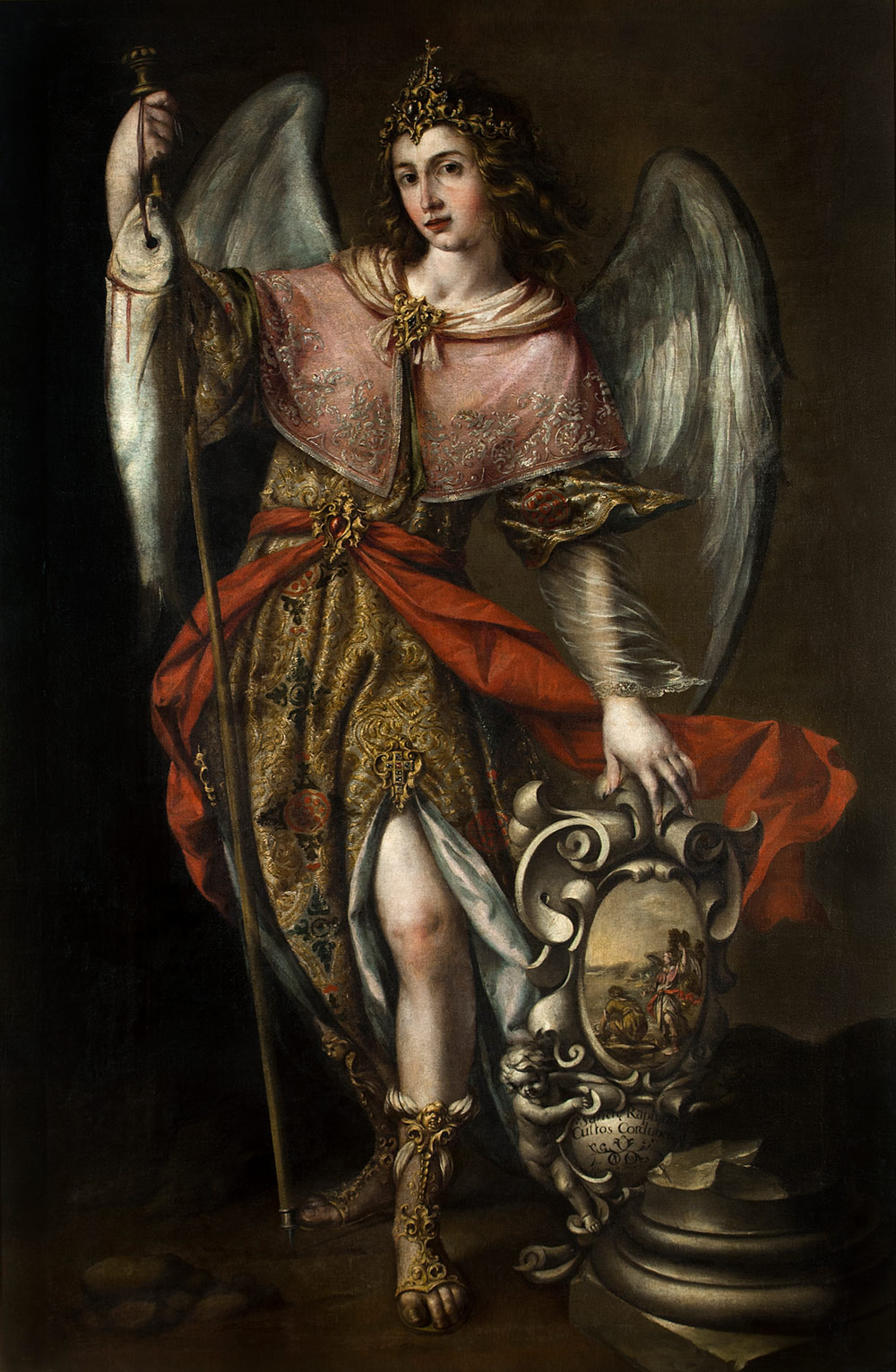
Every June, they celebrate the famous "Kinsan Festival," named for a fish that is usually abundant in months of May to July.[9] The town fiesta is celebrated every 23 and 24 October in honor of Saint Raphael the Archangel. Interestingly, the saint is sometimes depicted in religious iconography as holding a fish.[10]
Only Aloguinsan has a titular parish of Saint Raphael the Archangel in the entire Metropolitan Archdiocese of the Most Holy Name of Jesus.[11]
Tourist Attractions
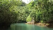
- Bojo River
- Hermit's Cove
- Hidden Beach
Notable residents
- Jojo Tangkay - A professional basketball player notably played in PBL then PBA's Welcoat Dragons.
References
- Municipality of Aloguinsan | (DILG)
- "Province: Cebu". PSGC Interactive. Quezon City, Philippines: Philippine Statistics Authority. Retrieved 12 November 2016.
- Census of Population (2015). "Region VII (Central Visayas)". Total Population by Province, City, Municipality and Barangay. PSA. Retrieved 20 June 2016.
- "PSA releases the 2015 Municipal and City Level Poverty Estimates". Quezon City, Philippines. Retrieved 12 October 2019.
- Lipsius 2011, p. 2.
- Census of Population and Housing (2010). "Region VII (Central Visayas)". Total Population by Province, City, Municipality and Barangay. NSO. Retrieved 29 June 2016.
- "Aloguinsan: Average Temperatures and Rainfall". Meteoblue. Retrieved 9 May 2020.
- Censuses of Population (1903–2007). "Region VII (Central Visayas)". Table 1. Population Enumerated in Various Censuses by Province/Highly Urbanized City: 1903 to 2007. NSO.
- Lipsius 2011, p. 95
- http://palaciodeviana.com/wp-content/uploads/2015/01/bb1.jpg
- https://cebuarchdiocese.wordpress.com/parishes/
Sources
- Lipsius, Terrie (2011). My Awe-Inspiring Journey. Trafford. ISBN 978-1466906679.CS1 maint: ref=harv (link)
- Freedom Wall, iAn (9 October 2016). "Bojo River and Hermit's Cove: The Stunner's of Aloguinsan | Freedom Wall". Archived from the original on 11 October 2016.CS1 maint: ref=harv (link)
External links
![]() Media related to Aloguinsan at Wikimedia Commons
Media related to Aloguinsan at Wikimedia Commons
Places adjacent to Aloguinsan | ||||||||||
|---|---|---|---|---|---|---|---|---|---|---|
| ||||||||||
Cebu City (capital) | |
| Municipalities |
|
| Component cities | |
| Highly urbanized cities | (Administratively independent from the province but grouped under Cebu by the Philippine Statistics Authority. However, qualified voters in Mandaue are allowed to vote in elections for Cebu provincial officials by virtue of Republic Act No. 6641, in accordance with Section 452-c of the Local Government Code of 1991.) |
| Authority control |
|---|