Balamban
Balamban, officially the Municipality of Balamban (Cebuano: Lungsod sa Balamban; Tagalog: Bayan ng Balamban), is a 1st class municipality in the province of Cebu, Philippines. According to the 2015 census, it has a population of 87,177 people. [3]
Balamban | |
|---|---|
| Municipality of Balamban | |
Seal | |
| Nickname(s): Ship building capital of Cebu | |
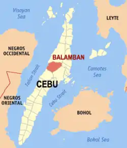 Map of Cebu with Balamban highlighted | |
OpenStreetMap 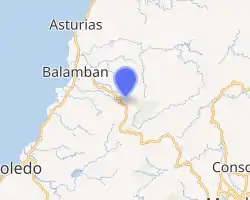
| |
.svg.png.webp) Balamban Location within the Philippines | |
| Coordinates: 10°28′N 123°47′E | |
| Country | |
| Region | Central Visayas (Region VII) |
| Province | Cebu |
| District | 3rd District |
| Barangays | 28 (see Barangays) |
| Government | |
| • Type | Sangguniang Bayan |
| • Mayor | Alex S. Binghay |
| • Vice Mayor | Alex Francis V. Binghay II |
| • Representative | Pablo John F. Garcia |
| • Electorate | 53,346 voters (2019) |
| Area | |
| • Total | 225.76 km2 (87.17 sq mi) |
| Elevation | 35 m (115 ft) |
| Population | |
| • Total | 87,177 |
| • Density | 390/km2 (1,000/sq mi) |
| • Households | 19,575 |
| Economy | |
| • Income class | 1st municipal income class |
| • Poverty incidence | 25.56% (2015)[4] |
| • Revenue | ₱309,906,408.00 (2016) |
| Time zone | UTC+8 (PST) |
| ZIP code | 6041 |
| PSGC | |
| IDD : area code | +63 (0)32 |
| Climate type | tropical monsoon climate |
| Native languages | Cebuano Tagalog |
Balamban is bordered to the north by the town of Asturias, to the west is the Tañon Strait, to the east Is Cebu City, and to the south is the City of Toledo.
Mount Manunggal in Barangay Magsaysay (formerly Sunog), is the site of the plane crash on 17 March 1957 in which President Ramon Magsaysay and 17 of his Presidential staff and news correspondents are killed.
Barangays
Balamban comprises 28 barangays:
| PSGC | Barangay | Population | ±% p.a. | |||
|---|---|---|---|---|---|---|
| 2015 [3] | 2010 [5] | |||||
| 072208001 | Abucayan | 6.1% | 5,315 | 4,591 | 2.83% | |
| 072208002 | Aliwanay | 3.8% | 3,277 | 3,186 | 0.54% | |
| 072208003 | Arpili | 7.2% | 6,312 | 4,877 | 5.03% | |
| 072208027 | Baliwagan (Poblacion) | 6.3% | 5,494 | 4,734 | 2.88% | |
| 072208004 | Bayong | 1.0% | 861 | 1,037 | −3.48% | |
| 072208005 | Biasong | 3.2% | 2,816 | 2,155 | 5.23% | |
| 072208006 | Buanoy | 13.8% | 12,057 | 8,368 | 7.20% | |
| 072208007 | Cabagdalan | 1.0% | 842 | 698 | 3.64% | |
| 072208008 | Cabasiangan | 1.4% | 1,233 | 1,078 | 2.59% | |
| 072208009 | Cambuhawe | 3.9% | 3,374 | 2,916 | 2.82% | |
| 072208010 | Cansomoroy | 2.2% | 1,920 | 1,415 | 5.98% | |
| 072208011 | Cantibas | 1.5% | 1,346 | 1,084 | 4.21% | |
| 072208012 | Cantuod | 3.9% | 3,426 | 2,641 | 5.08% | |
| 072208013 | Duangan | 1.5% | 1,334 | 1,256 | 1.15% | |
| 072208014 | Gaas | 3.3% | 2,908 | 2,812 | 0.64% | |
| 072208015 | Ginatilan | 1.8% | 1,592 | 1,485 | 1.33% | |
| 072208016 | Hingatmonan | 1.4% | 1,241 | 973 | 4.74% | |
| 072208017 | Lamesa | 2.1% | 1,799 | 1,656 | 1.59% | |
| 072208018 | Liki | 1.4% | 1,243 | 1,212 | 0.48% | |
| 072208019 | Luca | 1.6% | 1,399 | 761 | 12.29% | |
| 072208020 | Matun‑og | 1.1% | 1,002 | 693 | 7.27% | |
| 072208021 | Nangka | 7.1% | 6,151 | 4,420 | 6.49% | |
| 072208022 | Pondol | 11.3% | 9,872 | 7,897 | 4.34% | |
| 072208023 | Prenza | 3.3% | 2,863 | 2,285 | 4.39% | |
| 072208026 | Santa Cruz-Santo Niño (Poblacion) | 2.1% | 1,866 | 1,698 | 1.81% | |
| 072208024 | Singsing | 2.1% | 1,870 | 1,462 | 4.80% | |
| 072208025 | Sunog (Magsaysay) | 2.1% | 1,825 | 1,998 | −1.71% | |
| 072208026 | Vito | 2.2% | 1,939 | 1,849 | 0.91% | |
| Total | 87,177 | 71,237 | 3.92% | |||
Climate
| Climate data for Balamban, Cebu | |||||||||||||
|---|---|---|---|---|---|---|---|---|---|---|---|---|---|
| Month | Jan | Feb | Mar | Apr | May | Jun | Jul | Aug | Sep | Oct | Nov | Dec | Year |
| Average high °C (°F) | 28 (82) |
29 (84) |
30 (86) |
31 (88) |
31 (88) |
30 (86) |
30 (86) |
30 (86) |
30 (86) |
29 (84) |
29 (84) |
28 (82) |
30 (85) |
| Average low °C (°F) | 23 (73) |
23 (73) |
23 (73) |
24 (75) |
25 (77) |
25 (77) |
25 (77) |
25 (77) |
25 (77) |
25 (77) |
24 (75) |
23 (73) |
24 (75) |
| Average precipitation mm (inches) | 70 (2.8) |
49 (1.9) |
62 (2.4) |
78 (3.1) |
138 (5.4) |
201 (7.9) |
192 (7.6) |
185 (7.3) |
192 (7.6) |
205 (8.1) |
156 (6.1) |
111 (4.4) |
1,639 (64.6) |
| Average rainy days | 13.4 | 10.6 | 13.1 | 14.5 | 24.2 | 27.9 | 28.4 | 27.7 | 27.1 | 27.4 | 22.5 | 15.9 | 252.7 |
| Source: Meteoblue [6] | |||||||||||||
Demographics
| Year | Pop. | ±% p.a. |
|---|---|---|
| 1903 | 10,603 | — |
| 1918 | 18,943 | +3.94% |
| 1939 | 31,385 | +2.43% |
| 1948 | 34,488 | +1.05% |
| 1970 | 36,416 | +0.25% |
| 1975 | 37,351 | +0.51% |
| 1980 | 41,498 | +2.13% |
| 1990 | 45,909 | +1.02% |
| 1995 | 49,983 | +1.61% |
| 2000 | 59,922 | +3.96% |
| 2007 | 66,261 | +1.40% |
| 2010 | 71,237 | +2.67% |
| 2015 | 87,177 | +3.92% |
| Source: Philippine Statistics Authority [3] [5] [7][8] | ||
Economy
West Cebu Industrial Park (WCIP) is a 540-hectare mixed-used development in Balamban. It is anchored by a 283-hectare Philippine Economic Zone Authority (PEZA) registered zone tagged as the "Shipbuilding Capital of the Philippines". It hosts 11 locators from medium to heavy industries and employs 14,000 skilled workers.
Located in WCIP in Barangay Buanoy is Tsuneishi Heavy Industries (Cebu), Inc. (THICI). It builds merchant ships of up to 180,000 deadweight tons using the same high quality shipbuilding technologies and standards as those in Tsuneishi Japan. Also located in WCIP in Barangay Arpili is Austal Philippines Pty. Ltd. which caters to market demands for high speed ferries, workboats, fast crew transfer boats, other commercial vessels and defense vessels.
Other locators include Aboitiz Construction, Air Liquide, Linde, Balamban Enerzone, Mactan Rock Industries, Inc. Tsuneishi Holdings, Tsuneishi Technical Services (Phils.), Inc., K & A Metal Industries, Inc. Shillon Global Construction, Inc., and Advanced Composites Group,
There are currently two shopping malls. The Gaisano Balamban Town Center and Gaisano Grand Balamban.
TransCentral Highway (TCH) which runs through the mountains connects Balamban to Cebu City. It is popular by road trippers, bikers and riders for its tourist attractions, restaurants and cafes.
References
- Municipality of Balamban | (DILG)
- "Province: Cebu". PSGC Interactive. Quezon City, Philippines: Philippine Statistics Authority. Retrieved 12 November 2016.
- Census of Population (2015). "Region VII (Central Visayas)". Total Population by Province, City, Municipality and Barangay. PSA. Retrieved 20 June 2016.
- "PSA releases the 2015 Municipal and City Level Poverty Estimates". Quezon City, Philippines. Retrieved 12 October 2019.
- Census of Population and Housing (2010). "Region VII (Central Visayas)". Total Population by Province, City, Municipality and Barangay. NSO. Retrieved 29 June 2016.
- "Balamban: Average Temperatures and Rainfall". Meteoblue. Retrieved 10 May 2020.
- Censuses of Population (1903–2007). "Region VII (Central Visayas)". Table 1. Population Enumerated in Various Censuses by Province/Highly Urbanized City: 1903 to 2007. NSO.
- "Province of Cebu". Municipality Population Data. Local Water Utilities Administration Research Division. Retrieved 17 December 2016.
External links
Places adjacent to Balamban | ||||||||||
|---|---|---|---|---|---|---|---|---|---|---|
| ||||||||||
Cebu City (capital) | |
| Municipalities |
|
| Component cities | |
| Highly urbanized cities | (Administratively independent from the province but grouped under Cebu by the Philippine Statistics Authority. However, qualified voters in Mandaue are allowed to vote in elections for Cebu provincial officials by virtue of Republic Act No. 6641, in accordance with Section 452-c of the Local Government Code of 1991.) |