Consolacion, Cebu
Consolacion, officially the Municipality of Consolacion (Cebuano: Lungsod sa Consolacion; Tagalog: Bayan ng Consolacion), is a 1st class municipality in the province of Cebu, Philippines. According to the 2015 census, it has a population of 131,528 people. [3]
Consolacion | |
|---|---|
| Municipality of Consolacion | |
.jpg.webp) | |
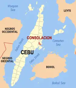 Map of Cebu with Consolacion highlighted | |
OpenStreetMap 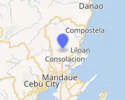
| |
.svg.png.webp) Consolacion Location within the Philippines | |
| Coordinates: 10°24′N 123°57′E | |
| Country | |
| Region | Central Visayas (Region VII) |
| Province | Cebu |
| District | 6th District |
| Founded Reestablished | 1871 1920 |
| Barangays | 21 (see Barangays) |
| Government | |
| • Type | Sangguniang Bayan |
| • Mayor | Joannes P. Alegado |
| • Vice Mayor | Teresa P. Alegado |
| • Representative | Emmarie M. Ouano-Dizon |
| • Electorate | 84,912 voters (2019) |
| Area | |
| • Total | 37.03 km2 (14.30 sq mi) |
| Elevation | 26 m (85 ft) |
| Population | |
| • Total | 131,528 |
| • Density | 3,600/km2 (9,200/sq mi) |
| • Households | 30,102 |
| Economy | |
| • Income class | 1st municipal income class |
| • Poverty incidence | 13.41% (2015)[4] |
| • Revenue | ₱300,974,038.69 (2016) |
| Time zone | UTC+8 (PST) |
| ZIP code | 6001 |
| PSGC | |
| IDD : area code | +63 (0)32 |
| Climate type | tropical monsoon climate |
| Native languages | Cebuano Tagalog |
Consolacion is bordered on the north by the town of Liloan, to the west by Cebu City, on the east by the Camotes Sea, and on the south by the city of Mandaue.
Consolacion lies within Metro Cebu area.[5]
History
Consolacion was a component barangay first founded in 1871 with a population of 14,248. Before this, it was only a barrio of the municipality of Mandaue. The barrio, formerly named "Kampiig" named after a kind of crab living in mangroves, which was abundant in the area, became a separate town in 1871. However, in 1902 and 1903, unable to maintain its status as an independent municipality, it reverted to Mandaue.
In 1920 Consolacion was again made an independent municipality after a petition was accepted by the governor. So grateful were the townspeople to the Cebuano governor that they named their new town after his daughter – Consolacion – and they also chose San Narciso as their patron saint, the namesake of the governor's wife, Narcisa.
A year after the construction of the Casa Real or municipal hall, the people built their first church. Because it was made of wood, nipa, and bamboo, it was totally destroyed by a typhoon in 1888. A second one was also destroyed by a typhoon in 1892. A third one was built just before World War II, on its current site.
The present municipal hall is already the third one. The first was destroyed by the typhoon of 1892. The second one was also destroyed, by the Japanese during World War II. Today, Consolacion is a robust residential urban municipality with a vigorous economy, providing a place to live for people employed in the neighboring cities of Mandaue, Lapu-Lapu and Cebu.
Geography
70% of the total area of the town is above or highland mountains and 18% foreshore land. The contours are irregular and the highest point is about 500 metres (1,600 ft) above sea level.
Barangays
Consolacion comprises 21 barangays over its 37 km2 (14.3 sq mi):
| PSGC | Barangay | Population | ±% p.a. | |||
|---|---|---|---|---|---|---|
| 2015 [3] | 2010 [6] | |||||
| 072219001 | Cabangahan | 1.9% | 2,483 | 2,015 | 4.06% | |
| 072219002 | Cansaga | 4.1% | 5,415 | 4,450 | 3.81% | |
| 072219003 | Casili | 12.2% | 16,025 | 12,745 | 4.46% | |
| 072219004 | Danglag | 3.2% | 4,235 | 2,796 | 8.23% | |
| 072219005 | Garing | 2.0% | 2,615 | 2,253 | 2.88% | |
| 072219006 | Jugan | 7.5% | 9,887 | 7,970 | 4.19% | |
| 072219007 | Lamac | 7.2% | 9,458 | 7,217 | 5.28% | |
| 072219008 | Lanipga | 0.7% | 855 | 748 | 2.58% | |
| 072219009 | Nangka | 10.1% | 13,327 | 11,021 | 3.68% | |
| 072219010 | Panas | 1.0% | 1,323 | 1,146 | 2.77% | |
| 072219011 | Panoypoy | 0.9% | 1,229 | 1,108 | 1.99% | |
| 072219012 | Pitogo | 4.0% | 5,278 | 3,857 | 6.15% | |
| 072219013 | Poblacion Occidental | 4.5% | 5,854 | 4,864 | 3.59% | |
| 072219014 | Poblacion Oriental | 2.5% | 3,314 | 3,163 | 0.89% | |
| 072219015 | Polog | 1.6% | 2,097 | 1,608 | 5.19% | |
| 072219016 | Pulpogan | 10.0% | 13,123 | 11,617 | 2.35% | |
| 072219017 | Sacsac | 1.4% | 1,861 | 1,542 | 3.65% | |
| 072219018 | Tayud | 15.4% | 20,192 | 15,683 | 4.93% | |
| 072219019 | Tilhaong | 1.0% | 1,337 | 1,183 | 2.36% | |
| 072219020 | Tolotolo | 2.4% | 3,156 | 2,555 | 4.10% | |
| 072219021 | Tugbongan | 6.4% | 8,464 | 7,108 | 3.38% | |
| Total | 131,528 | 106,649 | 4.07% | |||
Climate
| Climate data for Consolacion, Cebu | |||||||||||||
|---|---|---|---|---|---|---|---|---|---|---|---|---|---|
| Month | Jan | Feb | Mar | Apr | May | Jun | Jul | Aug | Sep | Oct | Nov | Dec | Year |
| Average high °C (°F) | 28 (82) |
29 (84) |
30 (86) |
31 (88) |
31 (88) |
30 (86) |
30 (86) |
30 (86) |
30 (86) |
29 (84) |
29 (84) |
28 (82) |
30 (85) |
| Average low °C (°F) | 23 (73) |
23 (73) |
23 (73) |
24 (75) |
25 (77) |
25 (77) |
25 (77) |
25 (77) |
25 (77) |
25 (77) |
24 (75) |
23 (73) |
24 (75) |
| Average precipitation mm (inches) | 70 (2.8) |
49 (1.9) |
62 (2.4) |
78 (3.1) |
138 (5.4) |
201 (7.9) |
192 (7.6) |
185 (7.3) |
192 (7.6) |
205 (8.1) |
156 (6.1) |
111 (4.4) |
1,639 (64.6) |
| Average rainy days | 13.4 | 10.6 | 13.1 | 14.5 | 24.2 | 27.9 | 28.4 | 27.7 | 27.1 | 27.4 | 22.5 | 15.9 | 252.7 |
| Source: Meteoblue (modeled/calculated data, not measured locally) [7] | |||||||||||||
Demographics
The population of Consolacion is fast-growing with an intercensal growth rate of 50.45% from 1980 to 1990, repeated and more in subsequent decades.
| Year | Pop. | ±% p.a. |
|---|---|---|
| 1903 | 5,511 | — |
| 1939 | 9,213 | +1.44% |
| 1948 | 9,432 | +0.26% |
| 1970 | 17,602 | +2.87% |
| 1975 | 20,444 | +3.05% |
| 1980 | 27,454 | +6.07% |
| 1990 | 41,270 | +4.16% |
| 1995 | 49,205 | +3.35% |
| 2000 | 62,298 | +5.19% |
| 2007 | 87,544 | +4.80% |
| 2010 | 106,649 | +7.45% |
| 2015 | 131,528 | +4.07% |
| Source: Philippine Statistics Authority [3] [6] [8][9] | ||
| Year | Density |
|---|---|
| 1970 | 480/km2 |
| 1980 | 740/km2 |
| 1990 | 1,100/km2 |
| 2000 | 1,700/km2 |
| 2010 | 2,900/km2 |
| 2015 | 3,600/km2 |
The demographic distribution profile of Consolacion shows sparsely populated upland barangays, and densely populated lowland barangays within the commercial area along the existing national highway.
Economy
Consolacion's recent economic trend is towards the development of operation of housing/subdivision facilities even with the presence of several medium size manufacturing industries. Consolacion is predicted to become a residential urban municipality in the next 5–10 years.
Infrastructure
- Road Network:
- National Road: 1.5 km (0.9 mi)
- Provincial Road: 2.5 km (1.6 mi)
- Municipal Road : 2.0 km (1.2 mi)
- Barangay Road : 43.7 km (27.2 mi)
Utilities
- Malls: 3
- In June 2012 SM Supermalls opened its second mall in Cebu – SM City Consolacion, located in Lamac.
- Public Market: 1
- Multi-purpose Building: 1
- Recreation Courts/Centers : 22
Education
- Elementary schools: 16
- High schools: 10
- Vocational: 1
- College: 1
Sarok Festival
The Sarok Festival is celebrated on Consolacion's foundation day. Sarok is a hat made of bamboo strips and dried banana leaves. Sarok Festival a mardigras of colors and street dancing along the main road of Consolacion is celebrated every 14 February in commemoration of Consolacion founding anniversary. The main attraction of this festival is the colorful Sarok and its wide uses.
- History
To protect farmers and the folks from the sun and the rain, the sarok, a conical hat made from bamboo strips and dried banana leaves, becomes the needed fad for the people of Consolacion especially that the town is an agricultural land. The festival was traditionally celebrated every 14 February to coincide with its charter day celebrations but this now celebrated in October. However, the Sarok Festival evolved into a free interpretation dance, with the musical concept inspired from the Miligoy de Cebu, a published Filipino folk dance originating from the same place.
- Contribution to Cultural Heritage
Consolacion is one of the contributor in Cultural History. It had created a dance called "Miligoy de Cebu". This dance is usually performed by pairs of dancers during social gatherings like baptism, weddings, and special programs in the poblacion. Dancers hold a pair of bamboo castanets in each hand.[10][11]
Notable people
- Juan Karlos Labajo - Singer/Actor
References
- Municipality of Consolacion | (DILG)
- "Province: Cebu". PSGC Interactive. Quezon City, Philippines: Philippine Statistics Authority. Retrieved 12 November 2016.
- Census of Population (2015). "Region VII (Central Visayas)". Total Population by Province, City, Municipality and Barangay. PSA. Retrieved 20 June 2016.
- "PSA releases the 2015 Municipal and City Level Poverty Estimates". Quezon City, Philippines. Retrieved 12 October 2019.
- Sun–Star 2005.
- Census of Population and Housing (2010). "Region VII (Central Visayas)". Total Population by Province, City, Municipality and Barangay. NSO. Retrieved 29 June 2016.
- "Consolacion: Average Temperatures and Rainfall". Meteoblue. Retrieved 10 May 2020.
- Censuses of Population (1903–2007). "Region VII (Central Visayas)". Table 1. Population Enumerated in Various Censuses by Province/Highly Urbanized City: 1903 to 2007. NSO.
- "Province of Cebu". Municipality Population Data. Local Water Utilities Administration Research Division. Retrieved 17 December 2016.
- Fun‑Philippines 2014.
- Cebu Daily News 2014.
Sources
- Cebu Daily News, Doris C. Bongcac (21 January 2014). "Placer's risks pay off with title". Archived from the original on 22 August 2016.CS1 maint: ref=harv (link)
- Fun‑Philippines (26 July 2014). "Sarok Festival in Consolacion, Cebu". Archived from the original on 31 August 2014. Retrieved 3 March 2016.CS1 maint: multiple names: authors list (link) CS1 maint: ref=harv (link)
- Gonzales, Glenda R. (December 2004). "Metro Cebu: A Metropolitan Area in Need of Coordinative Body" (PDF). Discussion Paper. 2004-49. PIDS. Archived (PDF) from the original on 10 March 2016. Retrieved 16 February 2016.CS1 maint: ref=harv (link)
External links
| Wikivoyage has a travel guide for Consolacion (Cebu). |
Places adjacent to Consolacion, Cebu | ||||||||||
|---|---|---|---|---|---|---|---|---|---|---|
| ||||||||||
| |||||||||||
| Authority control |
|---|