Aria, New Zealand
Aria is a rural community in the Waitomo District and Waikato region of New Zealand's North Island.[1]
Aria | |
|---|---|
Village | |
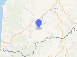
| |
| Coordinates: 38.561445°S 174.985295°E | |
| Region | Waikato region |
| Territorial authority | Waitomo District |
| Ward | Rural |
| Electorate | Taranaki-King Country |
| Population (2018 census) | |
| • Territorial | 129 |
| Time zone | UTC+12 (NZST) |
| • Summer (DST) | UTC+13 (NZDT) |
The area experienced severe flooding in September 2017.[2][3]
Demographics
| Year | Pop. | ±% p.a. |
|---|---|---|
| 2006 | 1,359 | — |
| 2013 | 1,194 | −1.83% |
| 2018 | 1,290 | +1.56% |
| Source: [4] | ||
The Aria statistical area, which at 532 square kilometres is much larger than the community and includes Piopio, had a population of 1,290 at the 2018 New Zealand census, an increase of 96 people (8.0%) since the 2013 census, and a decrease of 69 people (-5.1%) since the 2006 census. There were 462 households. There were 654 males and 636 females, giving a sex ratio of 1.03 males per female. The median age was 35.8 years (compared with 37.4 years nationally), with 324 people (25.1%) aged under 15 years, 237 (18.4%) aged 15 to 29, 567 (44.0%) aged 30 to 64, and 165 (12.8%) aged 65 or older.
Ethnicities were 76.5% European/Pākehā, 36.3% Māori, 1.4% Pacific peoples, 1.4% Asian, and 0.9% other ethnicities (totals add to more than 100% since people could identify with multiple ethnicities).
The proportion of people born overseas was 8.4%, compared with 27.1% nationally.
Although some people objected to giving their religion, 58.1% had no religion, 25.1% were Christian, 0.2% were Hindu, 0.2% were Muslim, 0.2% were Buddhist and 5.8% had other religions.
Of those at least 15 years old, 126 (13.0%) people had a bachelor or higher degree, and 225 (23.3%) people had no formal qualifications. The median income was $29,900, compared with $31,800 nationally. The employment status of those at least 15 was that 513 (53.1%) people were employed full-time, 210 (21.7%) were part-time, and 30 (3.1%) were unemployed.[4]
Aria community is in meshblocks 1014500, 1014600, 1014900 and 1015000, which had a population of 129 in the 2018 census.[5]
Education
Aria School is a co-educational state primary school,[6][7] with a roll of 45 as of March 2020.[8][9] The school was established in 1908.[10]
References
- Hariss, Gavin. "Aria, Waikato". topomap.co.nz. NZ Topo Map.
- Mooby, Caitlin (6 September 2017). "Tourists rescued from flooded car as wild weather hits North Island". Stuff. Waikato Times.
- "Tornado, lightning and flooding cause mayhem around NZ". Stuff. 6 September 2017.
- "Statistical area 1 dataset for 2018 Census". Statistics New Zealand. March 2020. Aria (187200). 2018 Census place summary: Aria
- "Meshblock Electoral Populations 2020 for proposed boundaries data". Statistics New Zealand. April 2020. Meshblocks 1014500, 1014600, 1014900 and 1015000.
- "Aria School Official School Website". aria.school.nz.
- "Aria School Ministry of Education School Profile". educationcounts.govt.nz. Ministry of Education.
- "New Zealand Schools Directory". New Zealand Ministry of Education. Retrieved 26 April 2020.
- "Aria School Education Review Office Report". ero.govt.nz. Education Review Office.
- "About Us". Aria School. Retrieved 15 November 2020.