Benneydale
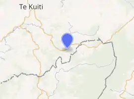
Maniaiti / Benneydale is a small town in the Waitomo District. It is situated on State Highway 30 approximately 35 km southeast of Te Kuiti.[1]
Maniaiti / Benneydale | |
|---|---|
| |
| Coordinates: 38°31′14.06″S 175°21′45.71″E | |
| Country | New Zealand |
| Region | Waikato |
| Territorial authority | Waitomo District |
| Population (2018) | |
| • Total | 186 |
| Postcode(s) | 3987 |
History
Coal township
Coal was discovered in the area in 1931, and a mine was built at the town's present location. In 1940 the government bought the mine and created the township of Benneydale. Its name is a portmanteau of the undersecretary of mines at the time (Matt Benney) and the mine superintendent (Tom Dale). It was the only town in the King Country that does not have a Māori name.[1]
At its peak the town had a population of 2000 with a butchery, bakery and picture theatre.[1][2] There were jobs in the coal mine until the early 1990s, but like many other rural areas in New Zealand the town has slowly declined.[2]
Modern history
Bush United is the town's local rugby union club, the clubhouse was built at Pureora in 1960 and was moved to Benneydale.[3]
Bennydale now mainly operates as a farm service town and it is the closest town to the Timber Trail in the Pureora Forest Park. The town has a police station, volunteer fire brigade, a garage, a corner store that sells hot food and basic groceries, a cafe with accommodation, and a primary school. There is also a meat works on the outskirts of town.
In 2018 the Maniapoto Māori Trust Board lodged an application to the New Zealand Geographic Board to change the name to Maniaiti, which means "a small slide, slip"[4] and is the name of a hill behind the township.[5] It was decided that it would have a dual name of Maniaiti / Benneydale.[4] There was substantial local opposition to the name change.[5]
Demographics
| Year | Pop. | ±% p.a. |
|---|---|---|
| 2006 | 1,269 | — |
| 2013 | 1,251 | −0.20% |
| 2018 | 1,221 | −0.48% |
| Source: [6] | ||
The statistical area of Waipa Valley, which at 818 square kilometres is much larger than the town and also includes Rangitoto, had a population of 1,221 at the 2018 New Zealand census, a decrease of 30 people (-2.4%) since the 2013 census, and a decrease of 48 people (-3.8%) since the 2006 census. There were 465 households. There were 642 males and 579 females, giving a sex ratio of 1.11 males per female. The median age was 39.6 years (compared with 37.4 years nationally), with 273 people (22.4%) aged under 15 years, 201 (16.5%) aged 15 to 29, 591 (48.4%) aged 30 to 64, and 156 (12.8%) aged 65 or older.
Ethnicities were 76.9% European/Pākehā, 28.7% Māori, 3.4% Pacific peoples, 3.4% Asian, and 1.5% other ethnicities (totals add to more than 100% since people could identify with multiple ethnicities).
The proportion of people born overseas was 10.3%, compared with 27.1% nationally.
Although some people objected to giving their religion, 53.6% had no religion, 33.4% were Christian, 0.2% were Hindu, 1.0% were Muslim, 0.2% were Buddhist and 3.4% had other religions.
Of those at least 15 years old, 114 (12.0%) people had a bachelor or higher degree, and 228 (24.1%) people had no formal qualifications. The median income was $32,800, compared with $31,800 nationally. The employment status of those at least 15 was that 531 (56.0%) people were employed full-time, 174 (18.4%) were part-time, and 21 (2.2%) were unemployed.[6]
The town is in meshblocks 1012500-900, which had a population of 186 in the 2018 census.[7]
Marae

Mangapeehi Marae is located near Benneydale. It is a meeting ground for the Maniapoto hapū of Matakore, Ngutu, Pare, Raukawa, Rereahu and Te Ihingarangi, and features the Rereahu meeting house.[8][9]
Te Miringa te Kakara, a local meeting house, is located one kilometre from Benneydale, between Benneydale and Tiroa[1]
Te Hape Marae and Te Kaha Tuatini meeting house is located east of Benneydale; it is a meeting place for the Rereahu hapū of Ngāti Te Rā and Ngāti Tuwhakahekeao.[8][9]
Education
Benneydale School is a co-educational state primary school,[10] with a roll of 31 as of March 2020.[11][12] The school opened in 1945.[13]
Notable people
- Keith Quinn, sports broadcaster[1]
References
- "Kia Ora: Benneydale". New Zealand Herald. 11 July 2014. ISSN 1170-0777. Retrieved 21 September 2016.
- "Rural exodus: Goodbye country ... small town NZ in decline as rush to cities grows". New Zealand Herald. 6 December 2012. ISSN 1170-0777. Retrieved 21 September 2016.
- Editors Carolyn M. King, D. John Gaukrodger, Neville A. Ritchie. The Drama of Conservation: The History of Pureora Forest, New Zealand, p. 178. Springer Verlag, Berlin, and Department of Conservation, Hamilton.ISBN 978-0-478-15044-5.
- "Benneydale to have dual English and Māori name". Stuff. Retrieved 18 November 2019.
- "'Ngāti Benneydale': Town divided over name change". Stuff. Retrieved 18 November 2019.
- "Statistical area 1 dataset for 2018 Census". Statistics New Zealand. March 2020. Waipa Valley (187500). 2018 Census place summary: Waipa Valley
- "Meshblock Electoral Populations 2020 for proposed boundaries data". Statistics New Zealand. April 2020. Meshblocks 1012600, 1012700, 1012800 and 1012900.
- "Te Kāhui Māngai directory". tkm.govt.nz. Te Puni Kōkiri.
- "Māori Maps". maorimaps.com. Te Potiki National Trust.
- "Benneydale School Ministry of Education School Profile". educationcounts.govt.nz. Ministry of Education.
- "New Zealand Schools Directory". New Zealand Ministry of Education. Retrieved 26 April 2020.
- "Benneydale School Education Review Office Report". ero.govt.nz. Education Review Office.
- "Past & Present". Benneydale School. Retrieved 15 November 2020.