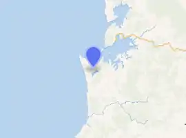
Taharoa
Taharoa (Māori: Tahaaroa or Tahāroa) is a small village on the west coast of the North Island of New Zealand, to the southwest of Kawhia Harbour and overlooking Lake Taharoa.[1]
Taharoa | |
|---|---|
Village | |
| |
| Coordinates: 38°09′03″S 174°44′01″E | |
| Country | New Zealand |
| Region | Waikato region |
| District | Waitomo District |
| Elevation | 50 m (160 ft) |
| Population (2018 census) | |
| • Territorial | 171 |
| Time zone | UTC+12 (NZST) |
| • Summer (DST) | UTC+13 (NZDT) |
The New Zealand Ministry for Culture and Heritage gives a translation of "long coast" for Taharoa.[2]
History and culture
It was at times the temporary home of the great Te Rauparaha used mainly as a battle ground on the vast expanses of sand dunes evident by the number of finds over the years, by 1822 they were being forced out of their land by stronger northern tribes. Te Rauparaha then began a fighting retreat or migration southwards, one which ended with them controlling a small part of the North Island and particularly Kapiti Island, which became the tribal stronghold.[3]
Marae
Taharoa has two marae: Āruka Marae and Tahaaroa meeting house, and Te Kōraha Marae and Te Ōhākī meeting house.[4] Both are affiliated with the Waikato Tainui hapū of Ngāti Mahuta ki te Hauāuru and Ngāti Rangitaka.
Iron sand mining
The main industrial activity is iron sand mining, run by New Zealand Steel, which began in 1972 was exporting about 1.4 Mt (1,500,000 short tons) a year, mainly to Japan, with small quantities to South Korea and China.[5] A 1993 study put reserves at 205 Mt of high concentrate and 360 Mt of lower grade sand.[6] An $80m investment in 2014 boosted potential exports to 4 Mt a year.[7]
In 2000 mining moved 2 km (1.2 mi) north, after the southern area was worked out. The roadway used for the move is now an airstrip.[8] Sand from the lake is dug by a 250 tonne cutter suction dredge, a 450 tonne floating Trommel screen removes particles larger than 2.5 mm (0.098 in), a 1,000 tonne floating concentrator removes lighter material and the denser sand is magnetically separated.[8]
1,375 tonnes an hour of sand[8] was piped 2.5 km (1.6 mi)[5] to an offshore mono-buoy,[9] which was extended a further 500m in 2012,[7] replaced in 2017[10] and is 17 m (56 ft) wide and weighs 250 tons.[11] The previous buoy was 11 m (36 ft) wide and weighed 185 tons.[8] The three bulk carriers used to transport the sand, Taharoa Destiny, Taharoa Providence and Taharoa Eos,[12][13] require a pilot to berth at the buoy[14] and also a support boat to move ropes and pipes.[15]
The mine employs about 150 workers,[16] though only 108 were recorded as working in the whole Taharoa area in the 2013 census.[17] To house its workers, NZ Steel built 65 houses, a hall, Kōhanga Reo, school, shop, and fire and ambulance facilities in the village.[8]
Demographics
| Year | Pop. | ±% p.a. |
|---|---|---|
| 2006 | 1,179 | — |
| 2013 | 1,056 | −1.56% |
| 2018 | 990 | −1.28% |
| Source: [18] | ||
The statistical area of Herangi, which at 1668 square kilometres is much larger than this village, also includes Te Anga, Mahoenui, Marokopa, Mokau and Awakino, It had a population of 990 at the 2018 New Zealand census, a decrease of 66 people (-6.2%) since the 2013 census, and a decrease of 189 people (-16.0%) since the 2006 census. There were 402 households. There were 513 males and 477 females, giving a sex ratio of 1.08 males per female. The median age was 44.1 years (compared with 37.4 years nationally), with 198 people (20.0%) aged under 15 years, 141 (14.2%) aged 15 to 29, 486 (49.1%) aged 30 to 64, and 165 (16.7%) aged 65 or older.
Ethnicities were 73.6% European/Pākehā, 38.2% Māori, 1.5% Pacific peoples, 0.6% Asian, and 0.6% other ethnicities (totals add to more than 100% since people could identify with multiple ethnicities).
The proportion of people born overseas was 7.0%, compared with 27.1% nationally.
Although some people objected to giving their religion, 54.8% had no religion, 33.0% were Christian, and 1.8% had other religions.
Of those at least 15 years old, 78 (9.8%) people had a bachelor or higher degree, and 204 (25.8%) people had no formal qualifications. The median income was $29,800, compared with $31,800 nationally. The employment status of those at least 15 was that 402 (50.8%) people were employed full-time, 150 (18.9%) were part-time, and 9 (1.1%) were unemployed.[18]
Taharoa had a population of 171 in the 2018 census, a decrease of 9 people since 2013. There were 87 males and 84 females. Almost 95 percent of the population had Māori ethnicity.[19]
Education
Kinohaku School is a co-educational state primary school,[20] with a roll of 20 as of March 2020.[21][22]
Te Kura o Tahaaroa is a co-educational state Māori immersion school,[23] with a roll of 25.[24]
References
- Hariss, Gavin. "Taharoa, Waikato". topomap.co.nz. NZ Topo Map.
- "1000 Māori place names". New Zealand Ministry for Culture and Heritage. 6 August 2019.
- Pollock, Kerryn. "King Country places - West coast". Te Ara - the Encyclopedia of New Zealand. Ministry for Culture and Heritage.
- "Māori Maps". maorimaps.com. Te Potiki National Trust.
- Tony Christie and Bob Brathwaite. "Mineral Commodity Report 15 — Iron" (PDF). MBIE.
- Donald C. Lawton & Manfred P. Hochstein (1993). "Geophysical study of the Taharoa ironsand deposit, west coast, North Island, New Zealand Journal of Geology and Geophysics" (PDF).
- "Huge ironsands expansion". Quarrying & Mining Magazine. 11 November 2014. Retrieved 29 January 2018.
- "Taharoa ironsand mining and ship loading". www.engineeringnz.org. Retrieved 29 January 2018.
- "TAHAROA EXPRESS experienced a complete loss of engine power". www.nzmaritimeindex.org.nz. Retrieved 28 January 2018.
- "TAHAROA BUOY - ShipSpotting.com - Ship Photos and Ship Tracker". www.shipspotting.com. Retrieved 28 January 2018.
- "Heavy lift made its way from Waiwhakaiho to Port Taranaki". Stuff. Retrieved 28 January 2018.
- O'Connell, Tim (13 April 2017). "Taharoa vessels Destiny and Providence taking their time in Tasman Bay". Stuff. Retrieved 1 July 2019.
- "Clayton Mitchell to the Minister of Transport". NZ Parliament List of Written questions. 2015. Retrieved 28 January 2018.
- "294m ship berth shocks marine officers". The New Zealand Herald. 12 December 2014. ISSN 1170-0777. Retrieved 28 January 2018.
- Ingram, John; et al. (May 1974). "Symposium on Taharoa ironsands project" (PDF). New Zealand Engineering.
- "Jobs go as part of Taharoa iron sands mine is shut down". Stuff. Retrieved 28 January 2018.
- "SNZ Commuter View". archive.stats.govt.nz. Retrieved 29 January 2018.
- "Statistical area 1 dataset for 2018 Census". Statistics New Zealand. March 2020. Herangi (187000). 2018 Census place summary: Herangi
- "Age and sex by ethnic group (grouped total response), for census usually resident population counts, 2006, 2013, and 2018 Censuses (urban rural areas)". Statistics New Zealand. Retrieved 20 November 2020.
- Education Counts: Kinohaku School
- "New Zealand Schools Directory". New Zealand Ministry of Education. Retrieved 26 April 2020.
- "Education Review Office Report". ero.govt.nz. Education Review Office.
- Education Counts: Te Kura o Tahaaroa
- "Education Review Office Report". ero.govt.nz. Education Review Office.
