Mokau
Mokau (Māori: Mōkau) is a small town on the west coast of New Zealand's North Island, located at the mouth of the Mokau River on the North Taranaki Bight. Mokau is in the Waitomo District and Waikato region local government areas, just north of the boundary with the New Plymouth District and the Taranaki Region. Prior to 1989, the town was classed as being in Taranaki, and there is still a feeling that the community of interest is most associated with New Plymouth, 90 km to the southwest.[1] State Highway 3 passes through the town on its route from Te Kuiti to Waitara and, eventually, New Plymouth.
Mokau | |
|---|---|
Village | |
| |
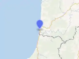
| Coordinates: 38°41′S 174°37′E | |
| Region | Waikato region |
| Territorial authority | Waitomo District |
| Ward | Rural |
| Electorate | Taranaki-King Country |
| Population (2018 census) | |
| • Territorial | 117 |
| Time zone | UTC+12 (NZST) |
| • Summer (DST) | UTC+13 (NZDT) |

The Mokau River Bridge opened in 1927.[2]
Mokau has a permanent population of about 400, but this swells to several thousand during the summer. It is in the Mahoenui census unit, which had 480 people in 183 households, a median age of 39.5 and median income of $20,700 in 2006.[3] Mokau is a popular location for whitebaiting and other fishing including for kahawai (mainly found at the river mouth) and snapper (which are found right along the coast in several spots).
Mokau also has a couple of outstanding surf breaks that, in the right conditions, can produce waves of up to 6 ft (1.8m).
The local marae, Te Kawau Papakainga Marae and Waiopapa meeting house, are affiliated with the Maniapoto hapū of Ngāti Rākei, Rōrā and Rungaterangi.[4][5]
Mokau had a population of 117 in the 2018 census, an increase of 9 people since 2013. There were 60 males and 57 females.[6]
Education
Mokau School is a co-educational state primary school,[7] with a roll of 8 as of March 2020.[8][9]
References
- McKinlay Douglas Ltd (October 2006). "Local government structure and efficiency" (PDF). p. 79.
- Auckland Weekly News photo of 1927 opening of Mokau River Bridge
- "Archived copy". Archived from the original on 30 October 2013. Retrieved 28 November 2013.CS1 maint: archived copy as title (link)
- "Te Kāhui Māngai directory". tkm.govt.nz. Te Puni Kōkiri.
- "Māori Maps". maorimaps.com. Te Potiki National Trust.
- "Age and sex by ethnic group (grouped total response), for census usually resident population counts, 2006, 2013, and 2018 Censuses (urban rural areas)". Statistics New Zealand. Retrieved 20 November 2020.
- "Ministry of Education School Profile". educationcounts.govt.nz. Ministry of Education.
- "New Zealand Schools Directory". New Zealand Ministry of Education. Retrieved 26 April 2020.
- "Education Review Office Report". ero.govt.nz. Education Review Office.
