Asakawa, Fukushima
Asakawa (浅川町, Asakawa-machi) is a town located in Fukushima Prefecture, Japan. As of 1 March 2020, the town had an estimated population of 6,315 in 21608 households,[1] and a population density of 170 persons per km². The total area of the town was 37.43 square kilometres (14.45 sq mi).
Asakawa
浅川町 | |
|---|---|
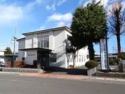 Asakawa Town Hall | |
Flag Seal | |
Location of Asakawa in Fukushima Prefecture | |
 Asakawa | |
| Coordinates: 37°04′51.5″N 140°24′46.3″E | |
| Country | Japan |
| Region | Tōhoku |
| Prefecture | Fukushima |
| District | Ishikawa |
| Area | |
| • Total | 37.43 km2 (14.45 sq mi) |
| Population (March 2020) | |
| • Total | 6,315 |
| • Density | 170/km2 (440/sq mi) |
| Time zone | UTC+9 (Japan Standard Time) |
| - Tree | Pinus densiflora |
| - Flower | Pecteilis radiata |
| - Bird | Azure-winged magpie |
| Phone number | 0247-36-4121 |
| Address | 112-15 Setoyachi, Asakawa, Asakawa-machi, Ishikawa-gun, Fukushima-ken 963-6204 |
| Website | Official website |

Geography
Asakawa is located in southern portion of Fukushima prefecture in the floodplain of the Abukuma River. Asakawa has a humid climate (Köppen climate classification Cfa). The average annual temperature in Asakawa is 11.6 °C (52.9 °F). The average annual rainfall is 1,386 mm (54.6 in) with September as the wettest month. The temperatures are highest on average in August, at around 23.9 °C (75.0 °F), and lowest in January, at around 0.5 °C (32.9 °F).[2]
Demographics
Per Japanese census data,[3] the population of Asakawa has declined over the past 40 years.
Demographics
Per Japanese census data,[4] the population of Kunimi has been in decline over the past 70 years.
| Year | Pop. | ±% |
|---|---|---|
| 1950 | 9,490 | — |
| 1960 | 8,625 | −9.1% |
| 1970 | 7,837 | −9.1% |
| 1980 | 7,488 | −4.5% |
| 1990 | 7,727 | +3.2% |
| 2000 | 7,484 | −3.1% |
| 2010 | 6,888 | −8.0% |
Climate
Asakawa has a humid climate (Köppen climate classification Cfa). The average annual temperature in Asakawa is 11.6 °C (52.9 °F). The average annual rainfall is 1,386 mm (54.6 in) with September being the wettest month. The temperatures are highest on average in August, at around 23.9 °C (75.0 °F), and lowest in January, at around 0.5 °C (32.9 °F).[5]
History
The area of present-day Asakuwa was part of ancient Mutsu Province. The area was mostly tenryō territory under direct control of the Tokugawa Shogunate during the Edo period. After the Meiji Restoration, it was organized as part of Ishikawa District in the Nakadōri region of Iwaki Province. The village of Asakuwa was formed on April 1, 1889, with the creation of the modern municipalities system. It was raised to town status on August 1, 1935. The town expanded on October 1, 1950, by the annexation of the neighboring village of Yamashiraishi.
Economy
The economy of Asakuwa is primarily based on agriculture.
Education
Asakawa has three public elementary schools and one public junior high school operated by the town government. The town does not have a high school.
- Asakawa Middle School
- Asakawa Elementary School
- Asakawa Yamashiraishi Elementary School
- Asakawa Satoshiraishi Elementary School
Transportation
Highway
Local attractions
- Yoshida Tomizo Memorial Museum
Noted people from Asakawa
- Tomizo Yoshida - pathologist
External links
![]() Media related to Asakawa, Fukushima at Wikimedia Commons
Media related to Asakawa, Fukushima at Wikimedia Commons
- Official website] (in Japanese)
References
| Core cities | ||
|---|---|---|
| Cities | ||
| Districts | ||
| Authority control |
|---|