Futaba, Fukushima
Futaba (双葉町, Futaba-machi) is a town in Fukushima Prefecture, Japan. As of 1 April 2020, the town had an actual population of zero, although as of 2017, the official registered population was 6,093 in 2,301 households.[1] The total area of the town is 51.42 square kilometres (19.85 sq mi).[2] However, as of March 2011, the entire population was evacuated as a result of the Fukushima Daiichi nuclear disaster. Since 2013, only 4% of the town has been open to visitors and residents, who are permitted to return only during daylight hours.
Futaba
双葉町 | |
|---|---|
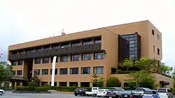 Futaba Town Hall | |
Flag Seal | |
Location of Futaba in Fukushima Prefecture | |
 Futaba | |
| Coordinates: 37°26′56.9″N 141°00′44.4″E | |
| Country | Japan |
| Region | Tōhoku |
| Prefecture | Fukushima |
| District | Futaba |
| Area | |
| • Total | 51.42 km2 (19.85 sq mi) |
| Population (January 1, 2020) | |
| • Total | 0 |
| • Density | 0.0/km2 (0.0/sq mi) |
| Time zone | UTC+9 (Japan Standard Time) |
| City symbols | |
| • Tree | Melia azedarach |
| • Flower | Sakura |
| • Bird | Green pheasant |
| Phone number | 0246-84-5200 |
| Address | Shinzan Maeoki 28, Futaba-machi, Futaba-gun, Fukushima-ken 979-1495 |
| Website | Official website |
Geography
Futaba is on the Pacific Ocean coastline of central Fukushima. The Fukushima Daiichi Nuclear Power Plant, owned by the Tokyo Electric Power Company, is on the southern border of Futaba in the neighboring town of Ōkuma.
Demographics
Per Japanese census data,[3] the population of Futaba was relatively stable until the nuclear disaster.
| Year | Pop. | ±% |
|---|---|---|
| 1960 | 7,836 | — |
| 1970 | 7,434 | −5.1% |
| 1980 | 8,017 | +7.8% |
| 1990 | 8,182 | +2.1% |
| 2000 | 7,645 | −6.6% |
| 2010 | 6,932 | −9.3% |
| 2015 | 0 | −100.0% |
| 2020 | 0 | 0.00% |
Climate
Futaba has a humid climate (Köppen climate classification Cfa). The average annual temperature in Futaba is 12.4 °C (54.3 °F). The average annual rainfall is 1,311 mm (51.6 in) with September as the wettest month. The temperatures are highest on average in August, at around 24.6 °C (76.3 °F), and lowest in January, at around 1.9 °C (35.4 °F).[4]
History
The area of present-day Futaba was part of Mutsu Province. The remains of Kofun period burial mounds have been found in the area. During the Nara period, it was the center of ancient Futaba District in Iwaki Province During the Edo period, it was part of Sōma Domain, ruled by the Sōma clan until the Meiji restoration. Town records indicate that over 700 residents of the region died due to a tsunami in the 1611 Sanriku earthquake. The area was the site of the Battle of Iwaki during the Boshin War.
On April 1, 1889, with the establishment of the modern municipalities system, the villages of Shinzan and Nagatsuka were created in Shineha District, Fukushima, which subsequently became Futaba District in April 1896. Shinzan was raised to town status on February 1, 1913. Shinzan merged with Nagatsuka on April 1, 1951 becoming the town of Shineha, which changed its name to Futaba on April 1, 1956.
2011 Tōhoku earthquake and tsunami
Futaba was severely affected by the Fukushima Daiichi nuclear disaster, and the 2011 Tōhoku earthquake and tsunami on March 11, 2011. Besides sustaining considerable damage from the earthquake and the tsunami (which devastated the coastal area), the entire population of the town was evacuated en masse on the morning of March 12 as it is well within the 20 km (12 mi) exclusion radius around the damaged Fukushima Daiichi nuclear power plant.[5]
On March 28, 2013, the central government rezoned the town into two areas according to level of radiation: in the first, people were free to go in and out but not allowed to stay overnight; in the second, all entry was forbidden because of elevated radiation levels that were not expected to go down within five years after the accident.[6] However, only 4 percent of the town area zone was opened to daytime return of residents, and the town remained uninhabitable.[7]
As of 2017, the Japanese government is leading a cleanup of the town, aiming for 11 percent to be livable by spring 2022.[8]
Economy
The economy of Futaba was heavily dependent on commercial fishing and agriculture. Raising of carnations was a major industry.
Education
Futaba has two public elementary schools and one public junior high school operated by the town government, and one public high school operated by the Fukushima Prefectural Board of Education. All schools remain closed.
Transportation
Railway
Highway
.png.webp) Jōban Expressway - Tomioka Interchange
Jōban Expressway - Tomioka Interchange National Route 6
 National Route 288
Noted residents
- Kazunari Watanabe, Olympic cyclist
Local attractions
- Kiyotosaku Cave Tombs, a National Historic Site with a kofun burial chamber decorated with murals[9]
References
- Futaba Town official home page (in Japanese)
- "Futaba official home page" (in Japanese). Japan: Futaba Town. Archived from the original on 16 June 2010. Retrieved 11 March 2012.
- Futaba population statistics
- Futaba climate data
- Nuclear crisis creates ghost town, CNN.com, 11 April 2011.
- Hongo, Jun "Fukushima debris disposal falling short", The Japan Times, May 7, 2013.
- "Last no-go zone designation in Fukushima lifted", The Japan Times, May 29, 2013.
- "Town of Futaba kicks off radiation cleanup with eye on 2022 revival", The Japan Times, December 25, 2017.
- "清戸迫横穴" [Kiyotosaku yokoaka] (in Japanese). Agency for Cultural Affairs.
External links
| Wikimedia Commons has media related to Futaba, Fukushima. |
- Official Website (in Japanese)
| Core cities | ||
|---|---|---|
| Cities | ||
| Districts | ||
| Authority control |
|---|
| Geology | |||||||||||||||
|---|---|---|---|---|---|---|---|---|---|---|---|---|---|---|---|
| Affected areas |
| ||||||||||||||
| Affected infrastructure |
| ||||||||||||||
| Nuclear Accidents and Incidents |
| ||||||||||||||
| Foreshocks, Aftershocks |
| ||||||||||||||
| People | |||||||||||||||
| Relief and Recovery |
| ||||||||||||||
| Media |
| ||||||||||||||
| Other | |||||||||||||||