Nishiaizu, Fukushima
Nishiaizu (西会津町, Nishiaizu-machi) is a town located in Fukushima Prefecture, Japan. As of 1 April 2020, the town had an estimated population of 6,090 in 2598 households,[1] and a population density of 20 persons per km². Approximately 66% of the population is over the age of 65.[2] The total area is 298.18 square kilometres (115.13 sq mi).
Nishiaizu
西会津町 | |
|---|---|
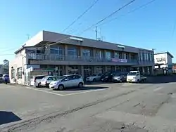 Nishiaizu Town Hall | |
Flag Seal | |
Location of Nishiaizu in Fukushima Prefecture | |
 Nishiaizu | |
| Coordinates: 37°35′19.8″N 139°38′50.9″E | |
| Country | Japan |
| Region | Tōhoku |
| Prefecture | Fukushima |
| District | Yama |
| Area | |
| • Total | 298.18 km2 (115.13 sq mi) |
| Population (April 2020) | |
| • Total | 6,090 |
| • Density | 20/km2 (53/sq mi) |
| Time zone | UTC+9 (Japan Standard Time) |
| - Tree | Paulownia tomentosa |
| - Flower | Lilium |
| Phone number | 0241-45-2211 |
| Address | 3261 Otsu Nozawa Shimokoyaue Nishiaizu-machi, Yama-gun, Fukushima-ken 969-4495 |
| Website | Official website |
_(2427076285).jpg.webp)
Geography
Nishiaizu is located at the far northwestern corner of the Aizu region of Fukushima Prefecture, bordered Niigata Prefecture to the north and the west. It is known as the "front door" to the Iide Mountains. About 86 percent of the total area is composed of mountains and forests.[3]
- Mountains : Mount Mikunidake (1644 m)
- Rivers : Aga River
Climate
Nishiaizu has a Humid continental climate (Köppen Dfb) characterized by warm summers and cold winters with heavy snowfall. The average annual temperature in Nishiaizu is 11.8 °C. The average annual rainfall is 1548 mm with September as the wettest month.The temperatures are highest on average in August, at around 25.4 °C, and lowest in January, at around -0.9 °C.[4]
Demographics
Per Japanese census data,[5] the population of Nishiaizu has declined by one half over the past 40 years.
| Year | Pop. | ±% |
|---|---|---|
| 1960 | 18,336 | — |
| 1970 | 14,200 | −22.6% |
| 1980 | 11,490 | −19.1% |
| 1990 | 10,122 | −11.9% |
| 2000 | 9,075 | −10.3% |
| 2010 | 7,362 | −18.9% |
History
The area of present-day Nishiaizu was part of ancient Mutsu Province and formed part of the holdings of Aizu Domain during the Edo period. After the Meiji Restoration, it was organized as part of Yama District, Fukushima Prefecture. The town of Nishiaizu was founded on July 1, 1954 through a merger of the villages of Shingo and Okugawa with the town of Nozawa and villages of Onomoto, Tosejima, Mutsuai, Shitatani, Muraoka, Kaminojiri and Hosaka in Kawanuma District. In 2006, Nishiaizu residents decided to decline a merger with the city of Kitakata.
Economy
Nishiaizu is a rural area with a local economy dependent on agriculture and forestry.
Education
Nishiaizu has one public elementary school and one public junior high school operated by the town government, and one public high school operated by the Fukushima Prefectural Board of Education.
- Nishiaizu Elementary School
- Nishiaizu High School.[6]
Transportation
Highway
.png.webp) Ban-etsu Expressway – Nishiaizu PA
Ban-etsu Expressway – Nishiaizu PA National Route 49
 National Route 400
 National Route 459
Local attractions
- Enmanji Kannon-dō, the temple building is the one designated Important Cultural Property in Nishiaizu.[7]
- Torioi-Kannon Nyohōji - the gate and four wooden statues are Fukushima Prefectural Important Cultural Properties. The temple houses one of the Aizu region's three important statues of Kannon.[8]
References
- Nishiaizu town official statistics(in Japanese)
- Fukushima Prefectural Demographics Archived 2012-09-07 at Archive.today, accessed February 13, 2009 [Japanese].
- Nishiaizu official website, accessed February 5, 2009 [Japanese].
- Nishiaizu climate data
- Nishiaizu population statistics
- , Nishiaizu official website.
- Japan National Cultural Properties database Archived 2008-07-30 at the Wayback Machine, accessed February 5, 2009. [Japanese]
- Torioi-Kannon Nyohōji official website, accessed February 13, 2009. (in Japanese)
External links
![]() Media related to Nishiaizu, Fukushima at Wikimedia Commons
Media related to Nishiaizu, Fukushima at Wikimedia Commons
- Official Website (in Japanese)
| Core cities | ||
|---|---|---|
| Cities | ||
| Districts | ||
| Authority control |
|---|